|
Topography of Troughs on Vesta
- Click the image above for a larger view
- Full-Res JPEG (993 x 680) (44.2 kB)
- Full-Res TIFF (993 x 680) (676.2 kB)
Caption:
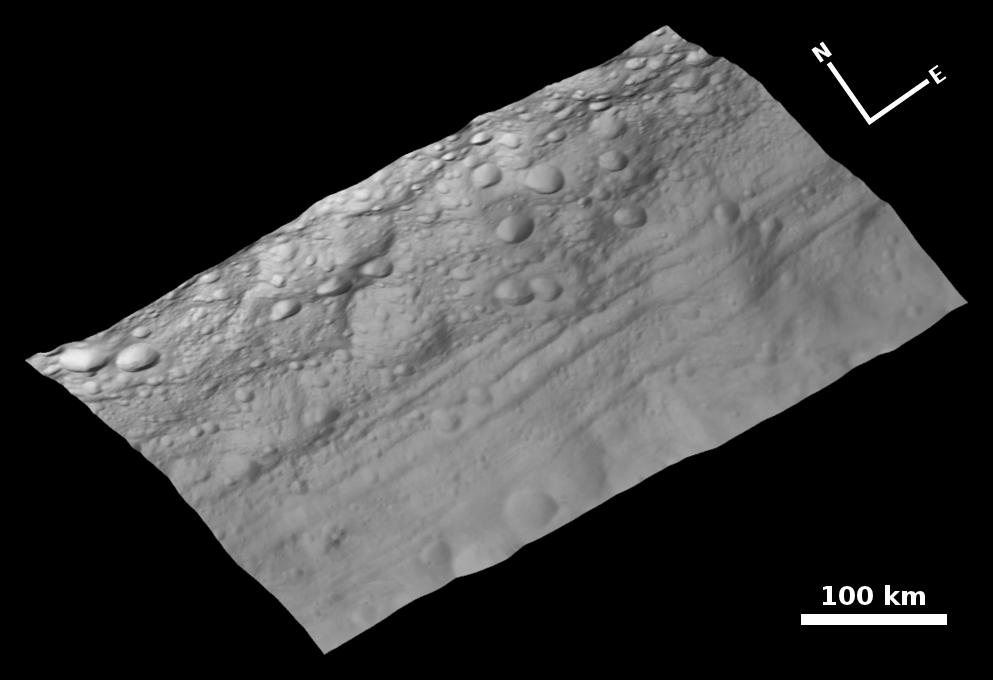
This view of the topography of Vesta's surface is composed of several images obtained with the clear filter in the framing camera on NASA's Dawn spacecraft on August 6, 2011. The image has a resolution of about 260 meters per pixel. The image mosaic is shown superimposed on a digital terrain model.
Background Info:
The Dawn mission to Vesta and Ceres is managed by the Jet Propulsion Laboratory, Pasadena, Calif., for NASA's Science Mission Directorate, Washington, D.C. It is a project of the Discovery Program managed by NASA's Marshall Space Flight Center, Huntsville, Ala. UCLA, is responsible for overall Dawn mission science. Orbital Sciences Corporation of Dulles, Va., designed and built the Dawn spacecraft.
The framing cameras were developed and built under the leadership of the Max Planck Institute for Solar System Research, Katlenburg-Lindau, Germany, with significant contributions by the German Aerospace Center (DLR) Institute of Planetary Research, Berlin, and in coordination with the Institute of Computer and Communication Network Engineering, Braunschweig. The framing camera project is funded by NASA, the Max Planck Society and DLR. JPL is a division of the California Institute of Technology, in Pasadena.
More information about Dawn is online at http://www.nasa.gov/dawn and http://dawn.jpl.nasa.gov .
Cataloging Keywords:
| Name | Value | Additional Values |
|---|---|---|
| Target | 4 Vesta | |
| System | Main Belt | |
| Target Type | Asteroid | |
| Mission | Dawn | |
| Instrument Host | Dawn | |
| Host Type | Orbiter | |
| Instrument | Framing Camera (FC) | |
| Detector | ||
| Extra Keywords | Grayscale | |
| Acquisition Date | ||
| Release Date | 2011-08-23 | |
| Date in Caption | 2011-08-06 | |
| Image Credit | NASA/JPL-Caltech/UCLA/MPS/DLR/IDA | |
| Source | photojournal.jpl.nasa.gov/catalog/PIA14679 | |
| Identifier | PIA14679 | |