|
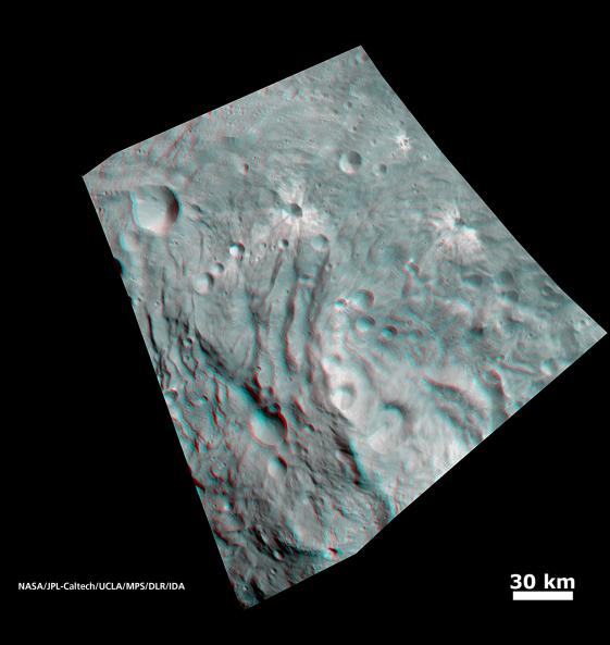
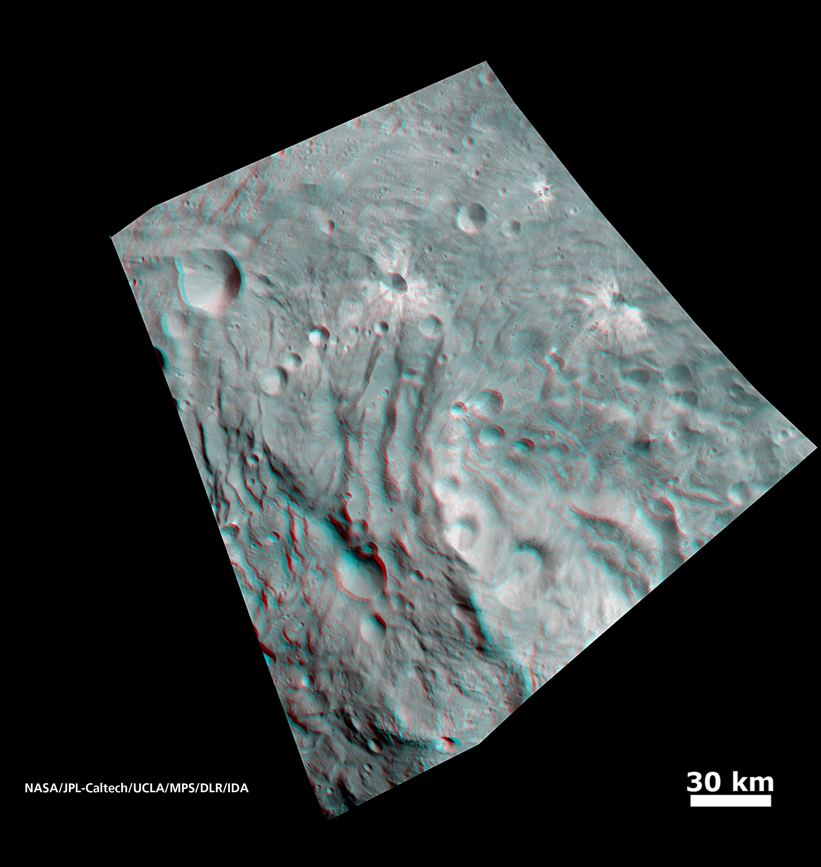
Vesta’s Surface in 3-D: Details of Wave-Like Terrain in the South Pole
- Click the image above for a larger view
- Full-Res JPEG (2810 x 2968) (505.5 kB)
- Full-Res TIFF (2810 x 2968) (25.0 MB)
Caption:
In this image, obtained by NASA's Dawn spacecraft from an orbit of about 1,700 miles (2,700 kilometers) above the surface of the giant asteroid Vesta, topography in the area surrounding Vesta's south pole area shows impact craters, ridges and grooves. These images in 3D provide scientists with a realistic impression of the solid surface of the celestial body.
Use red-cyan (red-blue, or red-green) glasses for a 3-D view of the image. Image resolution is about 260 meters per pixel.
Background Info:
The Dawn mission to Vesta and Ceres is managed by NASA's Jet Propulsion Laboratory, a division of the California Institute of Technology in Pasadena, for NASA's Science Mission Directorate, Washington. UCLA is responsible for overall Dawn mission science. The Dawn framing cameras have been developed and built under the leadership of the Max Planck Institute for Solar System Research, Katlenburg-Lindau, Germany, with significant contributions by DLR German Aerospace Center, Institute of Planetary Research, Berlin, and in coordination with the Institute of Computer and Communication Network Engineering, Braunschweig. The Framing Camera project is funded by the Max Planck Society, DLR, and NASA/JPL.
More information about Dawn is online at http://www.nasa.gov/dawn and http://dawn.jpl.nasa.gov .
Cataloging Keywords:
| Name | Value | Additional Values |
|---|---|---|
| Target | 4 Vesta | |
| System | Main Belt | |
| Target Type | Asteroid | |
| Mission | Dawn | |
| Instrument Host | Dawn | |
| Host Type | Orbiter | |
| Instrument | Framing Camera (FC) | |
| Detector | ||
| Extra Keywords | Color, Crater, Impact | |
| Acquisition Date | ||
| Release Date | 2011-09-16 | |
| Date in Caption | ||
| Image Credit | NASA/JPL-Caltech/UCLA/MPS/DLR/IDA | |
| Source | photojournal.jpl.nasa.gov/catalog/PIA14706 | |
| Identifier | PIA14706 | |