
|
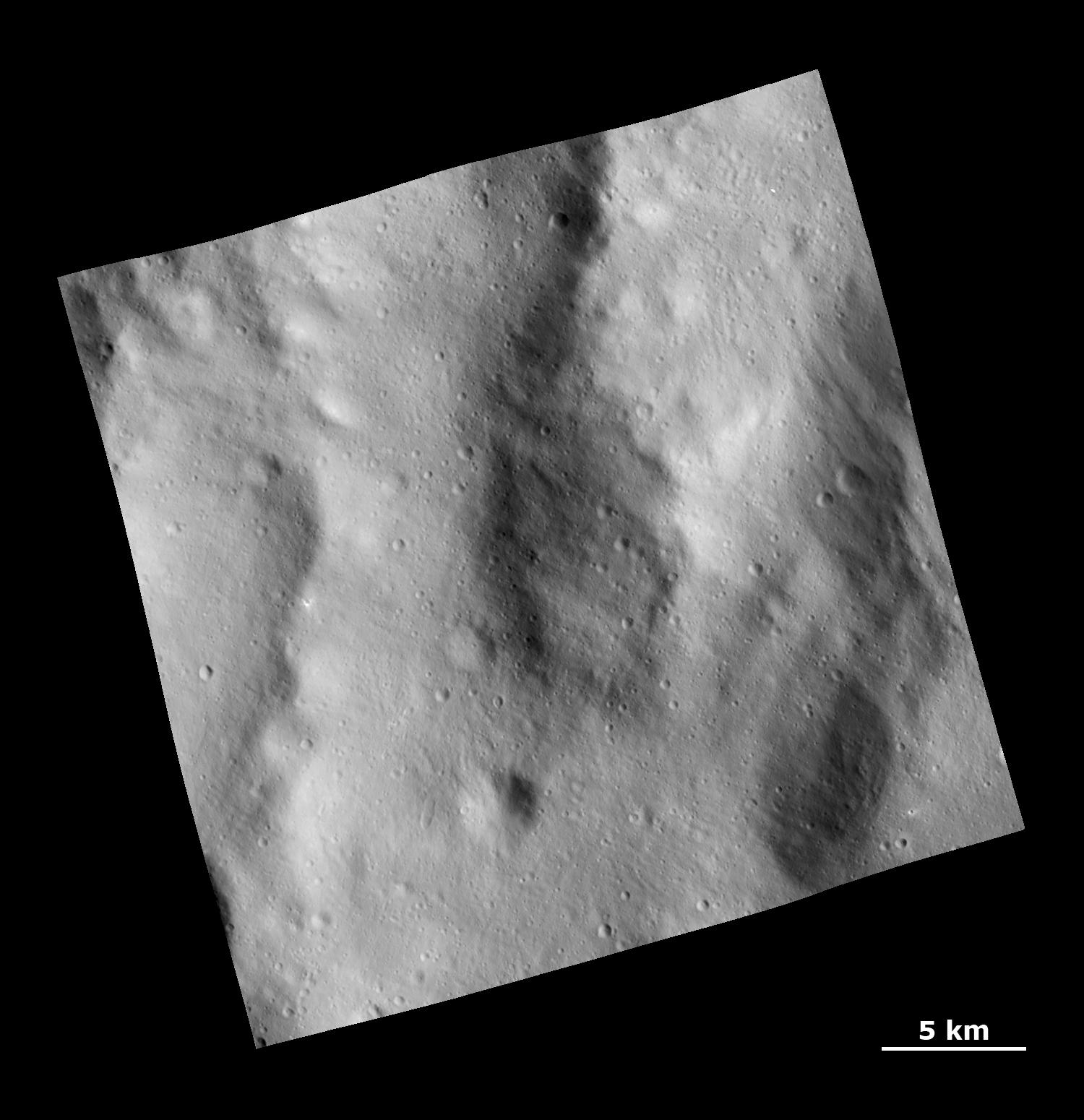
Rough Topography in the Rheasilvia Basin
- Click the image above for a larger view
- Full-Res JPEG (1500 x 1550) (169.0 kB)
- Full-Res TIFF (1500 x 1550) (2.3 MB)
Caption:
This Dawn Framing Camera (FC) image shows a rough surface covered with ejecta and fine grooves on the giant asteroid Vesta.
This image covers an area in the equatorial cratered terrain, centered around 51.6 degrees south latitude and 290.1 degrees east longitude. NASA's Dawn spacecraft obtained this image with its framing camera on Dec. 18, 2011. The distance to the surface of Vesta is 265 kilometers and the image has a resolution of about 25 meters per pixel. This image was acquired during the LAMO (Low Altitude Mapping Orbit) phase of the mission.
Background Info:
The Dawn mission to Vesta and Ceres is managed by NASA's Jet Propulsion Laboratory, a division of the California Institute of Technology in Pasadena, for NASA's Science Mission Directorate, Washington. UCLA is responsible for overall Dawn mission science. The Dawn framing cameras have been developed and built under the leadership of the Max Planck Institute for Solar System Research, Katlenburg-Lindau, Germany, with significant contributions by DLR German Aerospace Center, Institute of Planetary Research, Berlin, and in coordination with the Institute of Computer and Communication Network Engineering, Braunschweig. The framing camera project is funded by the Max Planck Society, DLR, and NASA/JPL.
More information about the Dawn mission is online at http://www.nasa.gov/dawn and http://dawn.jpl.nasa.gov .
Cataloging Keywords:
| Name | Value | Additional Values |
|---|---|---|
| Target | 4 Vesta | |
| System | Main Belt | |
| Target Type | Asteroid | |
| Mission | Dawn | |
| Instrument Host | Dawn | |
| Host Type | Orbiter | |
| Instrument | Framing Camera (FC) | |
| Detector | ||
| Extra Keywords | Crater, Grayscale | |
| Acquisition Date | ||
| Release Date | 2012-01-16 | |
| Date in Caption | 2011-12-18 | |
| Image Credit | NASA/JPL-Caltech/UCLA/MPS/DLR/IDA | |
| Source | photojournal.jpl.nasa.gov/catalog/PIA15299 | |
| Identifier | PIA15299 | |