|
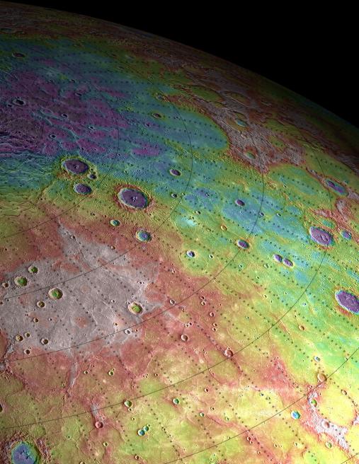
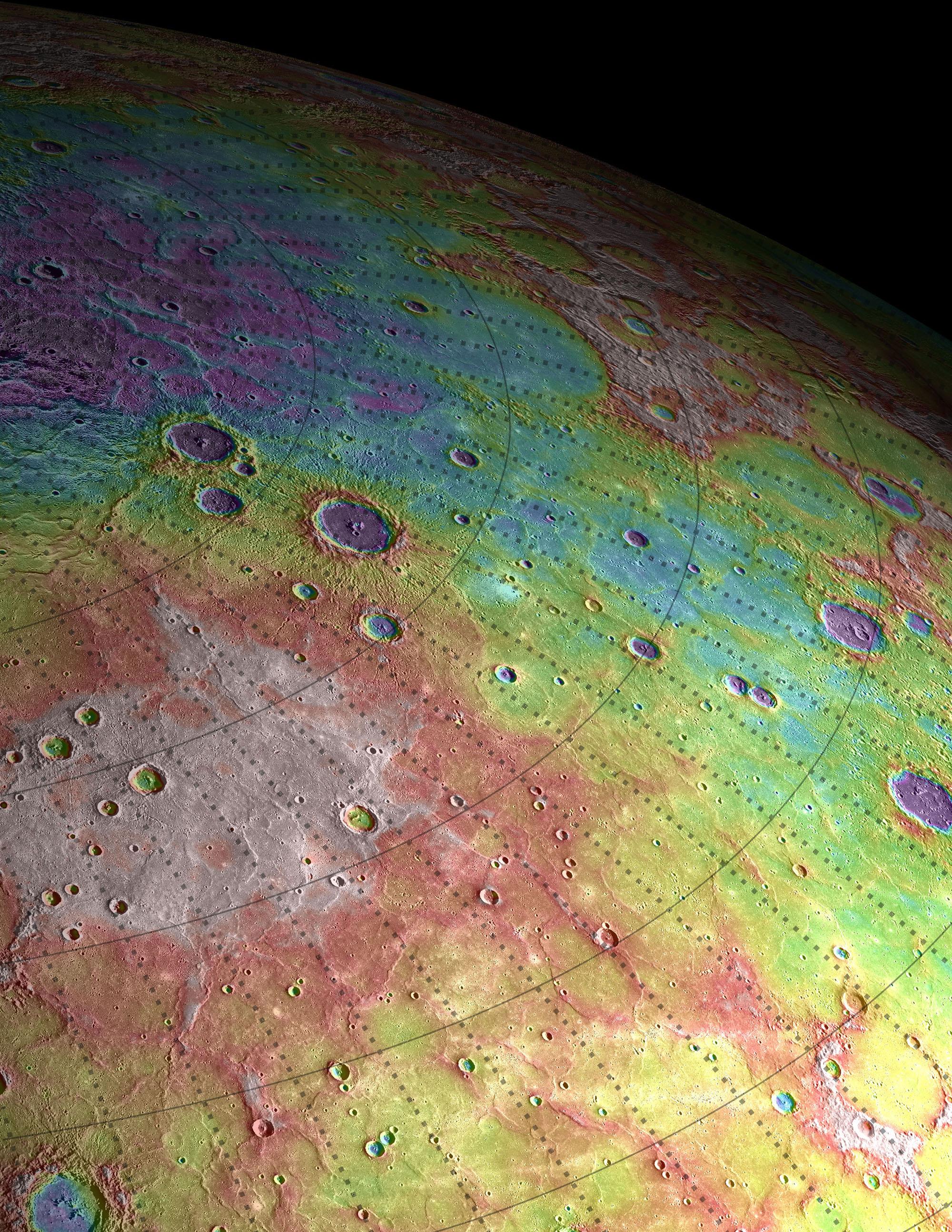
Perspective View of Mercury’s Topography
- Click the image above for a larger view
- Full-Res JPEG (2000 x 2588) (1.3 MB)
- Full-Res TIFF (2000 x 2588) (15.6 MB)
Caption:
Shown here is a perspective view of the immense volcanic plains that span Mercury's northern latitudes, colorized by the topographic height of the surface. The purple colors are the lowest and white is the highest. The total dynamical range of the height variation measured on Mercury is roughly 10 km, which is a smaller range than is found on either the Moon (20 km) or Mars (30 km).
Map Details:
Every 5 degrees in latitude and longitude is marked
Scale:
On Mercury, 5 degrees of latitude is approximately 213 kilometers (132 miles)
Background Info:
The MESSENGER spacecraft is the first ever to orbit the planet Mercury, and the spacecraft's seven scientific instruments and radio science investigation are unraveling the history and evolution of the Solar System's innermost planet. Visit the Why Mercury? section of this website to learn more about the key science questions that the MESSENGER mission is addressing. During the one-year primary mission, MDIS acquired 88,746 images and extensive other data sets. MESSENGER is now in a year-long extended mission, during which plans call for the acquisition of more than 80,000 additional images to support MESSENGER's science goals.
These images are from MESSENGER, a NASA Discovery mission to conduct the first orbital study of the innermost planet, Mercury. For information regarding the use of images, see the MESSENGER image use policy .
Cataloging Keywords:
| Name | Value | Additional Values |
|---|---|---|
| Target | Mercury | Mars |
| System | ||
| Target Type | Planet | |
| Mission | MESSENGER | |
| Instrument Host | MESSENGER | |
| Host Type | Orbiter | |
| Instrument | Mercury Laser Altimeter (MLA) | |
| Detector | ||
| Extra Keywords | Color, Map, Moon, Radio, Volcano | |
| Acquisition Date | ||
| Release Date | 2012-03-22 | |
| Date in Caption | ||
| Image Credit | NASA/Johns Hopkins University Applied Physics Laboratory/Carnegie Institution of Washington | |
| Source | photojournal.jpl.nasa.gov/catalog/PIA15534 | |
| Identifier | PIA15534 | |