|
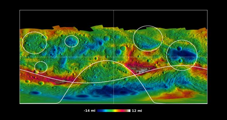
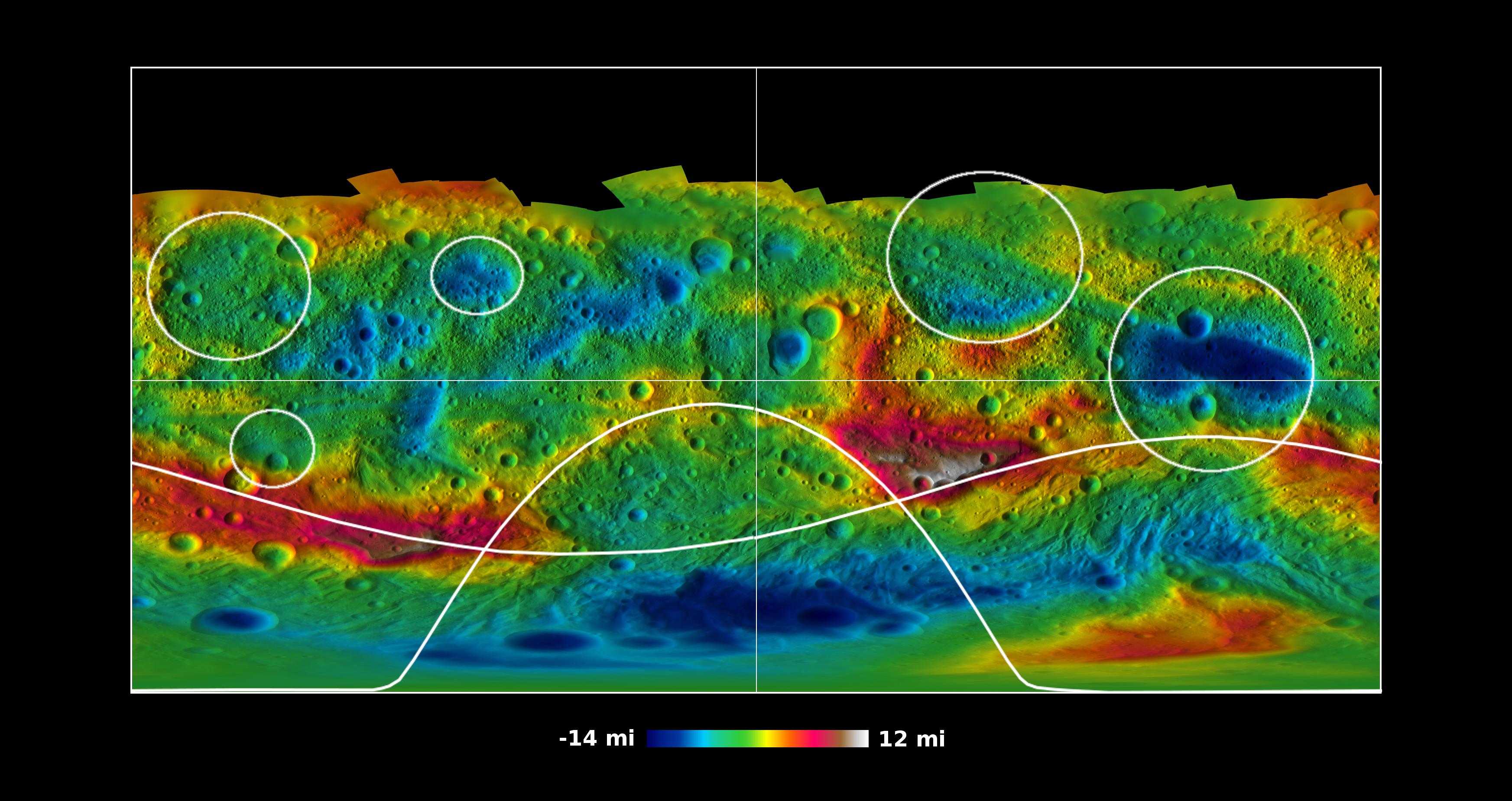
Global Topography of Vesta
- Click the image above for a larger view
- Full-Res JPEG (3490 x 1850) (606.6 kB)
- Full-Res TIFF (3490 x 1850) (19.4 MB)
Caption:
This global map from NASA's Dawn mission shows the topography of the giant asteroid Vesta, with the seven most prominent impact basins highlighted. These basins are larger than 60 miles (100 kilometers) across. Higher areas appear in red and lower areas appear in blue.
The topography was derived from images taken by Dawn's framing camera during Dawn's high-altitude mapping orbit, which averaged about 420 miles (680 kilometers) in altitude and took place from Sept. 30 to Nov. 2, 2011. The resolution during that orbit was about 200 feet (60 meters) per pixel. The elevations are relative to an ellipsoid model of Vesta that fits the body's average shape.
Background Info:
The Dawn mission to Vesta and Ceres is managed by NASA's Jet Propulsion Laboratory, a division of the California Institute of Technology in Pasadena, for NASA's Science Mission Directorate, Washington. UCLA is responsible for overall Dawn mission science. The Dawn framing cameras were developed and built under the leadership of the Max Planck Institute for Solar System Research, Katlenburg-Lindau, Germany, with significant contributions by DLR German Aerospace Center, Institute of Planetary Research, Berlin, and in coordination with the Institute of Computer and Communication Network Engineering, Braunschweig. The framing camera project is funded by the Max Planck Society, DLR and NASA/JPL.
More information about Dawn is online at http://www.nasa.gov/dawn and http://dawn.jpl.nasa.gov .
Cataloging Keywords:
| Name | Value | Additional Values |
|---|---|---|
| Target | 4 Vesta | |
| System | Main Belt | |
| Target Type | Asteroid | |
| Mission | Dawn | |
| Instrument Host | Dawn | |
| Host Type | Orbiter | |
| Instrument | Framing Camera (FC) | |
| Detector | ||
| Extra Keywords | Color, Impact, Map | |
| Acquisition Date | ||
| Release Date | 2012-05-10 | |
| Date in Caption | 2011-11-02 | |
| Image Credit | NASA/JPL-Caltech/UCLA/MPS/DLR/IDA/PSI | |
| Source | photojournal.jpl.nasa.gov/catalog/PIA15664 | |
| Identifier | PIA15664 | |