|
Mars Weather Map, 2008
- Click the image above for a larger view
- Full-Res JPEG (3258 x 1817) (354.0 kB)
- Full-Res TIFF (3258 x 1817) (17.8 MB)
Caption:
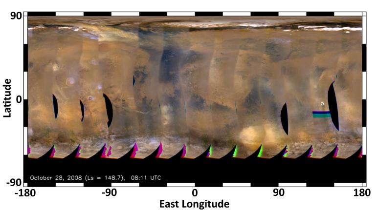
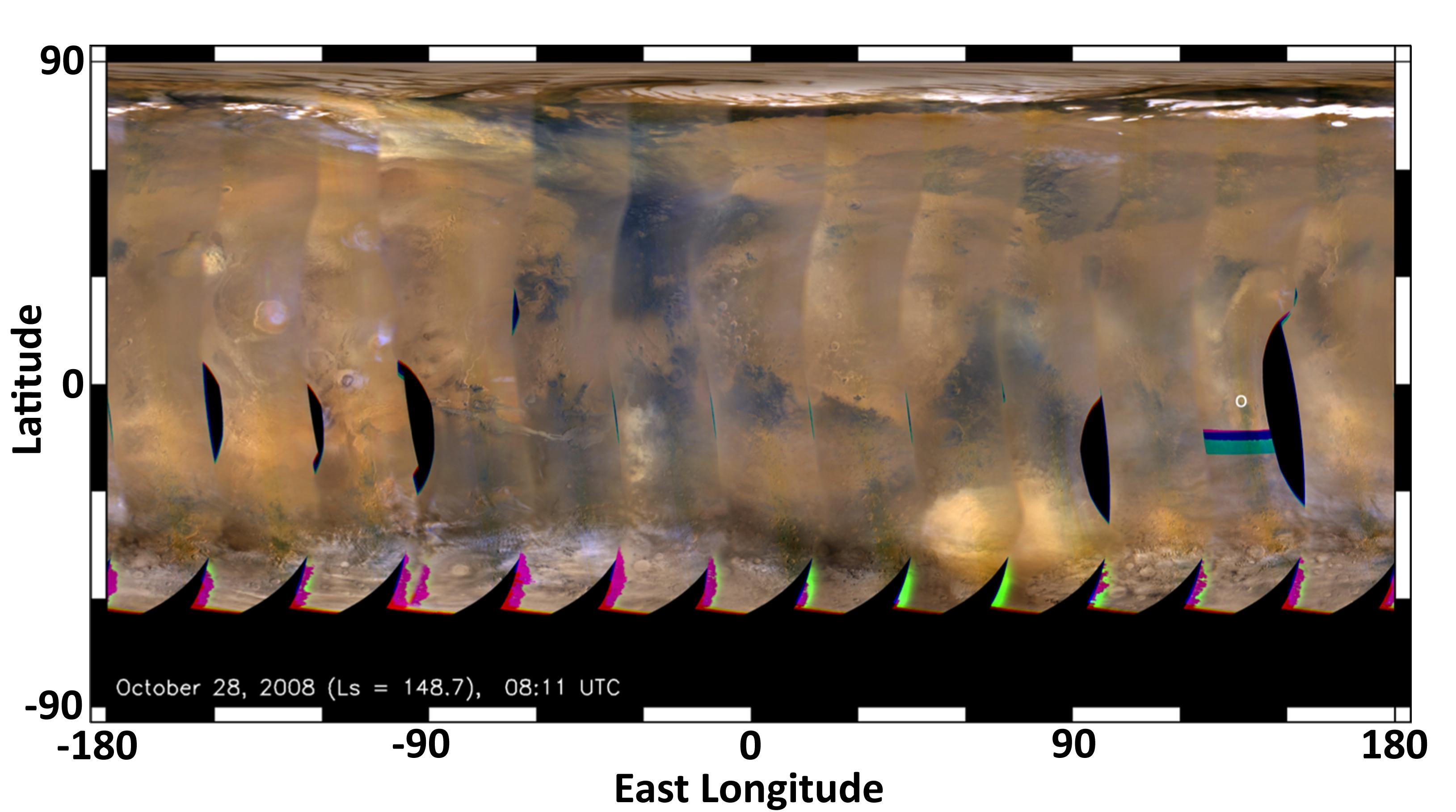
This global map of Mars was acquired on Oct. 28, 2008, by the Mars Color Imager instrument on NASA's Mars Reconnaissance Orbiter. It was acquired during the same season that NASA's Curiosity rover will land in, but two Mars years earlier. It is remarkably free of water ice clouds when compared with the maps acquired this year in the days leading up to Curiosity's landing.
In 2008, during this season, the planet was dustier than usual. Larger amounts of dust cause sunlight to warm the atmosphere and make it less dense, which means less stopping power for a landing rover. What's more, dusty conditions can lead to an increased chance for small, intense dust storms, another challenge for rover landings. So far, the weather forecast for Curiosity calls for a clearer atmosphere; nonetheless, the spacecraft has been designed to land safely under conditions similar to those observed in 2008.
The map is a rectangular projection of Mars (from 90 degrees latitude to minus 90 degrees latitude, and minus 180 degrees longitude to 180 degrees east longitude). The landing site is located on the right side of the map, near 137 degrees east longitude and 4.5 degrees south latitude. Along the northern (top) and southern (bottom) parts of the map there are patches of orange clouds, indicating dust lofted into the atmosphere.
Cataloging Keywords:
| Name | Value | Additional Values |
|---|---|---|
| Target | Mars | |
| System | ||
| Target Type | Planet | |
| Mission | Mars Reconnaissance Orbiter (MRO) | Mars Science Laboratory (MSL) |
| Instrument Host | Mars Reconnaissance Orbiter | Curiosity Rover |
| Host Type | Orbiter | Rover |
| Instrument | Mars Color Imager (MARCI) | |
| Detector | ||
| Extra Keywords | Atmosphere, Color, Dust, Map, Storm, Water | |
| Acquisition Date | ||
| Release Date | 2012-08-04 | |
| Date in Caption | 2008-10-28 | |
| Image Credit | NASA/JPL-Caltech/MSSS | |
| Source | photojournal.jpl.nasa.gov/catalog/PIA15963 | |
| Identifier | PIA15963 | |