
|
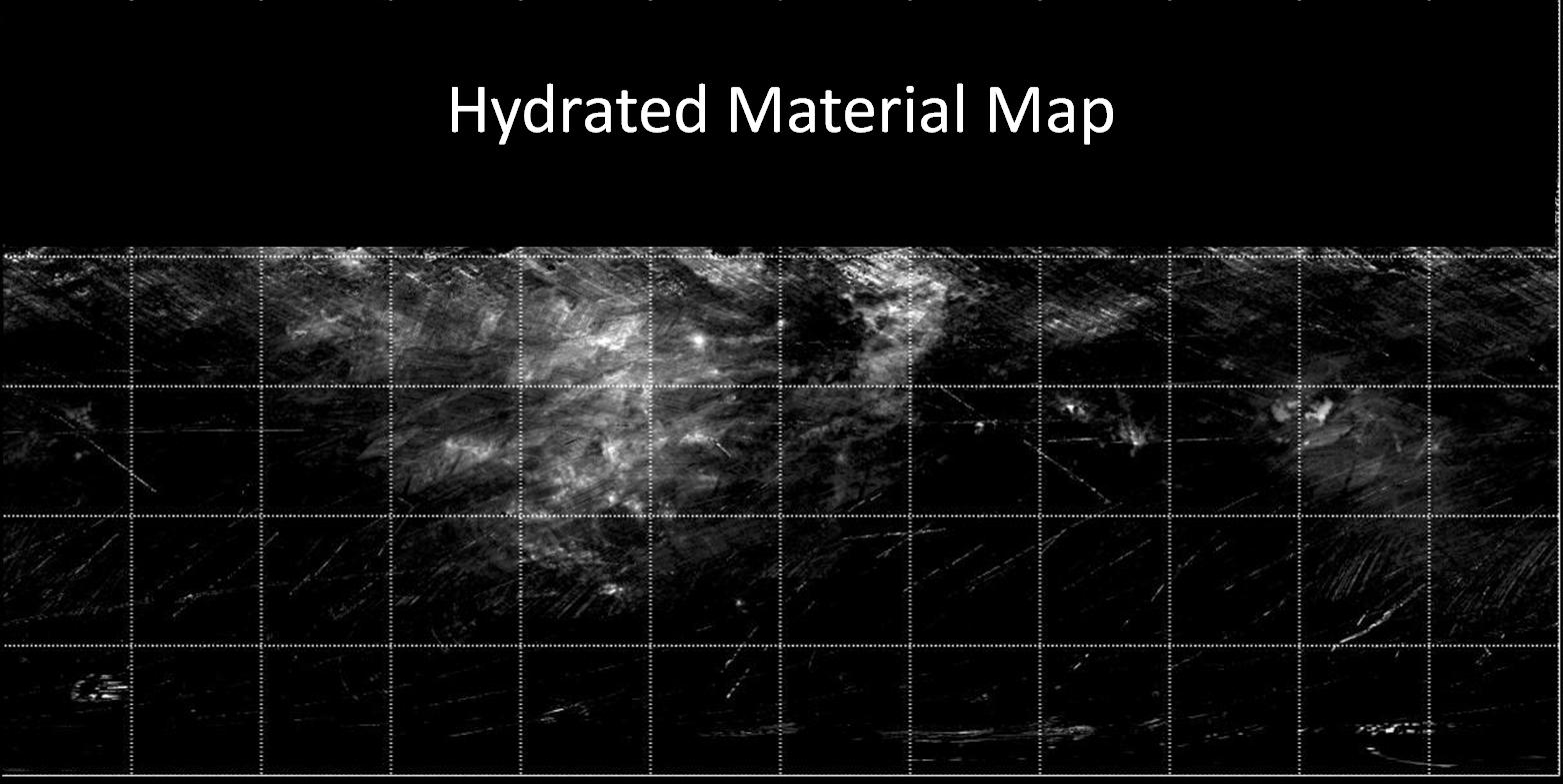
Map of Hydrated Minerals on Vesta
- Click the image above for a larger view
- Full-Res JPEG (1563 x 785) (139.1 kB)
- Full-Res TIFF (1563 x 785) (1.2 MB)
Caption:
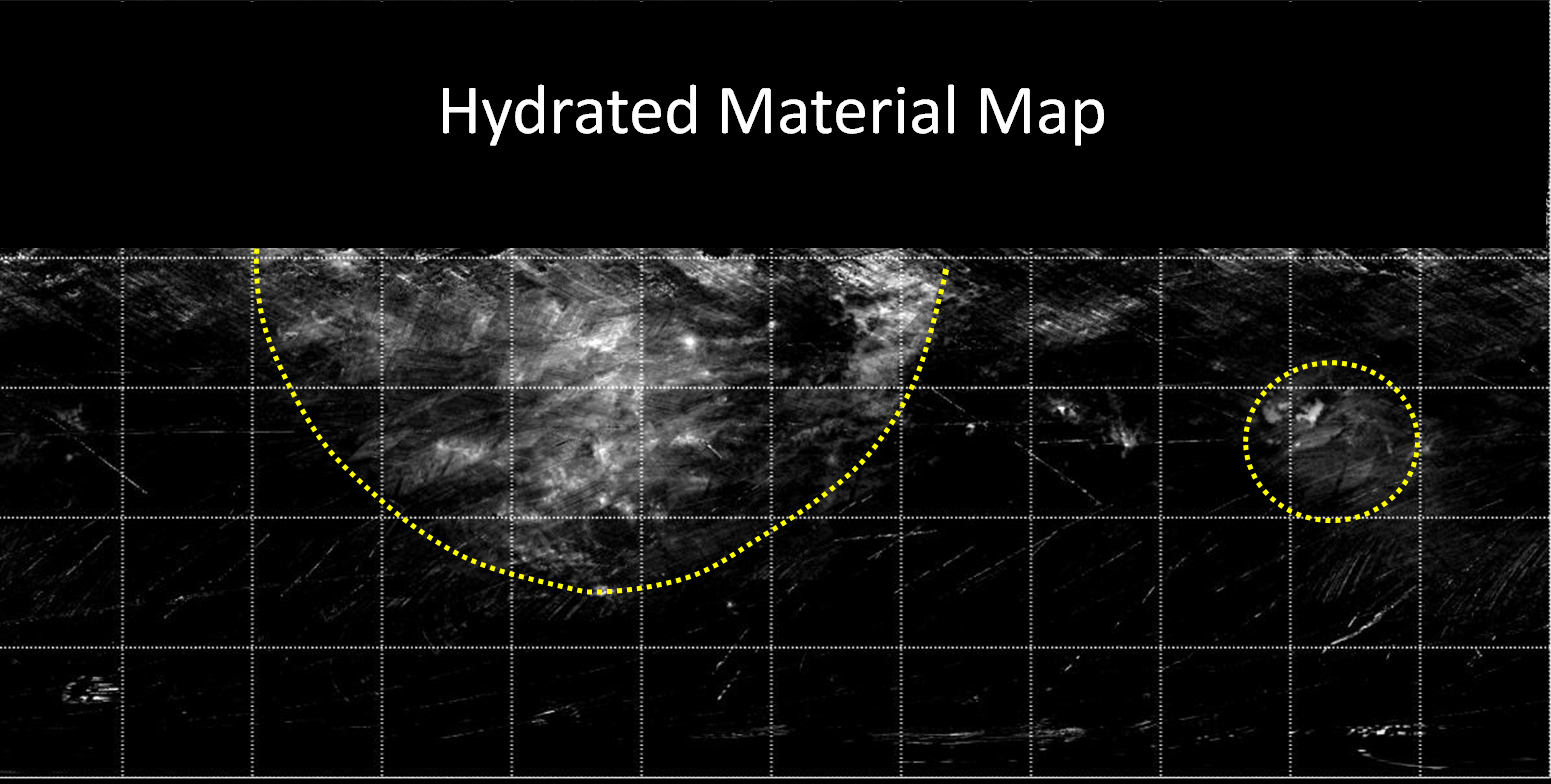
Annotated Version
Click on the image for larger version
This map from NASA's Dawn mission indicates the presence of hydrated minerals on the giant asteroid Vesta. Hydrated minerals are seen in white, with areas of high concentrations circled with a yellow dotted line in the annotated version. The data were obtained by Dawn's visible and infrared mapping spectrometer in August 2011, from an altitude of 1,700 miles (2,700 kilometers).
The data included in the map are from Dawn's first science orbit, known as the survey orbit, and are limited to about 30 degrees north latitude because areas above that latitude were poorly illuminated. At that time, it was winter in Vesta's northern hemisphere.
Background Info:
The Dawn mission to Vesta and Ceres is managed by NASA's Jet Propulsion Laboratory, a division of the California Institute of Technology in Pasadena, for NASA's Science Mission Directorate, Washington. UCLA is responsible for overall Dawn mission science. The visible and infrared mapping spectrometer was provided by the Italian Space Agency and is managed by Italy's National Institute for Astrophysics, Rome, in collaboration with Selex Galileo, where it was built.
More information about Dawn is online at http://www.nasa.gov/dawn and http://dawn.jpl.nasa.gov .
Cataloging Keywords:
| Name | Value | Additional Values |
|---|---|---|
| Target | 4 Vesta | |
| System | Main Belt | |
| Target Type | Asteroid | |
| Mission | Dawn | |
| Instrument Host | Dawn | |
| Host Type | Orbiter | |
| Instrument | Visible and Infrared Spectrometer (VIR) | |
| Detector | ||
| Extra Keywords | Grayscale, Infrared, Map | |
| Acquisition Date | ||
| Release Date | 2012-09-26 | |
| Date in Caption | ||
| Image Credit | NASA/JPL-Caltech/UCLA/INAF | |
| Source | photojournal.jpl.nasa.gov/catalog/PIA16186 | |
| Identifier | PIA16186 | |