
|
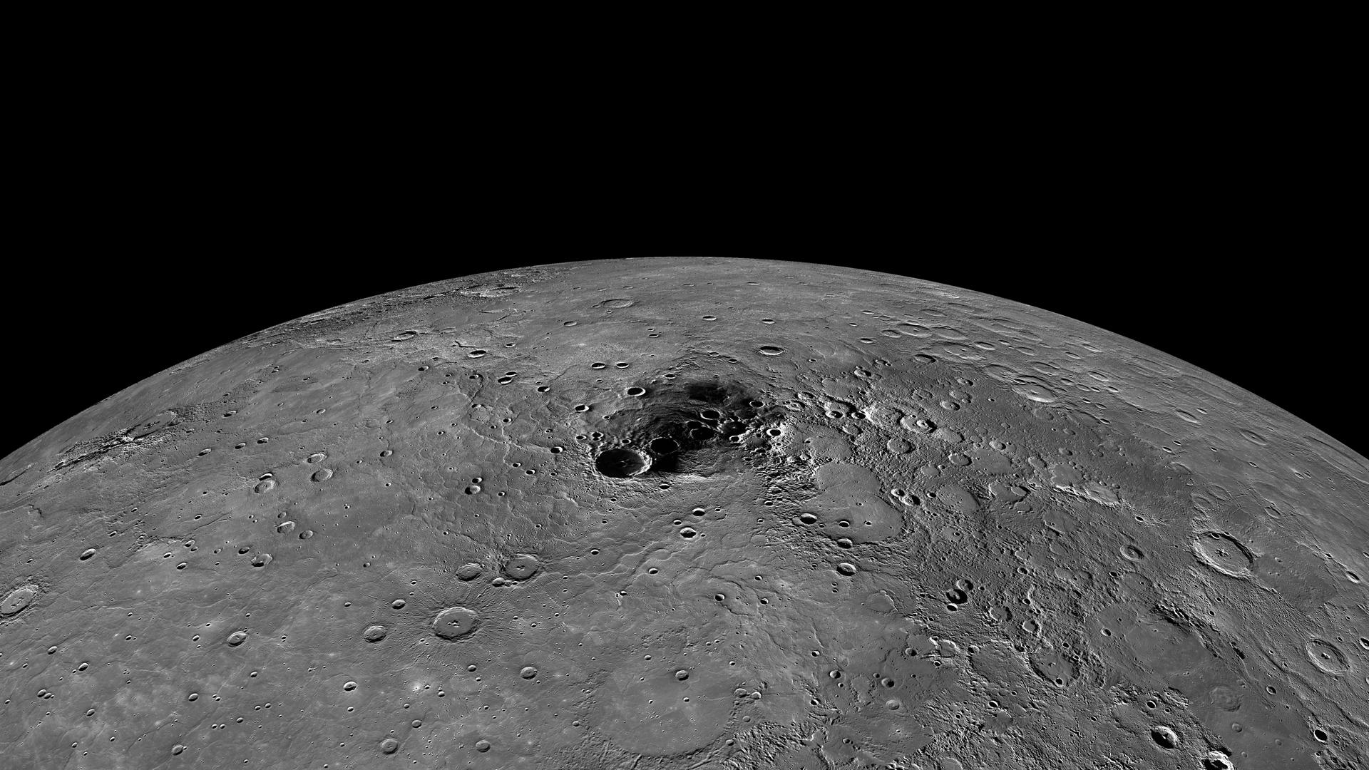
Mercury’s Polar Region
- Click the image above for a larger view
- Full-Res JPEG (1920 x 1080) (335.4 kB)
- Full-Res TIFF (1920 x 1080) (2.1 MB)
Caption:
Due to its nearly vertical spin axis, Mercury's north pole is never fully sunlit. If it were, it might look something like this image, which is an orthographic projection of a global mosaic . The dark area towards the center of the image contains the north pole .
Instrument:
Wide Angle Camera (WAC) of the Mercury Dual Imaging System (MDIS)
Scale:
The diameter of Mercury is 4880 km (3030 miles).
Map Projection:
Orthographic
Background Info:
The MESSENGER spacecraft is the first ever to orbit the planet Mercury, and the spacecraft's seven scientific instruments and radio science investigation are unraveling the history and evolution of the Solar System's innermost planet. Visit the Why Mercury? section of this website to learn more about the key science questions that the MESSENGER mission is addressing. During the one-year primary mission, MDIS acquired 88,746 images and extensive other data sets. MESSENGER is now in a year-long extended mission, during which plans call for the acquisition of more than 80,000 additional images to support MESSENGER's science goals.
These images are from MESSENGER, a NASA Discovery mission to conduct the first orbital study of the innermost planet, Mercury. For information regarding the use of images, see the MESSENGER image use policy .
Cataloging Keywords:
| Name | Value | Additional Values |
|---|---|---|
| Target | Mercury | |
| System | ||
| Target Type | Planet | |
| Mission | MESSENGER | |
| Instrument Host | MESSENGER | |
| Host Type | Orbiter | |
| Instrument | Mercury Dual Imaging System (MDIS) | |
| Detector | Wide Angle Camera (WAC) | |
| Extra Keywords | Grayscale, Map, Radio, Rotation | |
| Acquisition Date | ||
| Release Date | 2012-11-28 | |
| Date in Caption | ||
| Image Credit | NASA/Johns Hopkins University Applied Physics Laboratory/Carnegie Institution of Washington | |
| Source | photojournal.jpl.nasa.gov/catalog/PIA16549 | |
| Identifier | PIA16549 | |