
|
Northern Topography
- Click the image above for a larger view
- Full-Res JPEG (1082 x 1082) (398.8 kB)
- Full-Res TIFF (1082 x 1082) (3.5 MB)
Caption:
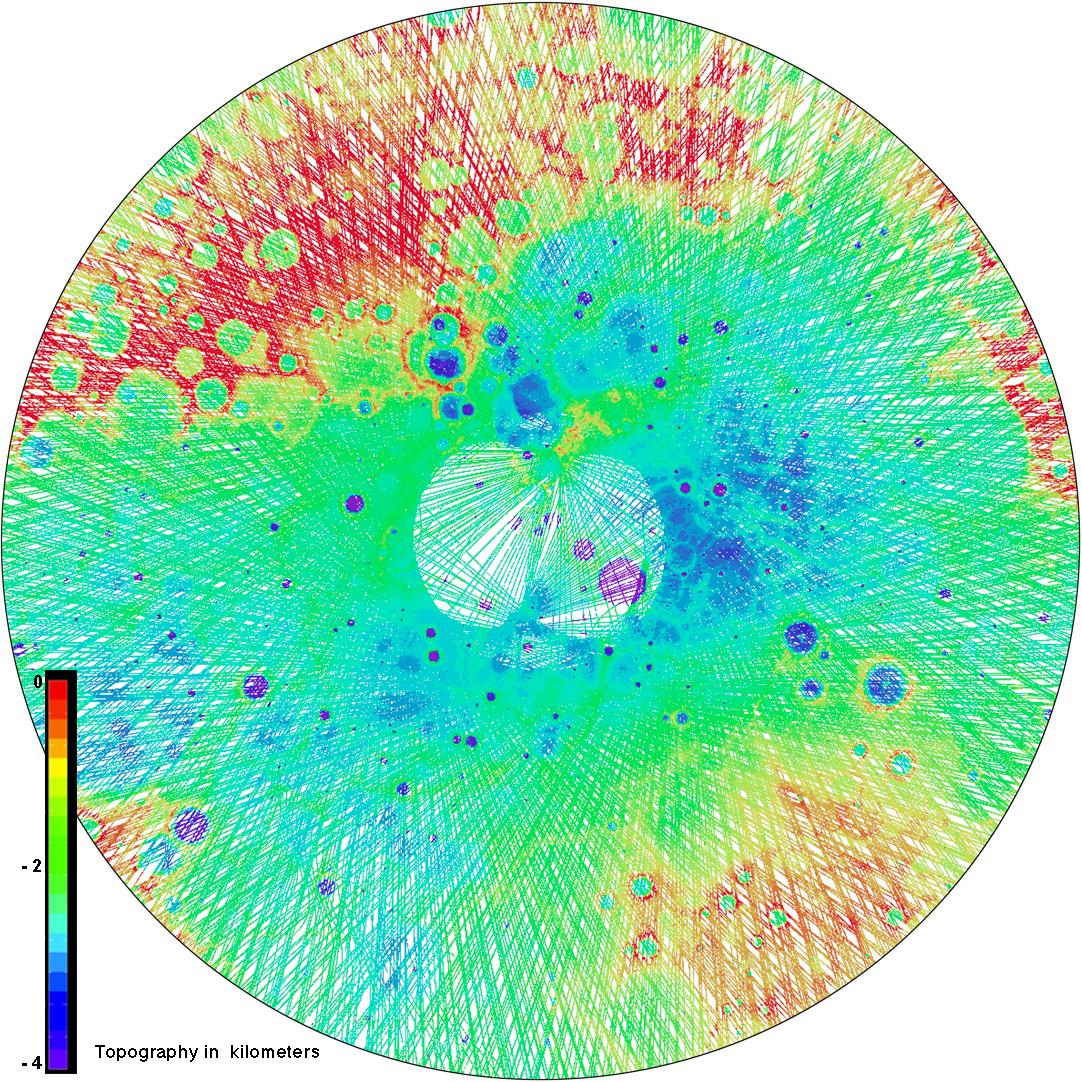
This view of the topography of Mercury's north polar region complements yesterday's image of the day ( PIA16950 ). Both were used during The Challenge of Discovery Educator Workshop , which was held last weekend. Workshop participants learned about MESSENGER's recent evidence for water ice near Mercury's poles through an activity that explored different datasets of Mercury's north polar region. Those activity materials can be viewed and download from this workshop website . In this view, MLA tracks across the surface are colored by the height of the surface relative to a reference sphere with a radius of 2440 kilometers.
Instrument:
Mercury Laser Altimeter (MLA)
Center Latitude:
90° N
Map Projection:
Polar stereographic projection, extending southward to 65° N, with 0° longitude at the bottom
Scale:
The diameter of this polar map projection covers 2,130 kilometers (1320 miles)
Background Info:
The MESSENGER spacecraft is the first ever to orbit the planet Mercury, and the spacecraft's seven scientific instruments and radio science investigation are unraveling the history and evolution of the Solar System's innermost planet. MESSENGER acquired over 150,000 images and extensive other data sets. MESSENGER is capable of continuing orbital operations until early 2015.
For information regarding the use of images, see the MESSENGER image use policy .
Cataloging Keywords:
| Name | Value | Additional Values |
|---|---|---|
| Target | Mercury | |
| System | ||
| Target Type | Planet | |
| Mission | MESSENGER | |
| Instrument Host | MESSENGER | |
| Host Type | Orbiter | |
| Instrument | Mercury Laser Altimeter (MLA) | |
| Detector | ||
| Extra Keywords | Color, Map, Radio, Water | |
| Acquisition Date | ||
| Release Date | 2013-04-09 | |
| Date in Caption | ||
| Image Credit | NASA/Johns Hopkins University Applied Physics Laboratory/Carnegie Institution of Washington | |
| Source | photojournal.jpl.nasa.gov/catalog/PIA16951 | |
| Identifier | PIA16951 | |