
|
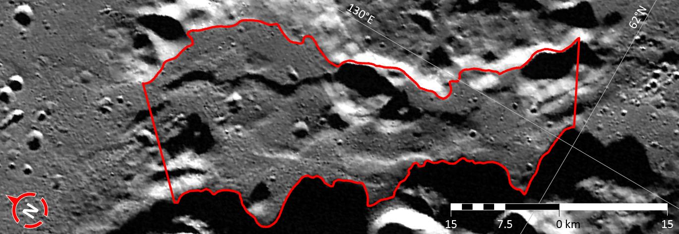
In Focus: Caral Vallis
- Click the image above for a larger view
- Full-Res JPEG (1370 x 472) (118.8 kB)
- Full-Res TIFF (1370 x 472) (1.9 MB)
Caption:
This image shows the third of five broad channels on Mercury for which names were recently approved (see Caral Vallis ). The valleys are named according to the theme of "abandoned cities (and towns and settlements) of antiquity" that was developed especially for these landforms.
The vallis shown in this figure is named for Caral-Supe, a large settlement in the Barranca province of Peru that has been dated as one of the most ancient cities of the Americas, being inhabited from ca. 2627-1977 BCE. At its peak, Caral supported a population in excess of 3,000. This image is a portion of the MDIS global mosaic basemap MDIS global mosaic basemap that was acquired during MESSENGER's first year in orbit.
Date Created:
March 26, 2013
Instrument:
Wide Angle Camera (WAC) of the Mercury Dual Imaging System (MDIS)
Feature Latitude Range:
61.8° N to 63.3° N
Feature Longitude Range:
128.3° E to 130.6° E
Feature Diameter:
64 km
Projection:
Azimuthal equidistant
Background Info:
The MESSENGER spacecraft is the first ever to orbit the planet Mercury, and the spacecraft's seven scientific instruments and radio science investigation are unraveling the history and evolution of the Solar System's innermost planet. MESSENGER acquired over 150,000 images and extensive other data sets. MESSENGER is capable of continuing orbital operations until early 2015.
For information regarding the use of images, see the MESSENGER image use policy .
Cataloging Keywords:
| Name | Value | Additional Values |
|---|---|---|
| Target | Mercury | |
| System | ||
| Target Type | Planet | |
| Mission | MESSENGER | |
| Instrument Host | MESSENGER | |
| Host Type | Orbiter | |
| Instrument | Mercury Dual Imaging System (MDIS) | |
| Detector | Wide Angle Camera (WAC) | |
| Extra Keywords | Color, Map, Radio | |
| Acquisition Date | ||
| Release Date | 2013-05-08 | |
| Date in Caption | 2013-03-26 | |
| Image Credit | NASA/Johns Hopkins University Applied Physics Laboratory/Carnegie Institution of Washington | |
| Source | photojournal.jpl.nasa.gov/catalog/PIA17028 | |
| Identifier | PIA17028 | |