|
Flying V
- Click the image above for a larger view
- Full-Res JPEG (806 x 782) (89.3 kB)
- Full-Res TIFF (806 x 782) (631.1 kB)
Caption:
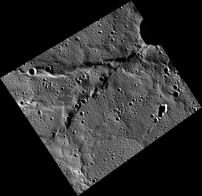
This view of a location within Mercury's northern volcanic plains includes a set of wrinkle ridges that form a "V" shape.
This image was acquired as part of MDIS's high-resolution surface morphology base map. The surface morphology base map covers more than 99% of Mercury's surface with an average resolution of 200 meters/pixel. Images acquired for the surface morphology base map typically are obtained at off-vertical Sun angles (i.e., high incidence angles) and have visible shadows so as to reveal clearly the topographic form of geologic features.
Date acquired:
October 14, 2011
Image Mission Elapsed Time (MET):
227092494
Image ID:
884412
Instrument:
Wide Angle Camera (WAC) of the Mercury Dual Imaging System (MDIS)
WAC filter:
7 (748 nanometers)
Center Latitude:
79.09°
Center Longitude:
352.7° E
Resolution:
140 meters/pixel
Scale:
The "V" is about 59 km (37 mi.) long
Incidence Angle:
84.1°
Emission Angle:
28.2°
Phase Angle:
112.3°
Background Info:
The MESSENGER spacecraft is the first ever to orbit the planet Mercury, and the spacecraft's seven scientific instruments and radio science investigation are unraveling the history and evolution of the Solar System's innermost planet. MESSENGER acquired over 150,000 images and extensive other data sets. MESSENGER is capable of continuing orbital operations until early 2015.
For information regarding the use of images, see the MESSENGER image use policy .
Cataloging Keywords:
| Name | Value | Additional Values |
|---|---|---|
| Target | Mercury | |
| System | ||
| Target Type | Planet | |
| Mission | MESSENGER | |
| Instrument Host | MESSENGER | |
| Host Type | Orbiter | |
| Instrument | Mercury Dual Imaging System (MDIS) | |
| Detector | Wide Angle Camera (WAC) | |
| Extra Keywords | Grayscale, Map, Radio, Shadow, Volcano | |
| Acquisition Date | ||
| Release Date | 2013-09-04 | |
| Date in Caption | 2011-10-14 | |
| Image Credit | NASA/Johns Hopkins University Applied Physics Laboratory/Carnegie Institution of Washington | |
| Source | photojournal.jpl.nasa.gov/catalog/PIA17452 | |
| Identifier | PIA17452 | |