
|
Curiosity’s View Past Dune at ‘Dingo Gap’
- Click the image above for a larger view
- Full-Res JPEG (4075 x 1439) (876.4 kB)
- Full-Res TIFF (4075 x 1439) (5.9 MB)
Caption:
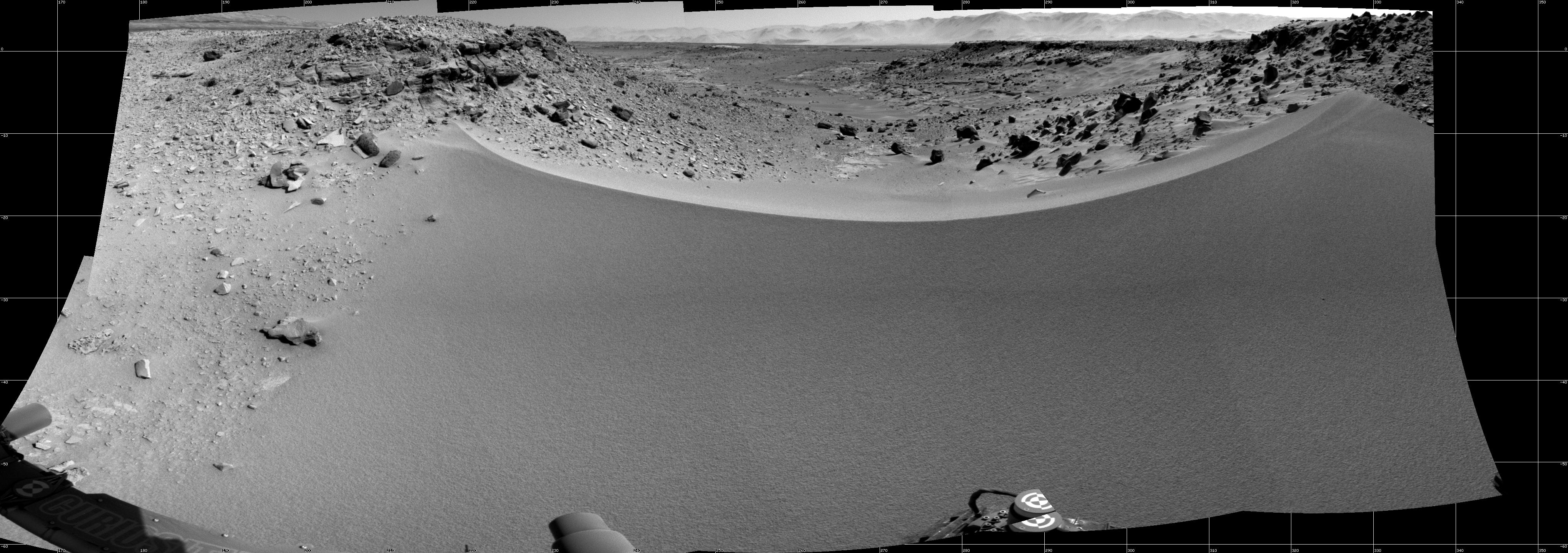
This mosaic of images from the Navigation Camera (Navcam) on NASA's Mars rover Curiosity shows the terrain to the west from the rover's position on the 528th Martian day, or sol, of the mission (Jan. 30, 2014). The images were taken right after Curiosity had arrived at the eastern edge of a location called "Dingo Gap." A dune across the gap is about 3 feet (1 meter) high in the middle and tapered at south and north ends onto low scarps on either side of the gap. The rover team is evaluating possible driving routes on the other side before a decision whether the cross the gap.
The view covers a panorama from south, at the left edge, to north-northwest at the right edge. It is presented as a cylindrical projection.
Background Info:
NASA's Jet Propulsion Laboratory, a division of the California Institute of Technology, Pasadena, manages the Mars Science Laboratory Project for NASA's Science Mission Directorate, Washington. JPL designed and built the project's Curiosity rover.
More information about Curiosity is online at http://www.nasa.gov/msl and http://mars.jpl.nasa.gov/msl/ .
Cataloging Keywords:
| Name | Value | Additional Values |
|---|---|---|
| Target | Mars | |
| System | ||
| Target Type | Planet | |
| Mission | Mars Science Laboratory (MSL) | |
| Instrument Host | Curiosity Rover | |
| Host Type | Rover | |
| Instrument | Navigation Camera (Navcam) | |
| Detector | ||
| Extra Keywords | Dune, Grayscale | |
| Acquisition Date | ||
| Release Date | 2014-01-31 | |
| Date in Caption | 2014-01-30 | |
| Image Credit | NASA/JPL-Caltech | |
| Source | photojournal.jpl.nasa.gov/catalog/PIA17930 | |
| Identifier | PIA17930 | |