
|
Strange Flow: Landslide, Impact Melt or Lava?
- Click the image above for a larger view
- Full-Res JPEG (2880 x 1800) (794.7 kB)
- Full-Res TIFF (2880 x 1800) (15.6 MB)
Caption:
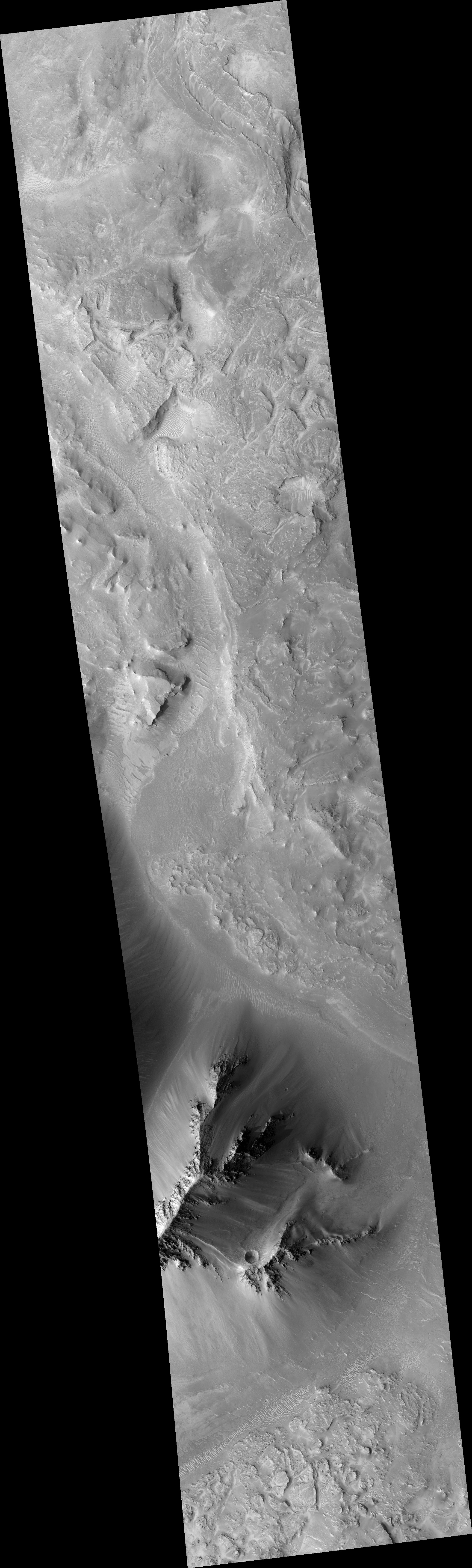
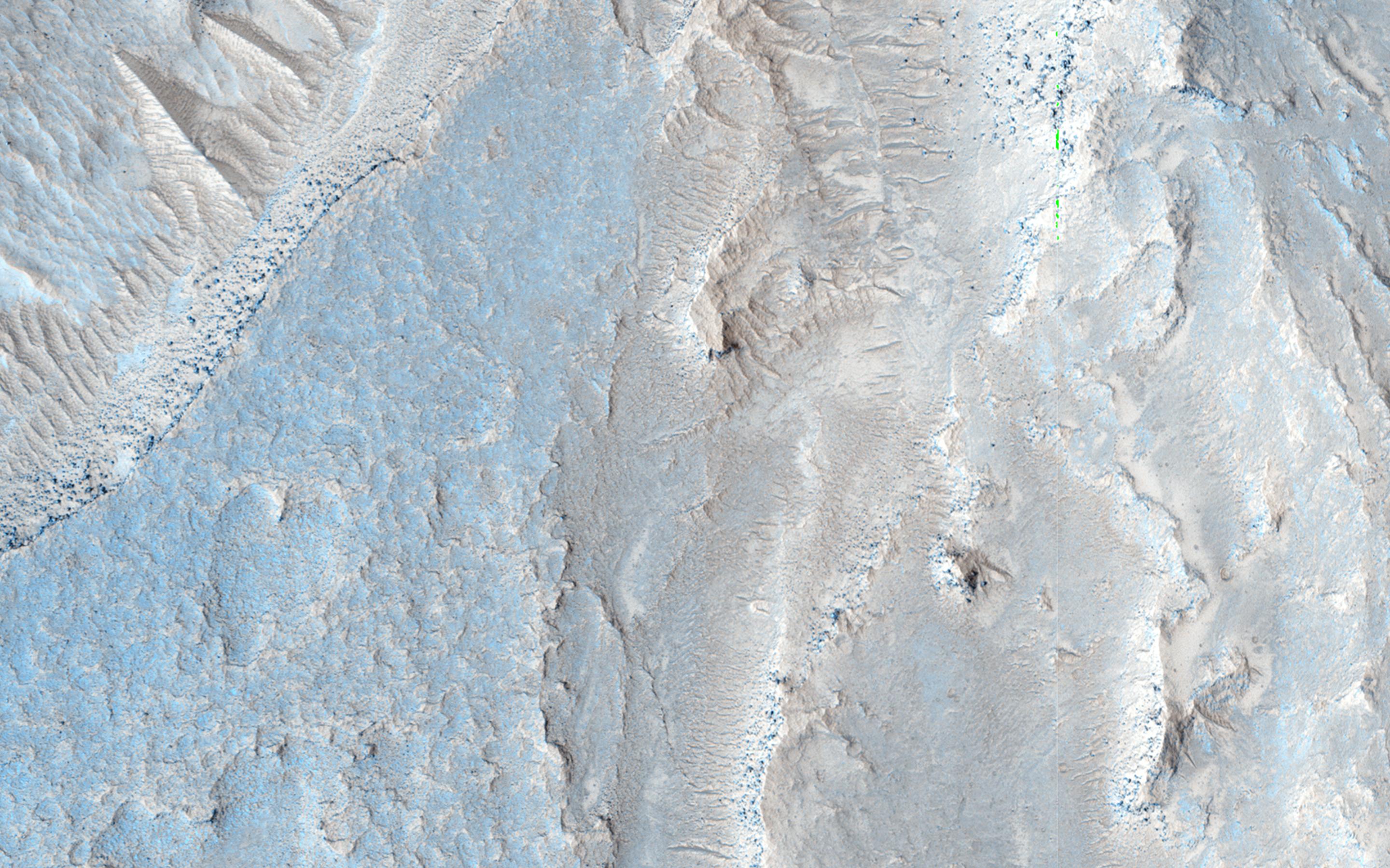
Map Projected Browse Image
Click on the image for larger version
This observation shows the full-width of a HiRISE image and its enhanced color strip, which only covers approximately 20 percent of the picture.
The image is approximately 6 by 6 kilometers and is located east of Noctis Labyrinthus, in a portion the large canyon system Valles Marineris. Visible in this image is a close-up of extensive deposits (some of which has a bluish color) that originated outside of the valley. These deposits appear to have flowed down towards low-lying areas and then bank up against higher topographic features.
Scientists are trying to determine if these deposits represent materials deposited by a massive landslide, an impact crater or a nearby volcanic event.
Background Info:
HiRISE is one of six instruments on NASA's Mars Reconnaissance Orbiter. The University of Arizona, Tucson, operates HiRISE, which was built by Ball Aerospace & Technologies Corp., Boulder, Colorado. NASA's Jet Propulsion Laboratory, a division of the California Institute of Technology in Pasadena, manages the Mars Reconnaissance Orbiter Project for NASA's Science Mission Directorate, Washington.
Cataloging Keywords:
| Name | Value | Additional Values |
|---|---|---|
| Target | Mars | |
| System | ||
| Target Type | Planet | |
| Mission | Mars Reconnaissance Orbiter (MRO) | Mariner |
| Instrument Host | Mars Reconnaissance Orbiter | |
| Host Type | Orbiter | Flyby Spacecraft |
| Instrument | High Resolution Imaging Science Experiment (HiRISE) | |
| Detector | ||
| Extra Keywords | Color, Crater, Impact, Map, Volcano | |
| Acquisition Date | ||
| Release Date | 2015-01-07 | |
| Date in Caption | ||
| Image Credit | NASA/JPL-Caltech/University of Arizona | |
| Source | photojournal.jpl.nasa.gov/catalog/PIA19126 | |
| Identifier | PIA19126 | |