|
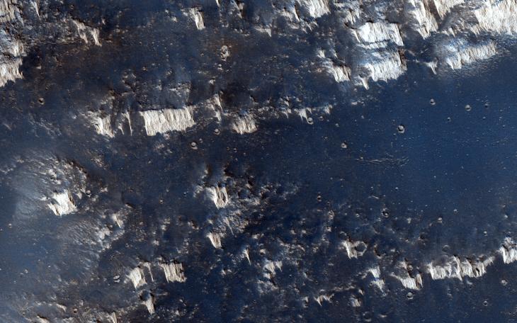
Higher Terrain between Sinai and Solis Plana
- Click the image above for a larger view
- Full-Res JPEG (2880 x 1800) (827.0 kB)
- Full-Res TIFF (2880 x 1800) (15.6 MB)
Caption:
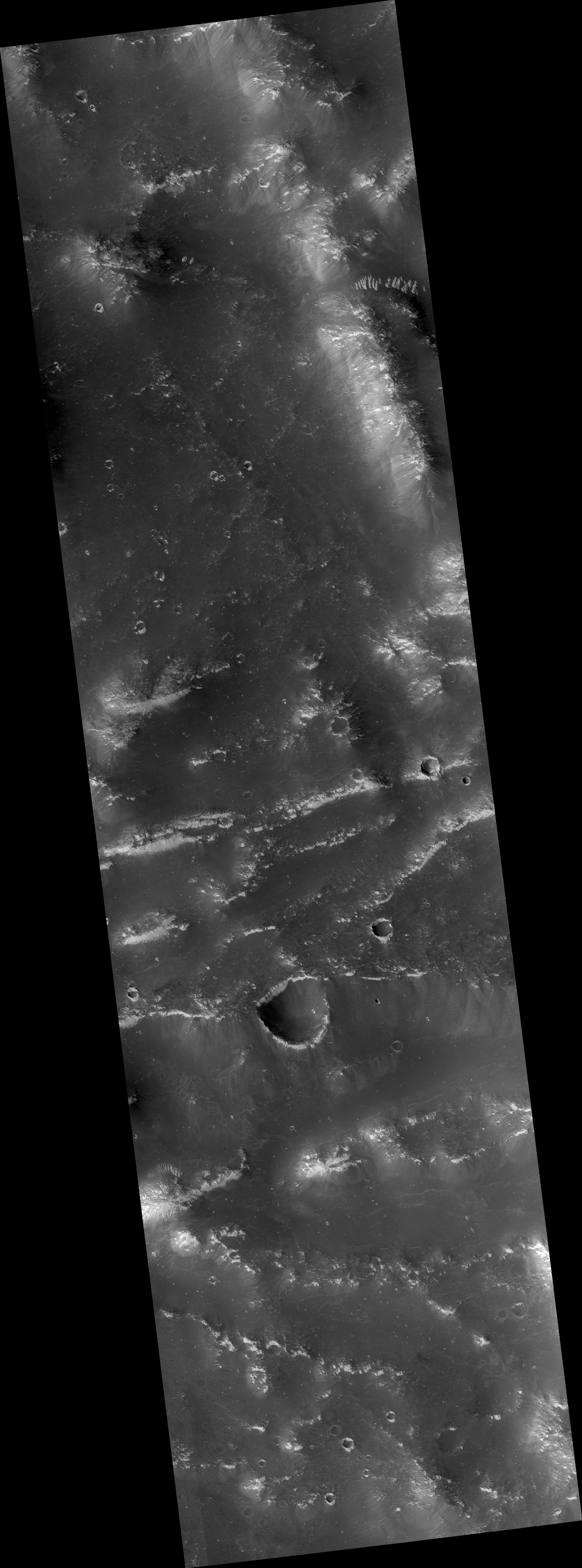
Map Projected Browse Image
Click on the image for larger version
The terrain in this observation looks like an ancient uplifted crustal block. The area is riddled with faults (big cracks that allow rocks to slide) and ridges that look like uncovered magma dikes.
A Mars Orbital Camera picture shows the region to be moderately dusty, but rocks do poke out along the ridges. With a high resolution images, we want to know if the dikes are of the same composition as the flood lavas that surround this high terrain. And what material did the dikes intrude upon which can be eroded away?
This caption is based on the original science rationale.
Background Info:
The University of Arizona, Tucson, operates HiRISE, which was built by Ball Aerospace & Technologies Corp., Boulder, Colo. NASA's Jet Propulsion Laboratory, a division of the California Institute of Technology in Pasadena, manages the Mars Reconnaissance Orbiter Project for NASA's Science Mission Directorate, Washington.
Cataloging Keywords:
| Name | Value | Additional Values |
|---|---|---|
| Target | Mars | |
| System | ||
| Target Type | Planet | |
| Mission | Mars Reconnaissance Orbiter (MRO) | |
| Instrument Host | Mars Reconnaissance Orbiter | |
| Host Type | Orbiter | |
| Instrument | High Resolution Imaging Science Experiment (HiRISE) | |
| Detector | ||
| Extra Keywords | Color, Dust, Map | |
| Acquisition Date | ||
| Release Date | 2015-01-28 | |
| Date in Caption | ||
| Image Credit | NASA/JPL-Caltech/University of Arizona | |
| Source | photojournal.jpl.nasa.gov/catalog/PIA19287 | |
| Identifier | PIA19287 | |