|
A Detailed Look at Raditladi Basin
- Click the image above for a larger view
- Full-Res JPEG (2700 x 2200) (1.1 MB)
- Full-Res TIFF (2700 x 2200) (5.9 MB)
Caption:
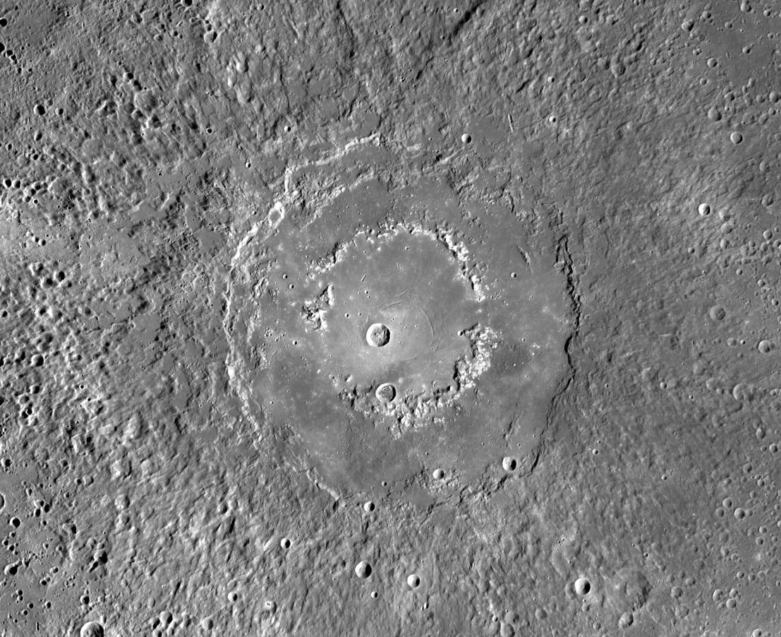
This MDIS mosaic provides a detailed view of the features and structures associated with the peak-ring basin Raditladi . Raditladi, first imaged during MESSENGER's first Mercury flyby and named in April 2008, continues to be an intriguing region of study, with its well-preserved features, relatively young age, exterior impact melt ponds , hollows-covered peak ring , and concentric troughs on its floor.
Instrument:
Mercury Dual Imaging System (MDIS)
Center Latitude:
27.1° N
Center Longitude:
119.2° E
Scale:
Raditladi has a diameter of 258 kilometers (160 miles)
Background Info:
The MESSENGER spacecraft is the first ever to orbit the planet Mercury, and the spacecraft's seven scientific instruments and radio science investigation are unraveling the history and evolution of the Solar System's innermost planet. In the mission's more than four years of orbital operations, MESSENGER has acquired over 250,000 images and extensive other data sets. MESSENGER's highly successful orbital mission is about to come to an end , as the spacecraft runs out of propellant and the force of solar gravity causes it to impact the surface of Mercury in April 2015.
For information regarding the use of images, see the MESSENGER image use policy .
Cataloging Keywords:
| Name | Value | Additional Values |
|---|---|---|
| Target | Mercury | |
| System | ||
| Target Type | Planet | |
| Mission | MESSENGER | |
| Instrument Host | MESSENGER | |
| Host Type | Orbiter | |
| Instrument | Mercury Dual Imaging System (MDIS) | |
| Detector | ||
| Extra Keywords | Grayscale, Impact, Radio | |
| Acquisition Date | ||
| Release Date | 2015-04-16 | |
| Date in Caption | ||
| Image Credit | NASA/Johns Hopkins University Applied Physics Laboratory/Carnegie Institution of Washington | |
| Source | photojournal.jpl.nasa.gov/catalog/PIA19409 | |
| Identifier | PIA19409 | |