|
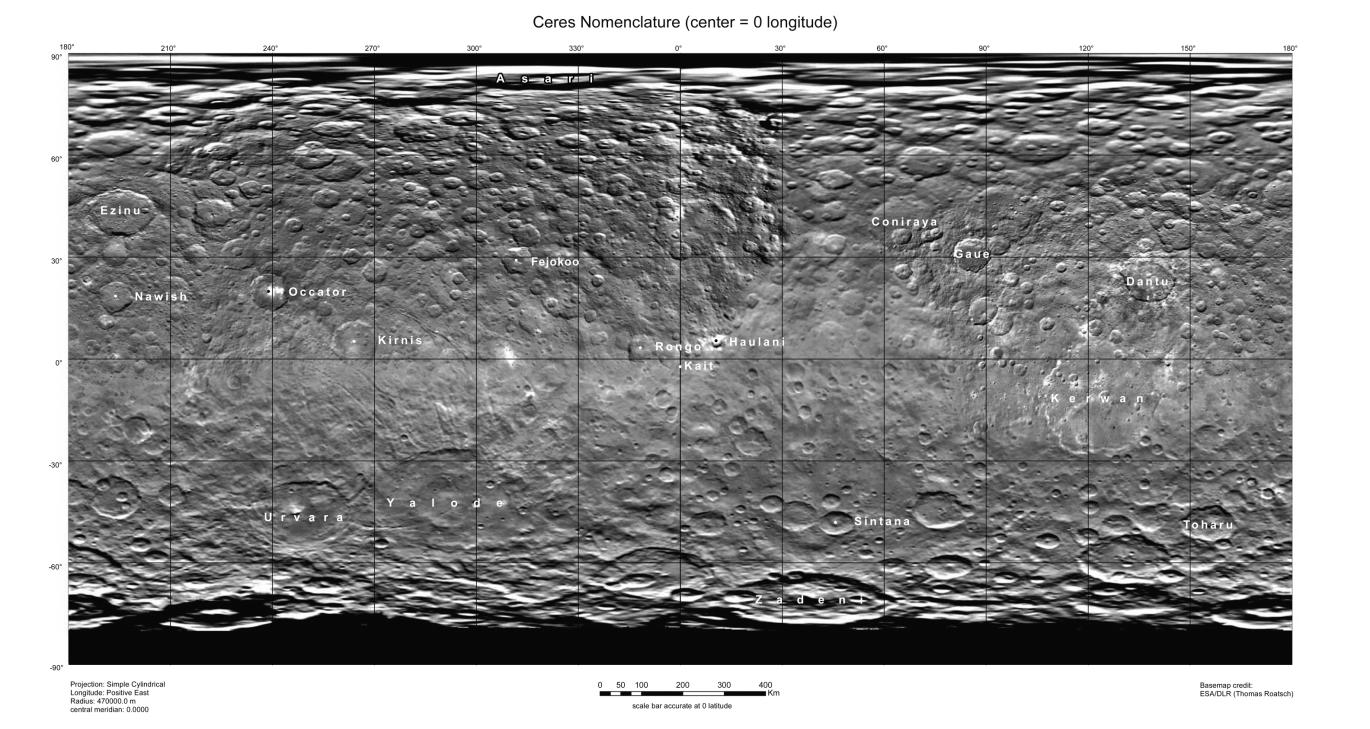
Ceres Map With Crater Names – August 2015
- Click the image above for a larger view
- Full-Res JPEG (3168 x 1686) (707.3 kB)
- Full-Res TIFF (3168 x 1686) (4.0 MB)
Caption:
This map of Ceres, constructed from data collected by NASA's Dawn spacecraft, shows the dwarf planet's surface with features that have been named as of August 14, 2015. This is a simple cylindrical projection centered on 0 degrees east longitude, created by science team members at the German Aerospace Center (DLR).
The most recently named feature is the small crater Kait, after the Hattic goddess of grain. It is a mere 0.2 miles (0.4 kilometers) across.
A full list of crater names on Ceres is available at http://planetarynames.wr.usgs.gov/SearchResults%3Ftarget=CERES .
Background Info:
Dawn's mission is managed by JPL for NASA's Science Mission Directorate in Washington. Dawn is a project of the directorate's Discovery Program, managed by NASA's Marshall Space Flight Center in Huntsville, Alabama. UCLA is responsible for overall Dawn mission science. Orbital ATK, Inc., in Dulles, Virginia, designed and built the spacecraft. The German Aerospace Center, the Max Planck Institute for Solar System Research, the Italian Space Agency and the Italian National Astrophysical Institute are international partners on the mission team. For a complete list of acknowledgments, see http://dawn.jpl.nasa.gov/mission .
For more information about the Dawn mission, visit http://dawn.jpl.nasa.gov .
Cataloging Keywords:
| Name | Value | Additional Values |
|---|---|---|
| Target | 1 Ceres | |
| System | Main Belt | |
| Target Type | Dwarf Planet | Asteroid |
| Mission | Dawn | |
| Instrument Host | Dawn | |
| Host Type | Orbiter | |
| Instrument | Framing Camera (FC) | |
| Detector | ||
| Extra Keywords | Crater, Grayscale, Map | |
| Acquisition Date | ||
| Release Date | 2015-08-17 | |
| Date in Caption | 2015-08-14 | |
| Image Credit | NASA/JPL-Caltech/UCLA/MPS/DLR/IDA | |
| Source | photojournal.jpl.nasa.gov/catalog/PIA19625 | |
| Identifier | PIA19625 | |