
|
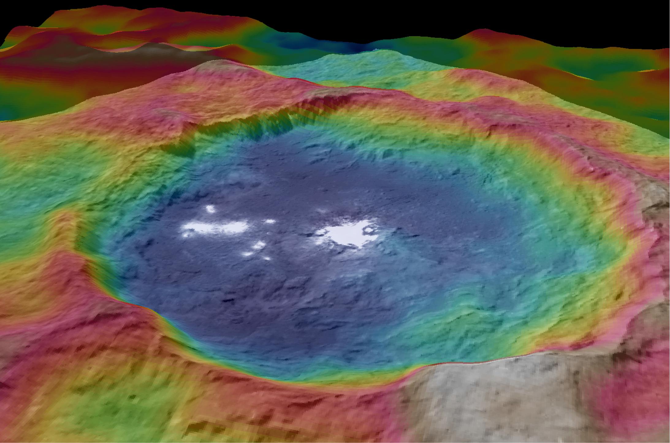
Occator Topography
- Click the image above for a larger view
- Full-Res JPEG (2186 x 1446) (273.6 kB)
- Full-Res TIFF (2186 x 1446) (7.2 MB)
Caption:
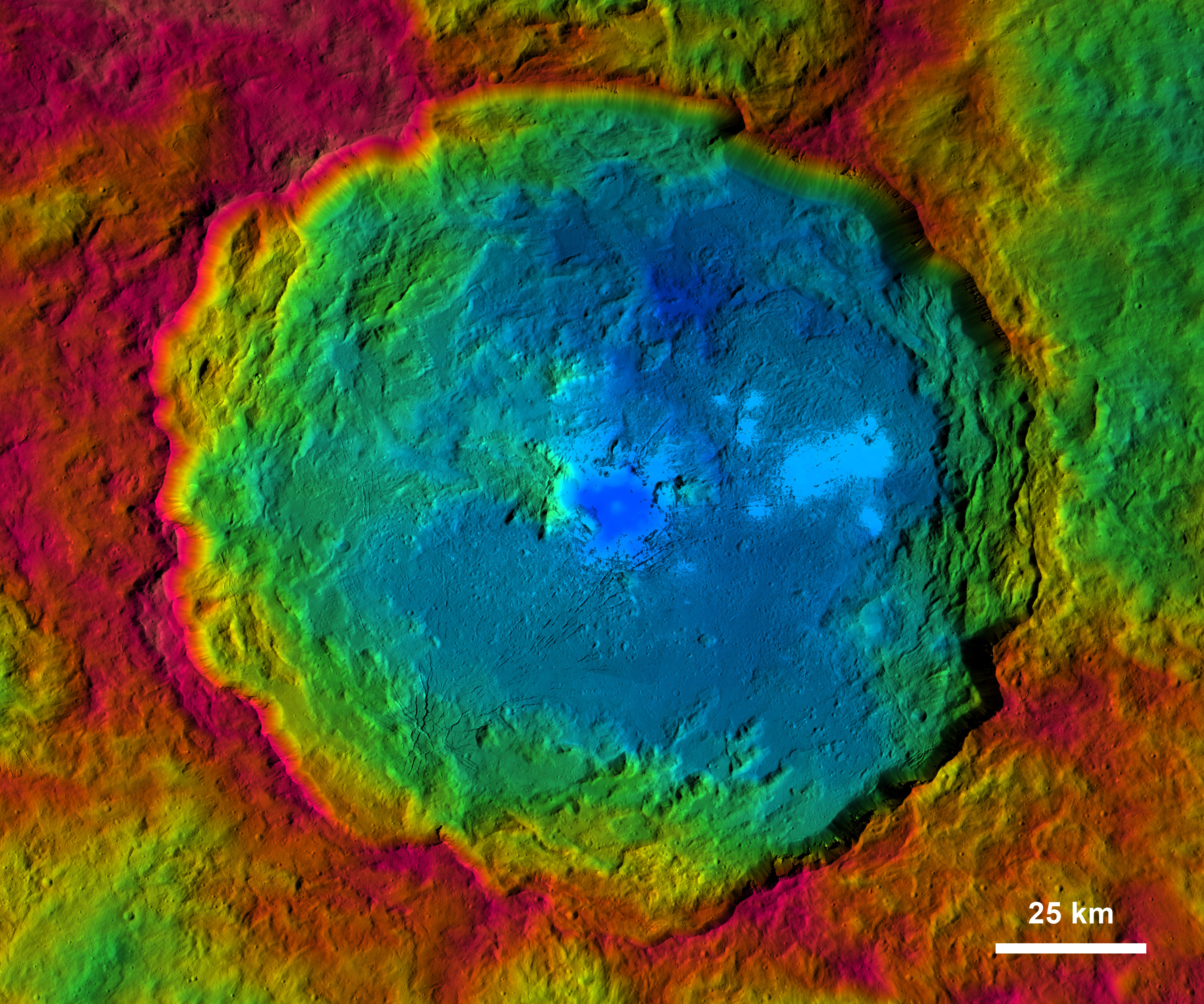
Figure 1
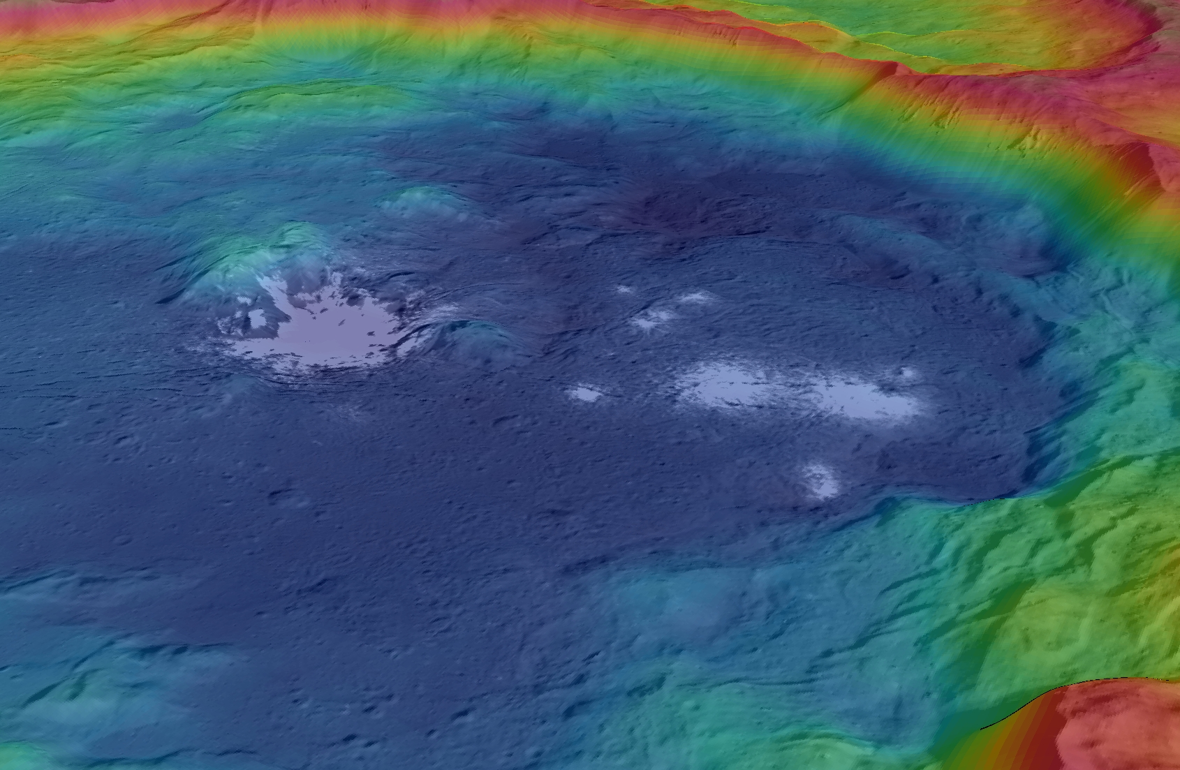
Figure 2

Figure 3
These views, made using images taken by NASA's Dawn spacecraft, show color-coded topographic maps of Occator Crater on Ceres.
Blue is the lowest elevation, and brown is the highest. The crater, which is home to the brightest spots on Ceres, is approximately 57 miles (92 kilometers) wide and 2.5 miles (4 kilometers) deep.
Background Info:
Dawn's mission is managed by JPL for NASA's Science Mission Directorate in Washington. Dawn is a project of the directorate's Discovery Program, managed by NASA's Marshall Space Flight Center in Huntsville, Alabama. UCLA is responsible for overall Dawn mission science. Orbital ATK, Inc., in Dulles, Virginia, designed and built the spacecraft. The German Aerospace Center, the Max Planck Institute for Solar System Research, the Italian Space Agency and the Italian National Astrophysical Institute are international partners on the mission team. For a complete list of acknowledgments, see http://dawn.jpl.nasa.gov/mission .
For more information about the Dawn mission, visit http://dawn.jpl.nasa.gov .
Cataloging Keywords:
| Name | Value | Additional Values |
|---|---|---|
| Target | 1 Ceres | |
| System | Main Belt | |
| Target Type | Dwarf Planet | Asteroid |
| Mission | Dawn | |
| Instrument Host | Dawn | |
| Host Type | Orbiter | |
| Instrument | Framing Camera (FC) | |
| Detector | ||
| Extra Keywords | Color, Crater | |
| Acquisition Date | ||
| Release Date | 2015-09-30 | |
| Date in Caption | ||
| Image Credit | NASA/JPL-Caltech/UCLA/MPS/DLR/IDA | |
| Source | photojournal.jpl.nasa.gov/catalog/PIA19975 | |
| Identifier | PIA19975 | |