|
Dawn HAMO Image 85
- Click the image above for a larger view
- Full-Res JPEG (1024 x 1024) (257.6 kB)
- Full-Res TIFF (1024 x 1024) (1.1 MB)
Caption:
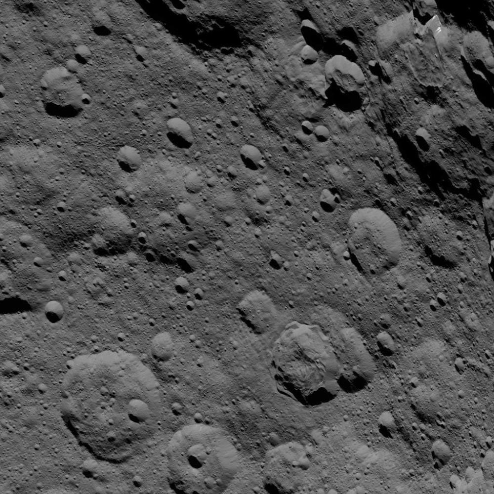
This image of Ceres, taken by NASA's Dawn spacecraft, shows cratered terrain at high northern latitudes. Dawn acquired the view from an altitude of 915 miles (1,470 kilometers) during the mission's High Altitude Mapping Orbit (HAMO) phase on Oct. 20, 2015. Image resolution is 450 feet (140 meters) per pixel.
Ghanan Crater, 42 miles (68 kilometers) in diameter, is seen at upper-right. A distinctive flow feature extends into the crater from its northern rim. The image is located at approximately 72 degrees north latitude, 8 degrees east longitude.
Background Info:
Dawn's mission is managed by JPL for NASA's Science Mission Directorate in Washington. Dawn is a project of the directorate's Discovery Program, managed by NASA's Marshall Space Flight Center in Huntsville, Alabama. UCLA is responsible for overall Dawn mission science. Orbital ATK, Inc., in Dulles, Virginia, designed and built the spacecraft. The German Aerospace Center, the Max Planck Institute for Solar System Research, the Italian Space Agency and the Italian National Astrophysical Institute are international partners on the mission team. For a complete list of acknowledgments, see http://dawn.jpl.nasa.gov/mission .
For more information about the Dawn mission, visit http://dawn.jpl.nasa.gov .
Cataloging Keywords:
| Name | Value | Additional Values |
|---|---|---|
| Target | 1 Ceres | |
| System | Main Belt | |
| Target Type | Dwarf Planet | Asteroid |
| Mission | Dawn | |
| Instrument Host | Dawn | |
| Host Type | Orbiter | |
| Instrument | Framing Camera (FC) | |
| Detector | ||
| Extra Keywords | Crater, Grayscale | |
| Acquisition Date | ||
| Release Date | 2016-01-05 | |
| Date in Caption | 2015-10-20 | |
| Image Credit | NASA/JPL-Caltech/UCLA/MPS/DLR/IDA | |
| Source | photojournal.jpl.nasa.gov/catalog/PIA20148 | |
| Identifier | PIA20148 | |