|
Dawn LAMO Image 10
- Click the image above for a larger view
- Full-Res JPEG (1024 x 1024) (121.5 kB)
- Full-Res TIFF (1024 x 1024) (1.1 MB)
Caption:
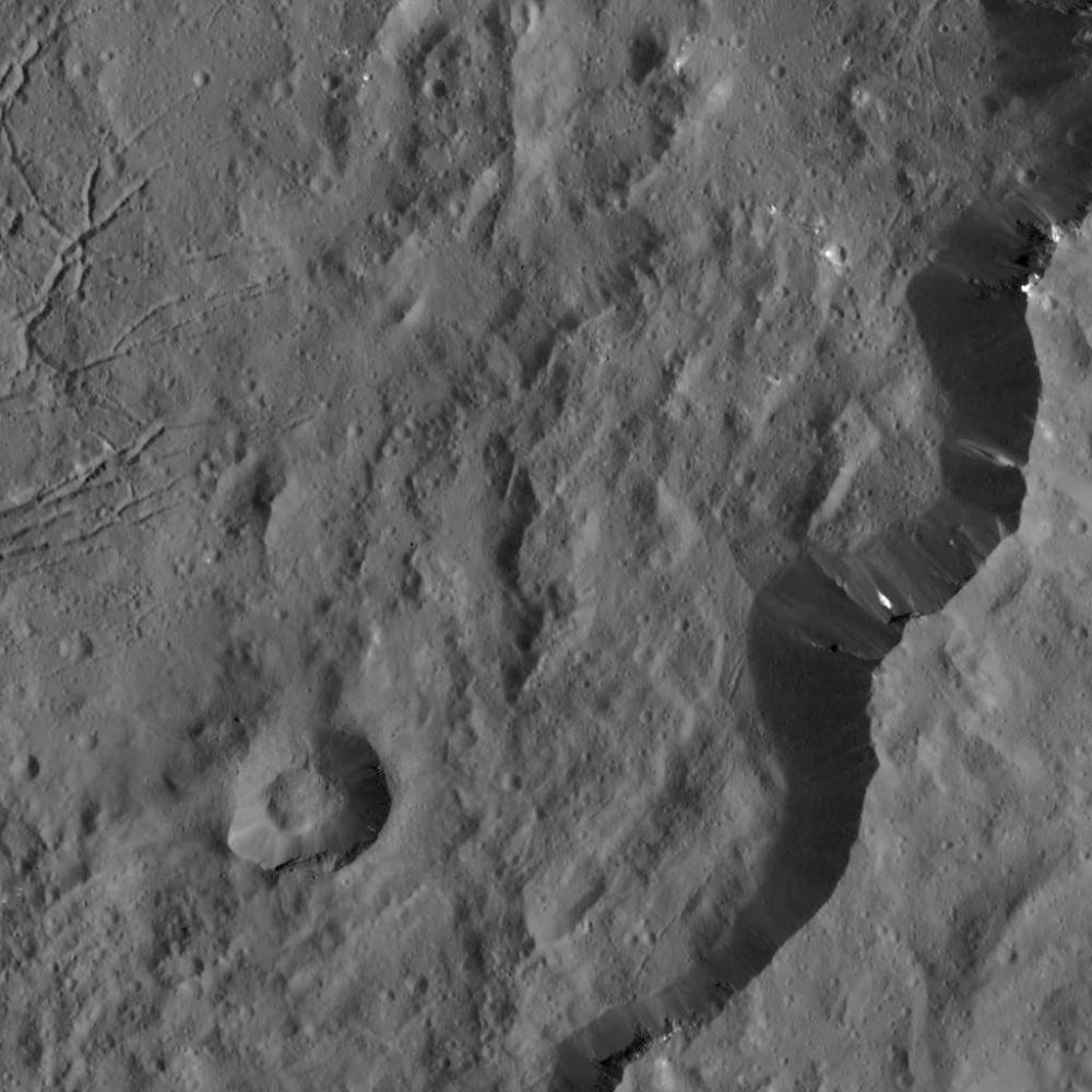
This view from NASA's Dawn spacecraft captures the southeast rim of Dantu Crater. Bright material can be seen in some places along the walls. A network of fractures in the crater floor is visible at upper right. Dawn previously imaged the whole of Dantu from a higher-altitude mapping orbit (see PIA19993 ).
The image is centered at approximately 20 degrees north latitude, 142 degrees east longitude. Dawn captured the scene on Dec. 20, 2015 from its low-altitude mapping orbit (LAMO), at an approximate altitude of 240 miles (385 kilometers) above Ceres. The image resolution is 120 feet (35 meters) per pixel.
Background Info:
Dawn's mission is managed by JPL for NASA's Science Mission Directorate in Washington. Dawn is a project of the directorate's Discovery Program, managed by NASA's Marshall Space Flight Center in Huntsville, Alabama. UCLA is responsible for overall Dawn mission science. Orbital ATK, Inc., in Dulles, Virginia, designed and built the spacecraft. The German Aerospace Center, the Max Planck Institute for Solar System Research, the Italian Space Agency and the Italian National Astrophysical Institute are international partners on the mission team. For a complete list of acknowledgments, see http://dawn.jpl.nasa.gov/mission .
For more information about the Dawn mission, visit http://dawn.jpl.nasa.gov .
Cataloging Keywords:
| Name | Value | Additional Values |
|---|---|---|
| Target | 1 Ceres | |
| System | Main Belt | |
| Target Type | Dwarf Planet | Asteroid |
| Mission | Dawn | |
| Instrument Host | Dawn | |
| Host Type | Orbiter | |
| Instrument | Framing Camera (FC) | |
| Detector | ||
| Extra Keywords | Crater, Grayscale | |
| Acquisition Date | ||
| Release Date | 2016-01-21 | |
| Date in Caption | 2015-12-20 | |
| Image Credit | NASA/JPL-Caltech/UCLA/MPS/DLR/IDA | |
| Source | photojournal.jpl.nasa.gov/catalog/PIA20300 | |
| Identifier | PIA20300 | |