|
Inverted Terrain in Eridania
- Click the image above for a larger view
- Full-Res JPEG (2880 x 1800) (768.0 kB)
- Full-Res TIFF (2880 x 1800) (15.6 MB)
Caption:
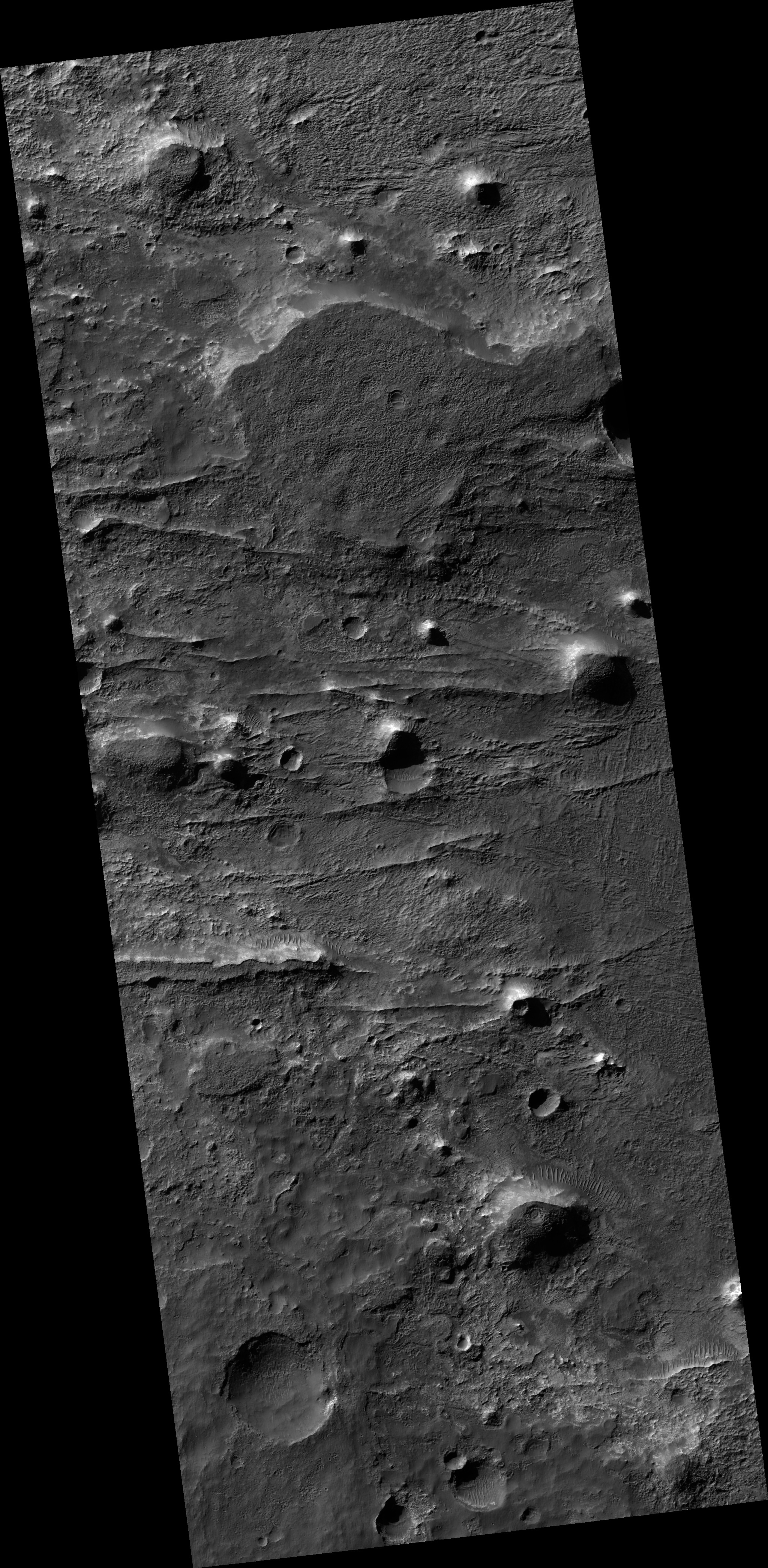
Map Projected Browse Image
Click on the image for larger version
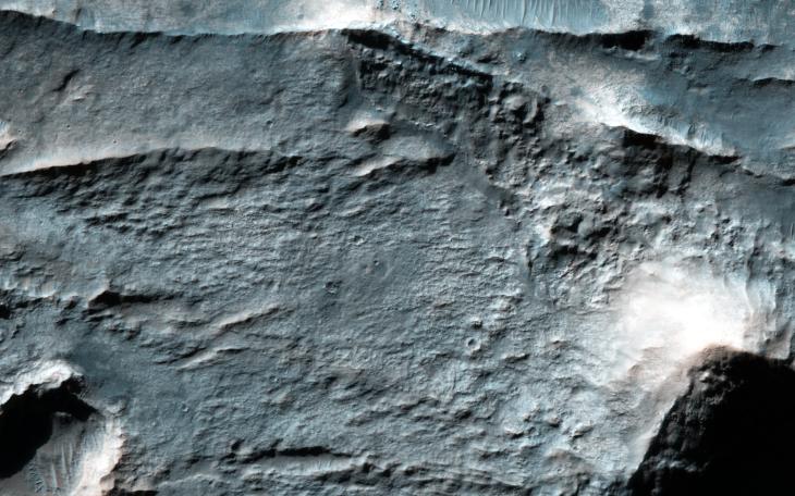
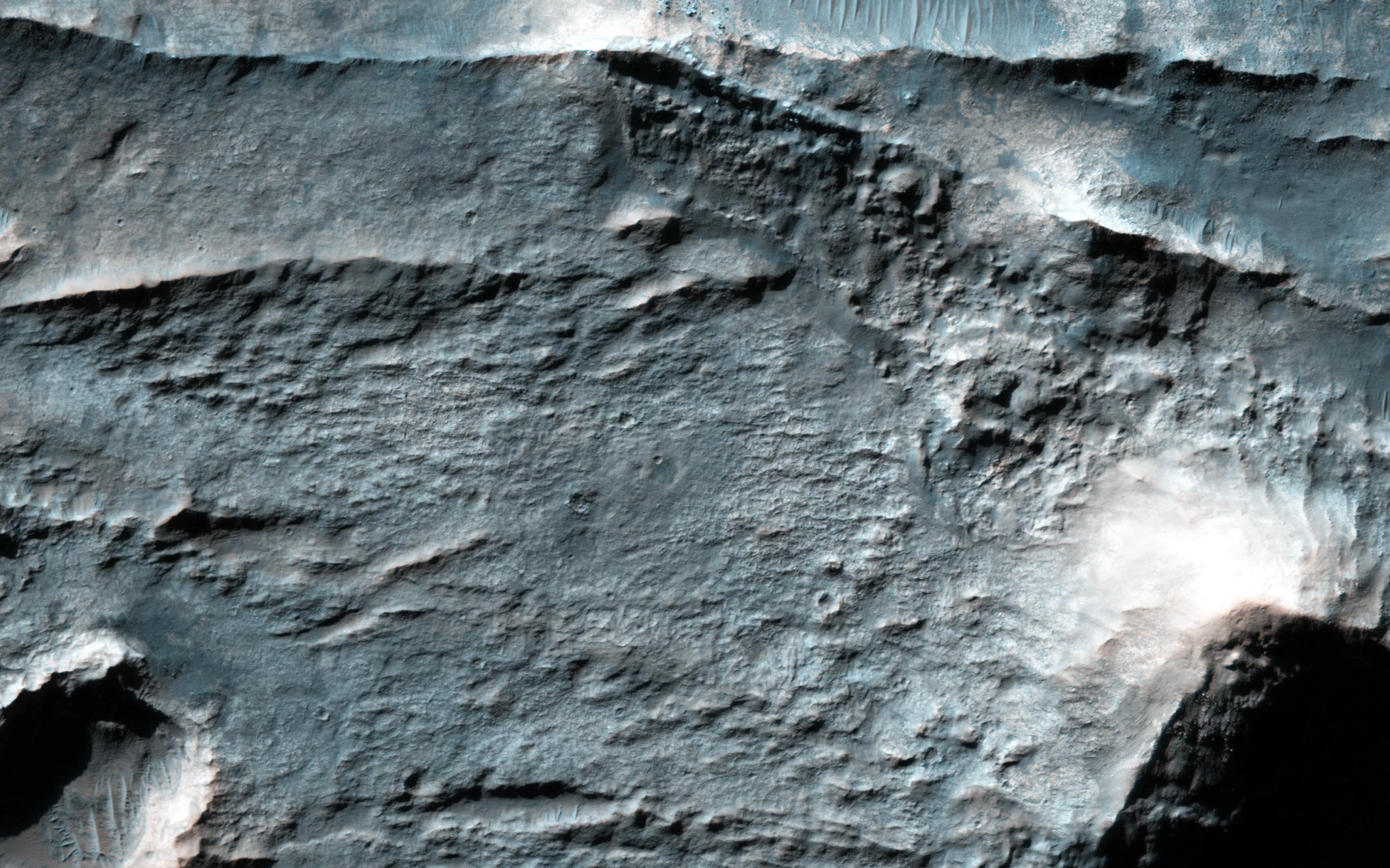
The Eridania Basin is thought to have once contained a large sea. This image shows the Gorgonum Basin, which lies along the eastern edge of Eridania.
Along this eastern boundary, the terrain is being eroded away to expose light-toned altered material, including clays . There are also linear ridges and inverted channels. The channels and ridges are now inverted because they are composed of material that is harder than their surroundings (e.g., cements) so as erosion removes the softer materials, the harder rocks within the channels and ridges remain.
The ridges and channels are interpreted to have formed by water flow, either along the surface (channels) or in the subsurface (ridges), providing clues to the water history of Eridania.
Background Info:
The University of Arizona, Tucson, operates HiRISE, which was built by Ball Aerospace & Technologies Corp., Boulder, Colo. NASA's Jet Propulsion Laboratory, a division of the California Institute of Technology in Pasadena, manages the Mars Reconnaissance Orbiter Project for NASA's Science Mission Directorate, Washington.
Cataloging Keywords:
| Name | Value | Additional Values |
|---|---|---|
| Target | Mars | |
| System | ||
| Target Type | Planet | |
| Mission | Mars Reconnaissance Orbiter (MRO) | |
| Instrument Host | Mars Reconnaissance Orbiter | |
| Host Type | Orbiter | |
| Instrument | High Resolution Imaging Science Experiment (HiRISE) | |
| Detector | ||
| Extra Keywords | Color, Map, Water | |
| Acquisition Date | ||
| Release Date | 2016-02-11 | |
| Date in Caption | ||
| Image Credit | NASA/JPL-Caltech/Univ. of Arizona | |
| Source | photojournal.jpl.nasa.gov/catalog/PIA20379 | |
| Identifier | PIA20379 | |