|
Faulted Layers in Collapse Pits
- Click the image above for a larger view
- Full-Res JPEG (2880 x 1800) (584.2 kB)
- Full-Res TIFF (2880 x 1800) (15.1 MB)
Caption:
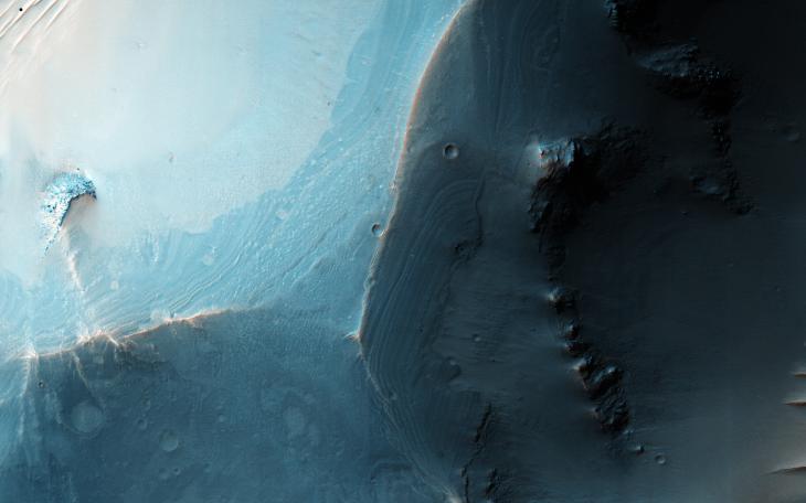
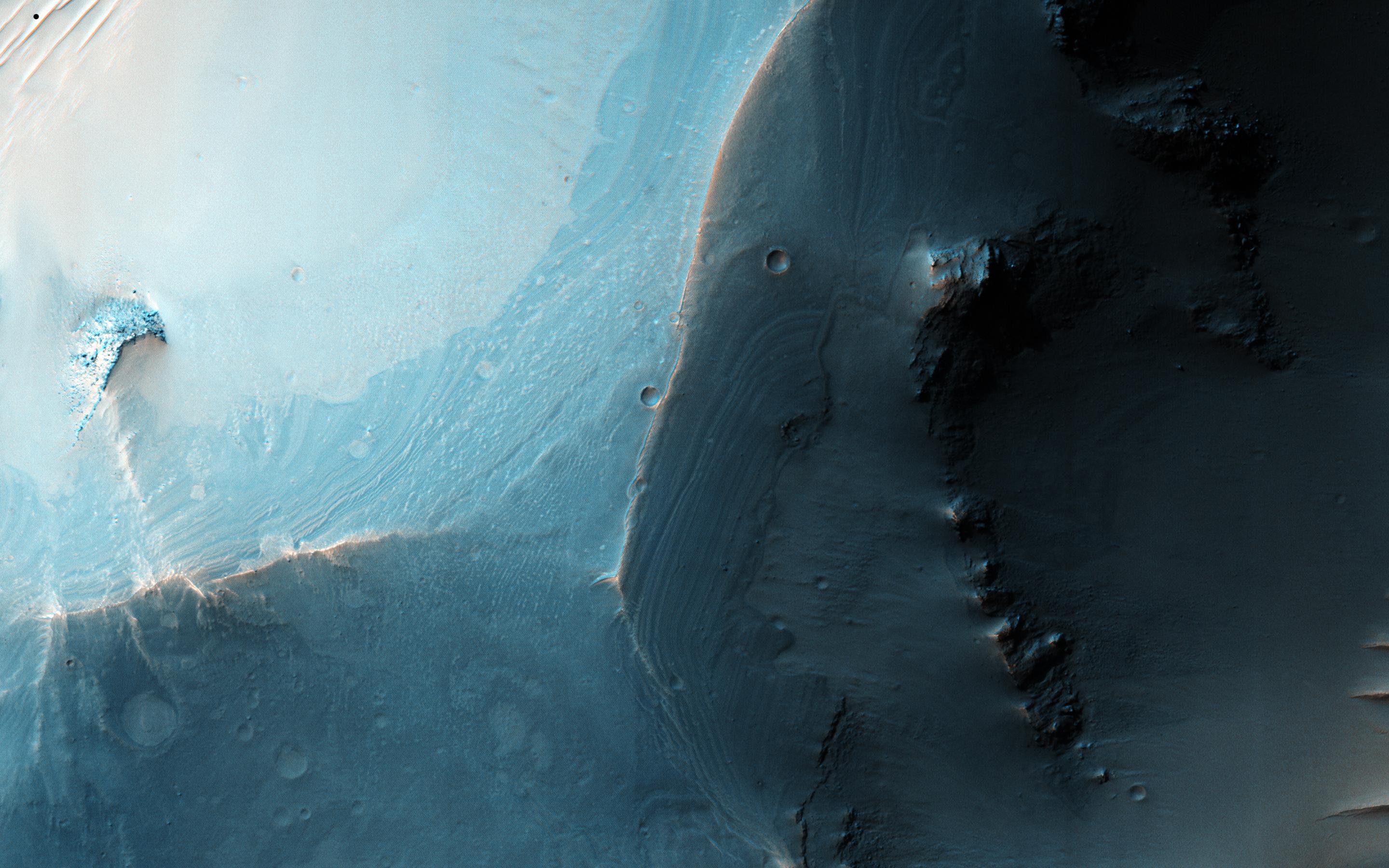
Map Projected Browse Image
Click on the image for larger version
This image shows a set of coalesced collapse pits in western Valles Marineris.
Fine layers are exposed in the walls of the pits, and in some places those layers are displaced by faults . What formed these layers, and what caused them to collapse into pits? Detailed study of this image and other data should help answer those questions.
This is a stereo pair with ESP_044982_2670 .
Background Info:
The University of Arizona, Tucson, operates HiRISE, which was built by Ball Aerospace & Technologies Corp., Boulder, Colo. NASA's Jet Propulsion Laboratory, a division of the California Institute of Technology in Pasadena, manages the Mars Reconnaissance Orbiter Project for NASA's Science Mission Directorate, Washington.
Cataloging Keywords:
| Name | Value | Additional Values |
|---|---|---|
| Target | Mars | |
| System | ||
| Target Type | Planet | |
| Mission | Mars Reconnaissance Orbiter (MRO) | Mariner |
| Instrument Host | Mars Reconnaissance Orbiter | |
| Host Type | Orbiter | Flyby Spacecraft |
| Instrument | High Resolution Imaging Science Experiment (HiRISE) | |
| Detector | ||
| Extra Keywords | Map | |
| Acquisition Date | ||
| Release Date | 2016-04-06 | |
| Date in Caption | ||
| Image Credit | NASA/JPL-Caltech/Univ. of Arizona | |
| Source | photojournal.jpl.nasa.gov/catalog/PIA20547 | |
| Identifier | PIA20547 | |