|
Dawn LAMO Image 81
- Click the image above for a larger view
- Full-Res JPEG (1024 x 1024) (197.6 kB)
- Full-Res TIFF (1024 x 1024) (1.1 MB)
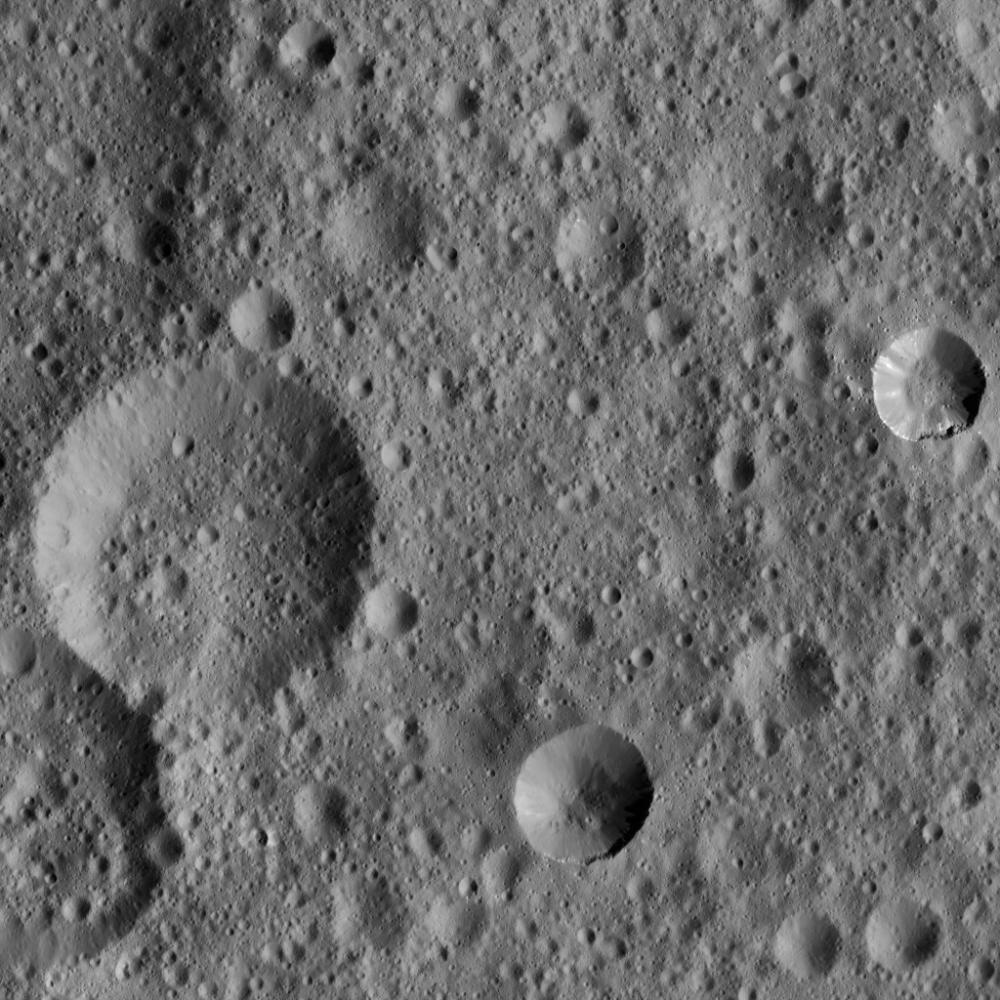
Caption:
This picture shows two relatively fresh craters (at center right and bottom center) within older, highly cratered terrain on Ceres. The young crater at right shows some spurs of compacted material along its rim, as well as some bright streaks along its flanks.
The view is centered at approximately 36 degrees north latitude, 347 degrees east longitude. NASA's Dawn spacecraft took this image on March 20, 2016, in its low-altitude mapping orbit, at a distance of about 240 miles (385 kilometers) above the surface. The image resolution is 120 feet (35 meters) per pixel.
Background Info:
Dawn's mission is managed by JPL for NASA's Science Mission Directorate in Washington. Dawn is a project of the directorate's Discovery Program, managed by NASA's Marshall Space Flight Center in Huntsville, Alabama. UCLA is responsible for overall Dawn mission science. Orbital ATK, Inc., in Dulles, Virginia, designed and built the spacecraft. The German Aerospace Center, the Max Planck Institute for Solar System Research, the Italian Space Agency and the Italian National Astrophysical Institute are international partners on the mission team. For a complete list of acknowledgments, see http://dawn.jpl.nasa.gov/mission .
For more information about the Dawn mission, visit http://dawn.jpl.nasa.gov .
Cataloging Keywords:
| Name | Value | Additional Values |
|---|---|---|
| Target | 1 Ceres | |
| System | Main Belt | |
| Target Type | Dwarf Planet | Asteroid |
| Mission | Dawn | |
| Instrument Host | Dawn | |
| Host Type | Orbiter | |
| Instrument | Framing Camera (FC) | |
| Detector | ||
| Extra Keywords | Crater, Grayscale | |
| Acquisition Date | ||
| Release Date | 2016-05-04 | |
| Date in Caption | 2016-03-20 | |
| Image Credit | NASA/JPL-Caltech/UCLA/MPS/DLR/IDA | |
| Source | photojournal.jpl.nasa.gov/catalog/PIA20576 | |
| Identifier | PIA20576 | |