|
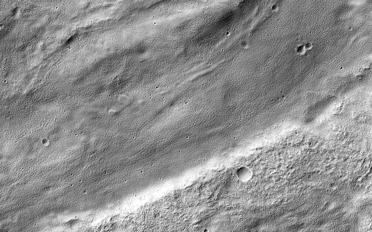
A Meandering Channel on Hellas’ Rim
- Click the image above for a larger view
- Full-Res JPEG (2880 x 1800) (1.5 MB)
- Full-Res TIFF (2880 x 1800) (5.2 MB)
Caption:

Map Projected Browse Image
Click on the image for larger version
The central portion of this image features a mildly-winding depression that was carved by water, likely around four billion years ago shortly after the Hellas basin formed following a giant asteroid or comet impact.
Water would have flowed from the uplands (to the east) and drained into the low-lying basin, carving river channels as it flowed. The gentle curves-called "meanders" by geomorphologists-imply that this paleoriver carried lots of sediment along with it, depositing it into Hellas.
Background Info:
The University of Arizona, Tucson, operates HiRISE, which was built by Ball Aerospace & Technologies Corp., Boulder, Colo. NASA's Jet Propulsion Laboratory, a division of the California Institute of Technology in Pasadena, manages the Mars Reconnaissance Orbiter Project for NASA's Science Mission Directorate, Washington.
Cataloging Keywords:
| Name | Value | Additional Values |
|---|---|---|
| Target | Mars | |
| System | ||
| Target Type | Planet | |
| Mission | Mars Reconnaissance Orbiter (MRO) | |
| Instrument Host | Mars Reconnaissance Orbiter | |
| Host Type | Orbiter | |
| Instrument | High Resolution Imaging Science Experiment (HiRISE) | |
| Detector | ||
| Extra Keywords | Asteroid, Comet, Grayscale, Impact, Map, Water | |
| Acquisition Date | ||
| Release Date | 2016-07-15 | |
| Date in Caption | ||
| Image Credit | NASA/JPL-Caltech/Univ. of Arizona | |
| Source | photojournal.jpl.nasa.gov/catalog/PIA20815 | |
| Identifier | PIA20815 | |