|
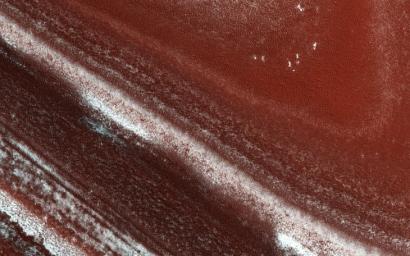
North Polar Cap Layers and Ledges
- Click the image above for a larger view
- Full-Res JPEG (2880 x 1800) (1.2 MB)
- Full-Res TIFF (2880 x 1800) (15.6 MB)
Caption:

Map Projected Browse Image
Click on the image for larger version
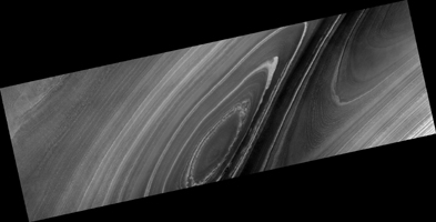
At the edge of Mars' permanent North Polar cap, we see an exposure of the internal layers, each with a different mix of water ice, dust and dirt. These layers are believed to correspond to different climate conditions over the past tens of thousands of years.
When we zoom in closer , we see that the distinct layers erode differently. Some are stronger and more resistant to erosion, others only weakly cemented. The strong layers form ledges.
Background Info:
The University of Arizona, Tucson, operates HiRISE, which was built by Ball Aerospace & Technologies Corp., Boulder, Colo. NASA's Jet Propulsion Laboratory, a division of the California Institute of Technology in Pasadena, manages the Mars Reconnaissance Orbiter Project for NASA's Science Mission Directorate, Washington.
Cataloging Keywords:
| Name | Value | Additional Values |
|---|---|---|
| Target | Mars | |
| System | ||
| Target Type | Planet | |
| Mission | Mars Reconnaissance Orbiter (MRO) | |
| Instrument Host | Mars Reconnaissance Orbiter | |
| Host Type | Orbiter | |
| Instrument | High Resolution Imaging Science Experiment (HiRISE) | |
| Detector | ||
| Extra Keywords | Color, Dust, Map, Water | |
| Acquisition Date | ||
| Release Date | 2016-08-24 | |
| Date in Caption | ||
| Image Credit | NASA/JPL-Caltech/Univ. of Arizona | |
| Source | photojournal.jpl.nasa.gov/catalog/PIA21022 | |
| Identifier | PIA21022 | |
