|
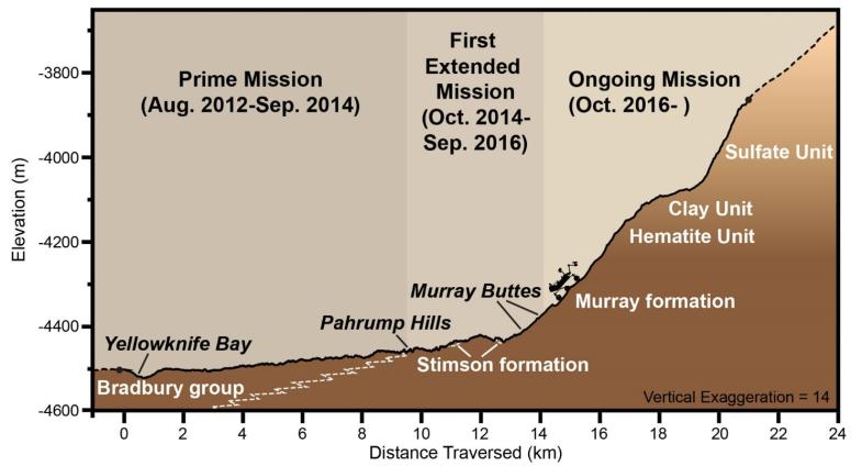
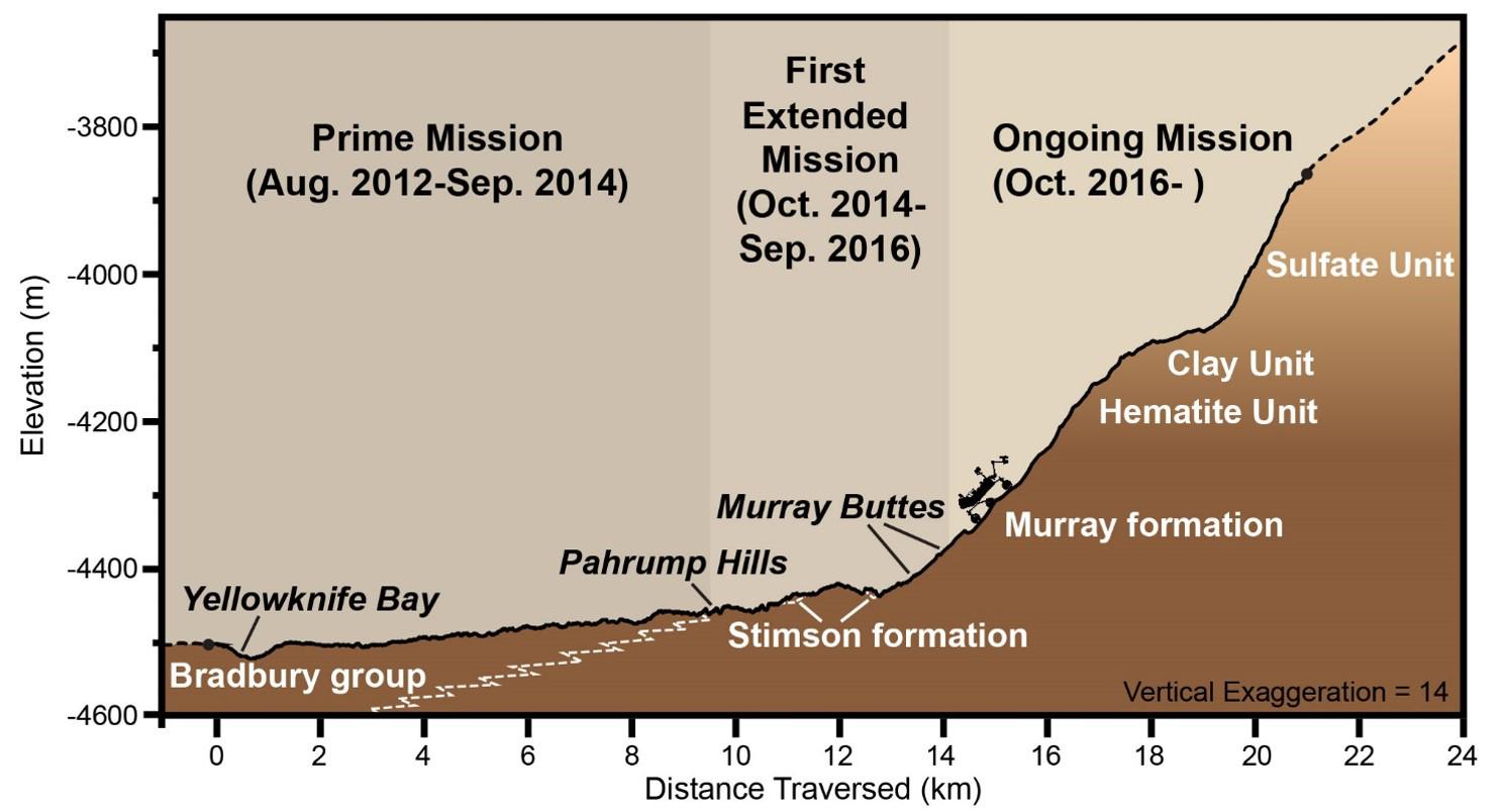
Curiosity Rover’s Martian Mission, Exaggerated Cross Section
- Click the image above for a larger view
- Full-Res JPEG (1490 x 804) (101.3 kB)
- Full-Res TIFF (1490 x 804) (994.6 kB)
Caption:
This graphic depicts aspects of the driving distance, elevation, geological units and time intervals of NASA's Curiosity Mars rover mission, as of late 2016. The vertical dimension is exaggerated 14-fold compared with the horizontal dimension, for presentation-screen proportions.
As of early December 2016, Curiosity had driven 9.3 miles (15 kilometers) since its August 2012 landing on the floor of Gale Crater near the base of Mount Sharp. It had climbed 541 feet (165 meters) in elevation. Elevation values shown on the vertical scale of this chart denote meters below an established zero-elevation level on Mars, which lacks a planetary "sea level." Because Curiosity is below the zero elevation, the numbers are negative.
Presented at the 2016 AGU Fall Meeting on Dec. 13. in San Francisco, CA.
Background Info:
NASA's Jet Propulsion Laboratory, a division of Caltech in Pasadena, California, manages the Mars Science Laboratory Project for NASA's Science Mission Directorate, Washington.
For more information about Curiosity, visit http://www.nasa.gov/msl and http://mars.jpl.nasa.gov/msl .
Cataloging Keywords:
| Name | Value | Additional Values |
|---|---|---|
| Target | Mars | |
| System | ||
| Target Type | Planet | |
| Mission | Mars Science Laboratory (MSL) | |
| Instrument Host | Curiosity Rover | |
| Host Type | Rover | |
| Instrument | ||
| Detector | ||
| Extra Keywords | Color, Crater | |
| Acquisition Date | ||
| Release Date | 2016-12-13 | |
| Date in Caption | ||
| Image Credit | NASA/JPL-Caltech | |
| Source | photojournal.jpl.nasa.gov/catalog/PIA21145 | |
| Identifier | PIA21145 | |