
|
Memnonia Sulci
- Click the image above for a larger view
- Full-Res JPEG (1363 x 2645) (429.7 kB)
- Full-Res TIFF (1363 x 2645) (2.9 MB)
Caption:
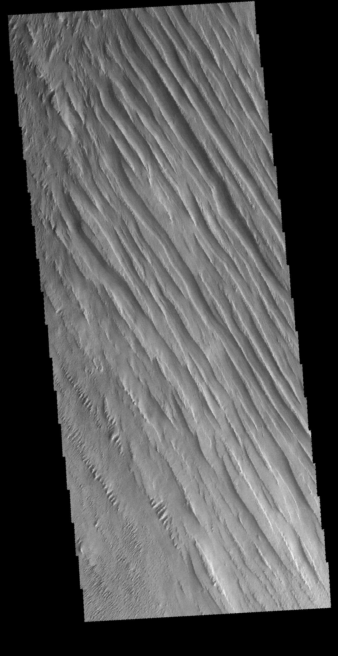
Context image
Today's VIS image shows some of the extensive wind etched terrain in Memnonia Sulci, located south west of Olympus Mons. The linear ridges are called yardangs and form by wind removal of semi-cemented material. The ridges are parallel to wind direction, so the predominate winds that created the yardangs in this image blew NW/SE. At the bottom of the image several of the ridges have been eroded into smaller ridges aligned perpendicular to the large yardangs, indicating winds at a different angle.
Orbit Number: 66197 Latitude: -5.91796 Longitude: 183.886 Instrument: VIS Captured: 2016-11-15 13:08
Background Info:
Please see the THEMIS Data Citation Note for details on crediting THEMIS images.
NASA's Jet Propulsion Laboratory manages the 2001 Mars Odyssey mission for NASA's Science Mission Directorate, Washington, D.C. The Thermal Emission Imaging System (THEMIS) was developed by Arizona State University, Tempe, in collaboration with Raytheon Santa Barbara Remote Sensing. The THEMIS investigation is led by Dr. Philip Christensen at Arizona State University. Lockheed Martin Astronautics, Denver, is the prime contractor for the Odyssey project, and developed and built the orbiter. Mission operations are conducted jointly from Lockheed Martin and from JPL, a division of the California Institute of Technology in Pasadena.
Cataloging Keywords:
| Name | Value | Additional Values |
|---|---|---|
| Target | Mars | |
| System | ||
| Target Type | Planet | |
| Mission | 2001 Mars Odyssey | |
| Instrument Host | Mars Odyssey | |
| Host Type | Orbiter | |
| Instrument | Thermal Emission Imaging System (THEMIS) | |
| Detector | ||
| Extra Keywords | Grayscale, Mountain, Thermal | |
| Acquisition Date | ||
| Release Date | 2017-01-09 | |
| Date in Caption | 2016-11-15 | |
| Image Credit | NASA/JPL-Caltech/ASU | |
| Source | photojournal.jpl.nasa.gov/catalog/PIA21283 | |
| Identifier | PIA21283 | |