|
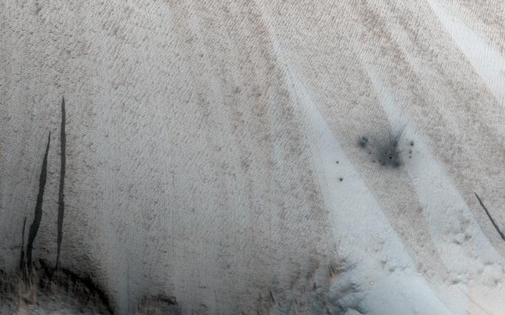
A New Crater on a Dusty Slope
- Click the image above for a larger view
- Full-Res JPEG (2880 x 1800) (770.5 kB)
- Full-Res TIFF (2880 x 1800) (13.9 MB)
Caption:
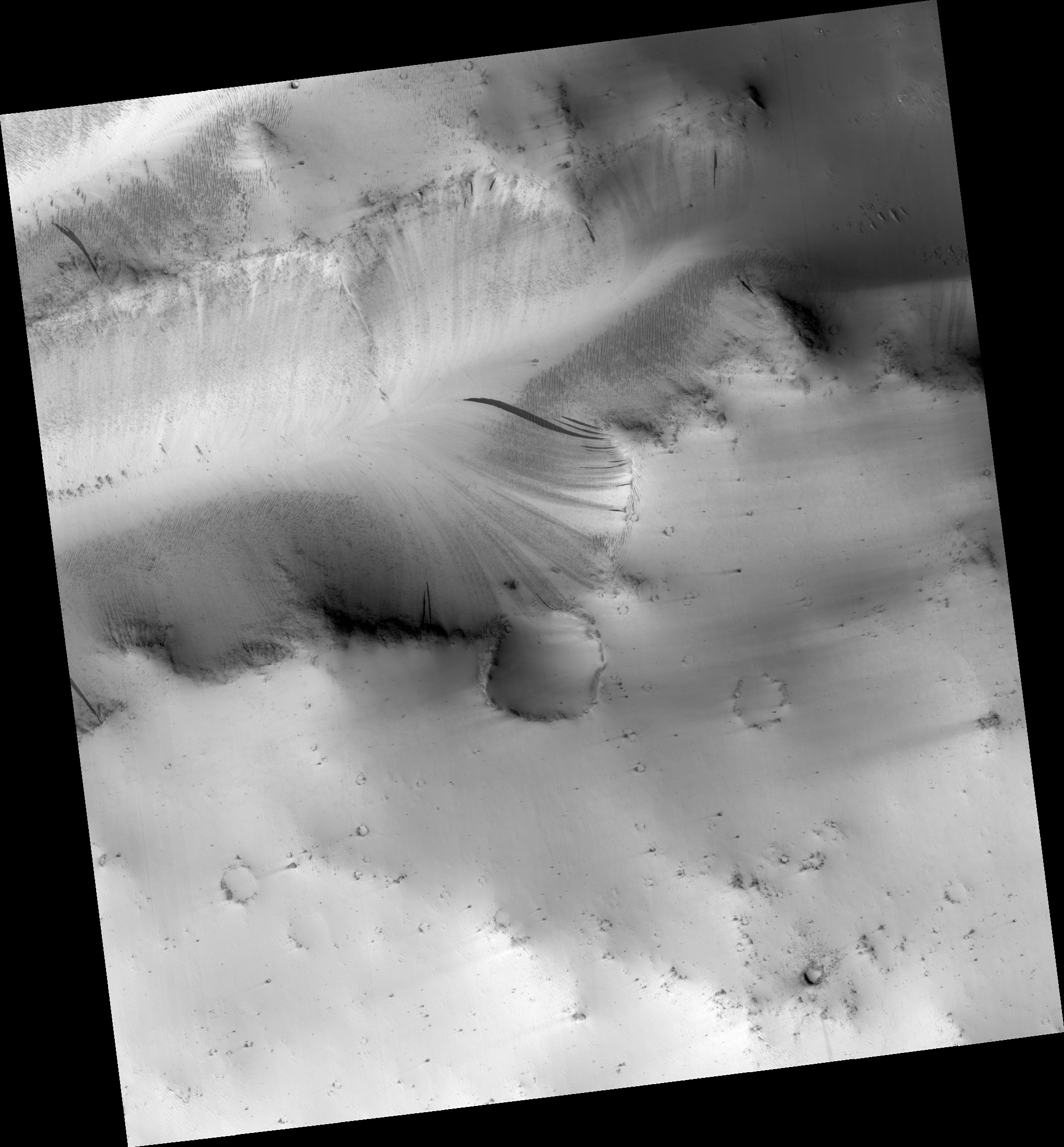
Map Projected Browse Image
Click on the image for larger version
This image shows a new impact site originally detected by the Context Camera onboard MRO. The crater is on a dusty slope, which also has several dark slope streaks due to dust avalanches.
A previous impact at another place on Mars triggered a major dust avalanche, but this one did not. This tells us that the dust here is more stable (stronger and/or on a lower slope).
The map is projected here at a scale of 25 centimeters (9.8 inches) per pixel. [The original image scale is 27.1 centimeters (9.8 inches) per pixel (with 1 x 1 binning); objects on the order of 81 centimeters (30 inches) across are resolved.] North is up.
Background Info:
The University of Arizona, Tucson, operates HiRISE, which was built by Ball Aerospace & Technologies Corp., Boulder, Colo. NASA's Jet Propulsion Laboratory, a division of Caltech in Pasadena, California, manages the Mars Reconnaissance Orbiter Project for NASA's Science Mission Directorate, Washington.
Cataloging Keywords:
| Name | Value | Additional Values |
|---|---|---|
| Target | Mars | |
| System | ||
| Target Type | Planet | |
| Mission | Mars Reconnaissance Orbiter (MRO) | |
| Instrument Host | Mars Reconnaissance Orbiter | |
| Host Type | Orbiter | |
| Instrument | High Resolution Imaging Science Experiment (HiRISE) | |
| Detector | ||
| Extra Keywords | Color, Crater, Dust, Impact, Map | |
| Acquisition Date | ||
| Release Date | 2017-02-20 | |
| Date in Caption | ||
| Image Credit | NASA/JPL-Caltech/Univ. of Arizona | |
| Source | photojournal.jpl.nasa.gov/catalog/PIA21459 | |
| Identifier | PIA21459 | |