
|
Putting Martian ‘Tribulation’ Behind
- Click the image above for a larger view
- Full-Res JPEG (3603 x 1468) (350.4 kB)
- Full-Res TIFF (3603 x 1468) (9.3 MB)
Caption:
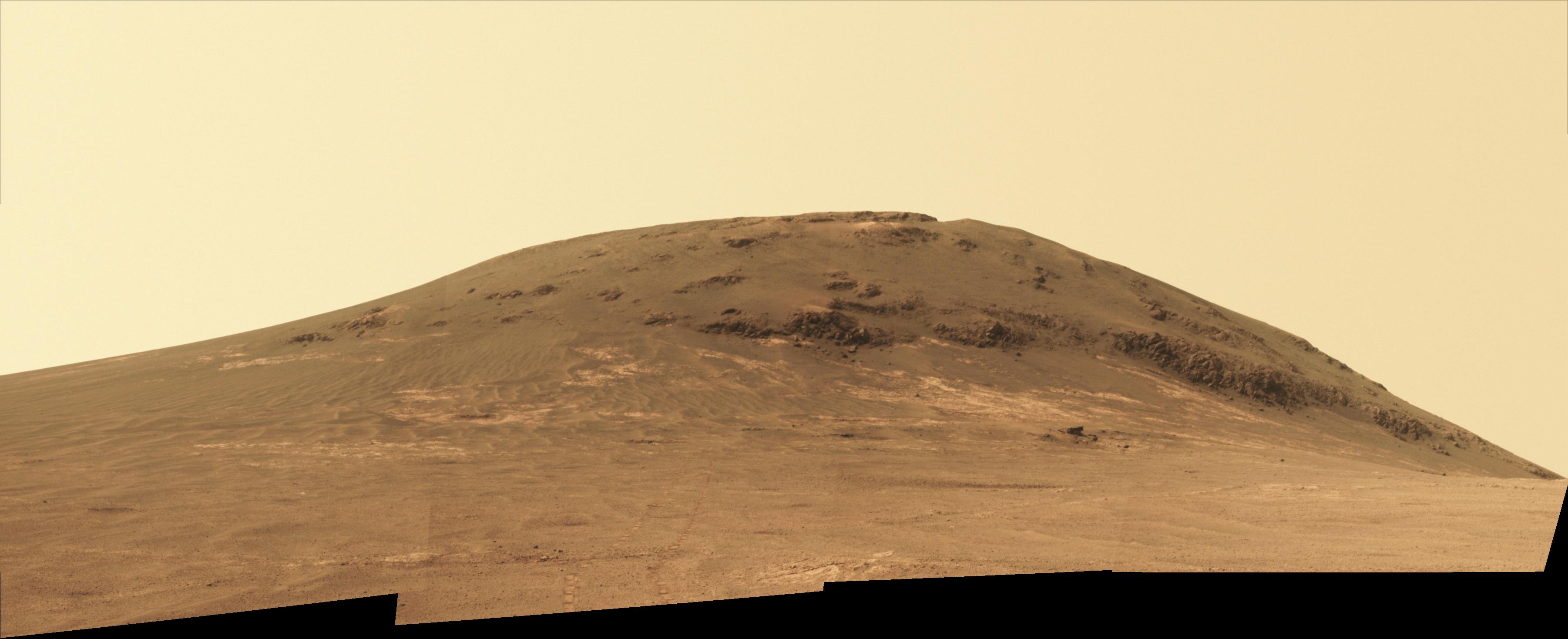
NASA's Mars Exploration Rover Opportunity worked for 30 months on a raised segment of Endeavour Crater's rim called "Cape Tribulation" until departing that segment in mid-April 2017, southbound toward a new destination. This view looks back at the southern end of Cape Tribulation from about two football fields' distance away. The component images were taken by the rover's Panoramic Camera (Pancam) on April 21, during the 4,707th Martian day, or sol, of Opportunity's mission on Mars.
Wheel tracks can be traced back to see the rover's route as it descended and departed Cape Tribulation. For scale, the distance between the two parallel tracks is about 3.3 feet (1 meter). The rover drove from the foot of Cape Tribulation to the head of "Perseverance Valley" in seven drives totaling about one-fifth of a mile (one-third of a kilometer). An annotated map of the area is at PIA21496 .
The elevation difference between the highest point visible in this scene and the rover's location when the images were taken is about 180 feet (55 meters).
This view looks northward. It merges exposures taken through three of the Pancam's color filters, centered on wavelengths of 753 nanometers (near-infrared), 535 nanometers (green) and 432 nanometers (violet). It is presented in approximately true color.
Cataloging Keywords:
| Name | Value | Additional Values |
|---|---|---|
| Target | Mars | |
| System | ||
| Target Type | Planet | |
| Mission | Mars Exploration Rover (MER) | Mars 2020 |
| Instrument Host | Opportunity (MER-B) | Perseverance |
| Host Type | Rover | |
| Instrument | Panoramic Camera (Pancam) | |
| Detector | ||
| Extra Keywords | Color, Crater, Infrared, Map | |
| Acquisition Date | ||
| Release Date | 2017-05-15 | |
| Date in Caption | ||
| Image Credit | NASA/JPL-Caltech/Cornell/Arizona State Univ. | |
| Source | photojournal.jpl.nasa.gov/catalog/PIA21497 | |
| Identifier | PIA21497 | |