
|
The Hills are Colorful in Juventae Chasma
- Click the image above for a larger view
- Full-Res JPEG (2880 x 1800) (624.7 kB)
- Full-Res TIFF (2880 x 1800) (15.6 MB)
Caption:

Map Projected Browse Image
Click on the image for larger version
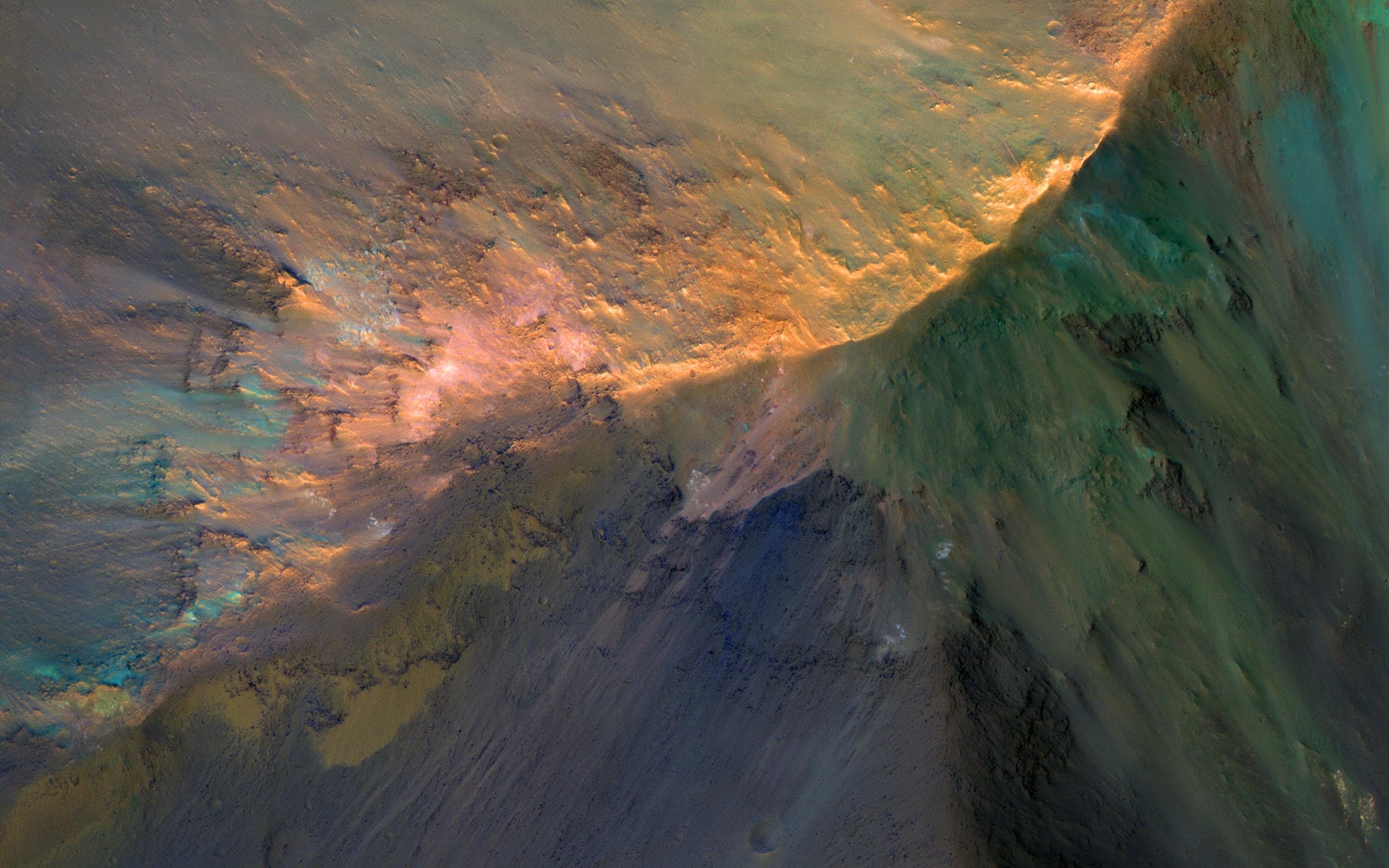
There are many hills about 1 kilometer high in Juventae Chasma, which is located north of the main Valles Marineris canyon system. The floor of the canyon is covered by a sea of sand, but the hills rise above the sand.
A few adventuresome sand dunes have slowly climbed up on the hills, like that near the upper left of the enhanced-color cutout . The color diversity here is exceptional, due to varying mineral compositions and good exposures.
The map is projected here at a scale of 50 centimeters (19.7 inches) per pixel. [The original image scale is 53.6 centimeters (21.1 inches) per pixel (with 2 x 2 binning); objects on the order of 161 centimeters (63.4 inches) across are resolved.] North is up.
Background Info:
The University of Arizona, Tucson, operates HiRISE, which was built by Ball Aerospace & Technologies Corp., Boulder, Colo. NASA's Jet Propulsion Laboratory, a division of Caltech in Pasadena, California, manages the Mars Reconnaissance Orbiter Project for NASA's Science Mission Directorate, Washington.
Cataloging Keywords:
| Name | Value | Additional Values |
|---|---|---|
| Target | Mars | |
| System | ||
| Target Type | Planet | |
| Mission | Mars Reconnaissance Orbiter (MRO) | Mariner |
| Instrument Host | Mars Reconnaissance Orbiter | |
| Host Type | Orbiter | Flyby Spacecraft |
| Instrument | High Resolution Imaging Science Experiment (HiRISE) | |
| Detector | ||
| Extra Keywords | Color, Dune, Map | |
| Acquisition Date | ||
| Release Date | 2017-03-20 | |
| Date in Caption | ||
| Image Credit | NASA/JPL-Caltech/Univ. of Arizona | |
| Source | photojournal.jpl.nasa.gov/catalog/PIA21567 | |
| Identifier | PIA21567 | |