
|
Is that an Impact Crater?
- Click the image above for a larger view
- Full-Res JPEG (2880 x 1800) (1.4 MB)
- Full-Res TIFF (2880 x 1800) (5.2 MB)
Caption:

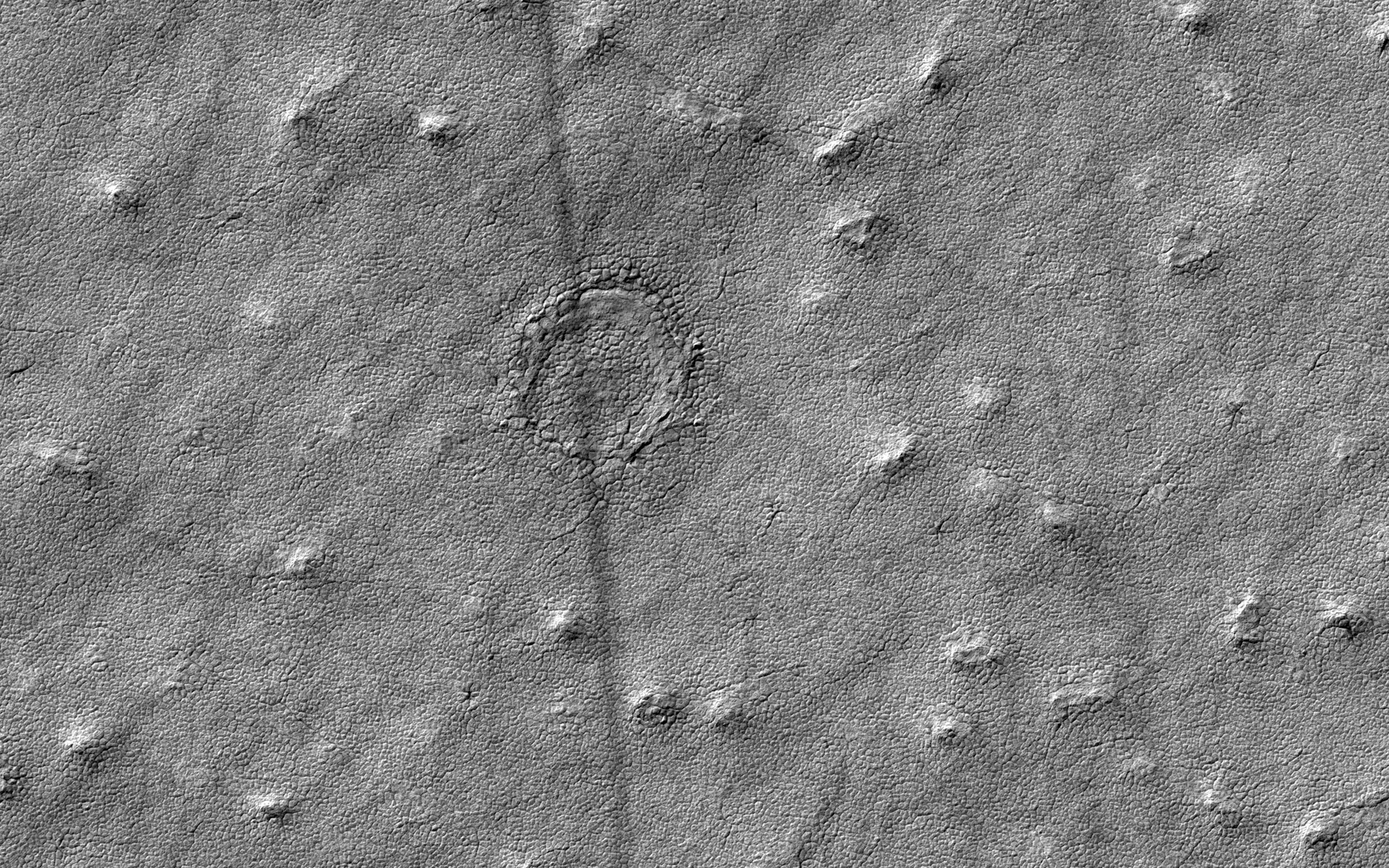
Map Projected Browse Image
Click on the image for larger version
This image was acquired to take a closer look at a circular feature that might be an impact structure on the South Polar layered deposits.
Measuring the sizes and frequency of impact craters provides a constraint on the age of the landscape. However, craters in icy terrain are modified by processes that flatten and change them in such a manner that it is hard to say for sure if it had an impact origin.
The map is projected here at a scale of 50 centimeters (19.7 inches) per pixel. [The original image scale is 49.8 centimeters (19.6 inches) per pixel (with 2 x 2 binning); objects on the order of 150 centimeters (59 inches) across are resolved.] North is up.
Background Info:
The University of Arizona, Tucson, operates HiRISE, which was built by Ball Aerospace & Technologies Corp., Boulder, Colo. NASA's Jet Propulsion Laboratory, a division of Caltech in Pasadena, California, manages the Mars Reconnaissance Orbiter Project for NASA's Science Mission Directorate, Washington.
Cataloging Keywords:
| Name | Value | Additional Values |
|---|---|---|
| Target | Mars | |
| System | ||
| Target Type | Planet | |
| Mission | Mars Reconnaissance Orbiter (MRO) | |
| Instrument Host | Mars Reconnaissance Orbiter | |
| Host Type | Orbiter | |
| Instrument | High Resolution Imaging Science Experiment (HiRISE) | |
| Detector | ||
| Extra Keywords | Crater, Grayscale, Impact, Map | |
| Acquisition Date | ||
| Release Date | 2017-04-04 | |
| Date in Caption | ||
| Image Credit | NASA/JPL-Caltech/Univ. of Arizona | |
| Source | photojournal.jpl.nasa.gov/catalog/PIA21576 | |
| Identifier | PIA21576 | |