|
Windblown Sand in Ganges Chasma
- Click the image above for a larger view
- Full-Res JPEG (2880 x 1800) (687.6 kB)
- Full-Res TIFF (2880 x 1800) (15.6 MB)
Caption:
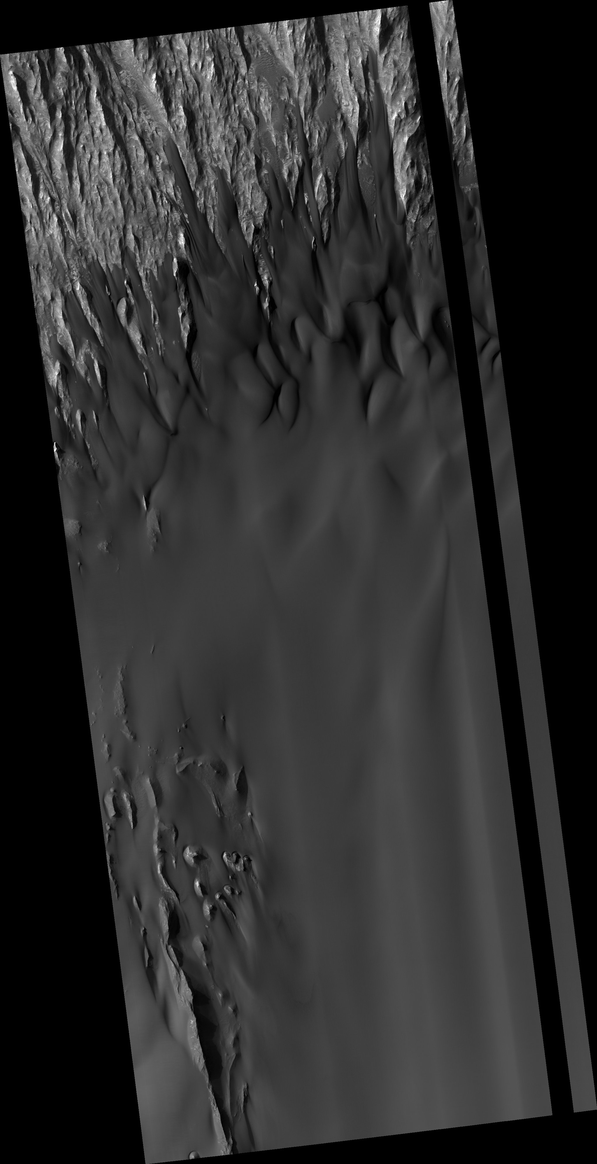
Map Projected Browse Image
Click on the image for larger version
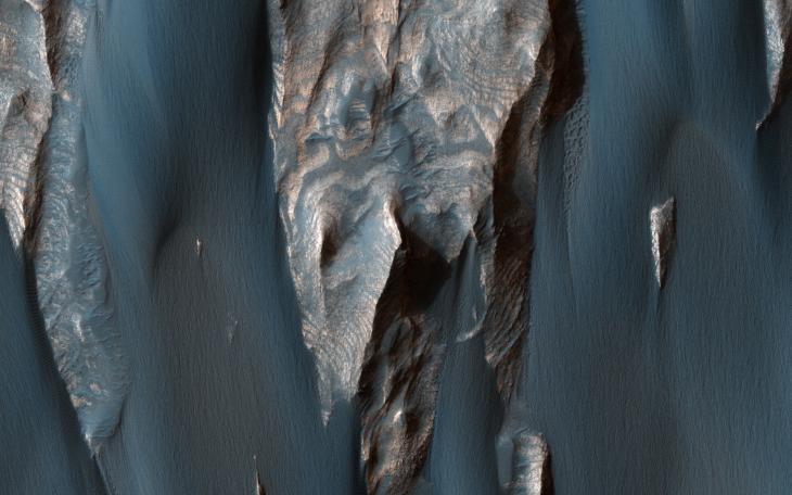
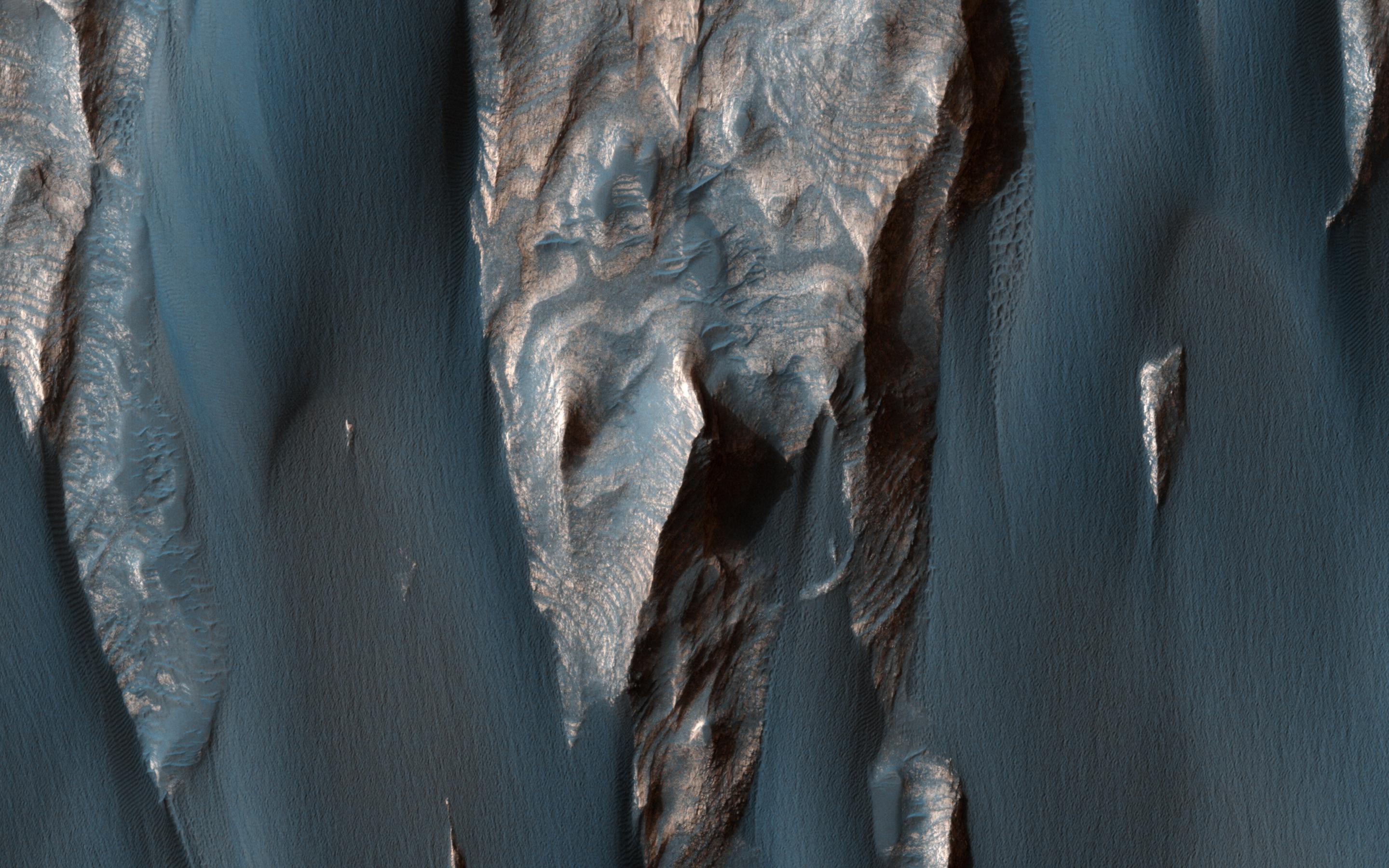
Dark, windblown sand covers intricate sedimentary rock layers in this image captured by NASA's Mars Reconnaissance Orbiter (MRO) from Ganges Chasma, a canyon in the Valles Marineris system.
These features are at once familiar and unusual to those familiar with Earth's beaches and deserts. Most sand dunes on Earth are made of silica-rich sand, giving them a light color; these Martian dunes owe their dark color to the iron and magnesium-rich sand found in the region.
The map is projected here at a scale of 25 centimeters (9.8 inches) per pixel. [The original image scale is 26.7 centimeters (10.5 inches) per pixel (with 1 x 1 binning); objects on the order of 80 centimeters (31.5 inches) across are resolved.] North is up.
Background Info:
The University of Arizona, Tucson, operates HiRISE, which was built by Ball Aerospace & Technologies Corp., Boulder, Colo. NASA's Jet Propulsion Laboratory, a division of Caltech in Pasadena, California, manages the Mars Reconnaissance Orbiter Project for NASA's Science Mission Directorate, Washington.
Cataloging Keywords:
| Name | Value | Additional Values |
|---|---|---|
| Target | Mars | |
| System | ||
| Target Type | Planet | |
| Mission | Mars Reconnaissance Orbiter (MRO) | Mariner |
| Instrument Host | Mars Reconnaissance Orbiter | |
| Host Type | Orbiter | Flyby Spacecraft |
| Instrument | High Resolution Imaging Science Experiment (HiRISE) | |
| Detector | ||
| Extra Keywords | Color, Dune, Map | |
| Acquisition Date | ||
| Release Date | 2017-04-25 | |
| Date in Caption | ||
| Image Credit | NASA/JPL-Caltech/Univ. of Arizona | |
| Source | photojournal.jpl.nasa.gov/catalog/PIA21600 | |
| Identifier | PIA21600 | |