|
An Ancient Valley Network
- Click the image above for a larger view
- Full-Res JPEG (2880 x 1800) (747.3 kB)
- Full-Res TIFF (2880 x 1800) (15.6 MB)
Caption:
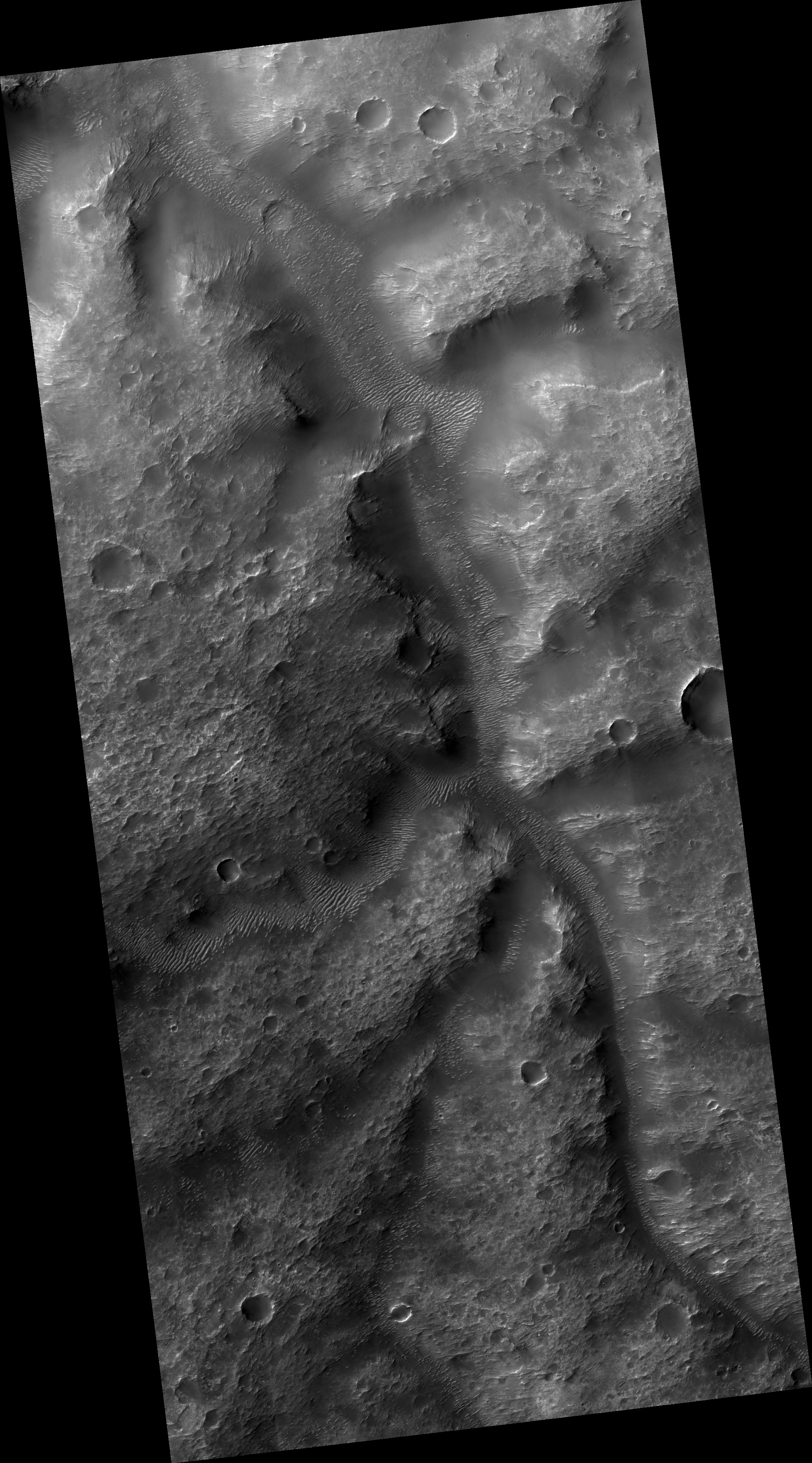
Map Projected Browse Image
Click on the image for larger version
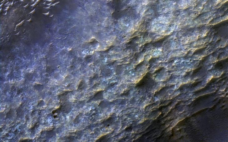
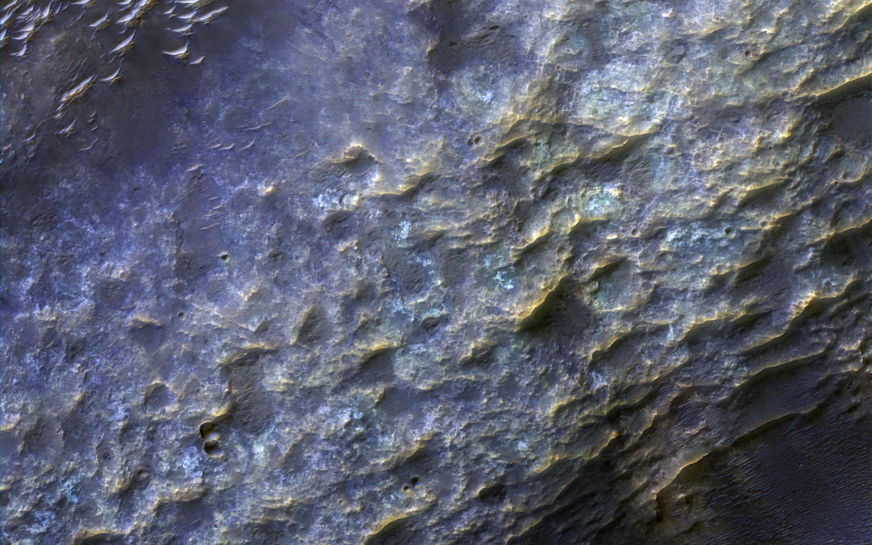
Most of the oldest terrains on Mars have eroded into branching valleys, as seen here in by NASA's Mars Reconnaisance Orbiter, much like many land regions of Earth are eroded by rain and snowmelt runoff. This is the primary evidence for major climate change on Mars billions of years ago.
How the climate of Mars could have supported a warmer and wetter environment has been the subject of scientific debates for 40 years. A full-resolution enhanced color closeup reveals details in the bedrock and dunes on the valley floor (upper left). The bedrock of ancient Mars has been hardened and cemented by groundwater.
The map is projected here at a scale of 50 centimeters (19.7 inches) per pixel. [The original image scale is 51.5 centimeters (22.4 inches) per pixel (with 2 x 2 binning); objects on the order of 155 centimeters (61 inches) across are resolved.] North is up.
Background Info:
The University of Arizona, Tucson, operates HiRISE, which was built by Ball Aerospace & Technologies Corp., Boulder, Colo. NASA's Jet Propulsion Laboratory, a division of Caltech in Pasadena, California, manages the Mars Reconnaissance Orbiter Project for NASA's Science Mission Directorate, Washington.
Cataloging Keywords:
| Name | Value | Additional Values |
|---|---|---|
| Target | Mars | |
| System | ||
| Target Type | Planet | |
| Mission | Mars Reconnaissance Orbiter (MRO) | |
| Instrument Host | Mars Reconnaissance Orbiter | |
| Host Type | Orbiter | |
| Instrument | High Resolution Imaging Science Experiment (HiRISE) | |
| Detector | ||
| Extra Keywords | Color, Dune, Map, Water | |
| Acquisition Date | ||
| Release Date | 2017-05-09 | |
| Date in Caption | ||
| Image Credit | NASA/JPL-Caltech/Univ. of Arizona | |
| Source | photojournal.jpl.nasa.gov/catalog/PIA21630 | |
| Identifier | PIA21630 | |