|
Erosion of the Edge of the South Polar Layered Deposits
- Click the image above for a larger view
- Full-Res JPEG (2880 x 1800) (705.3 kB)
- Full-Res TIFF (2880 x 1800) (15.6 MB)
Caption:

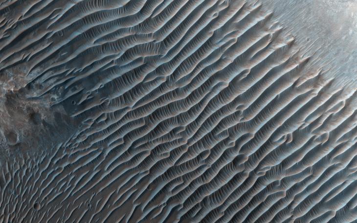
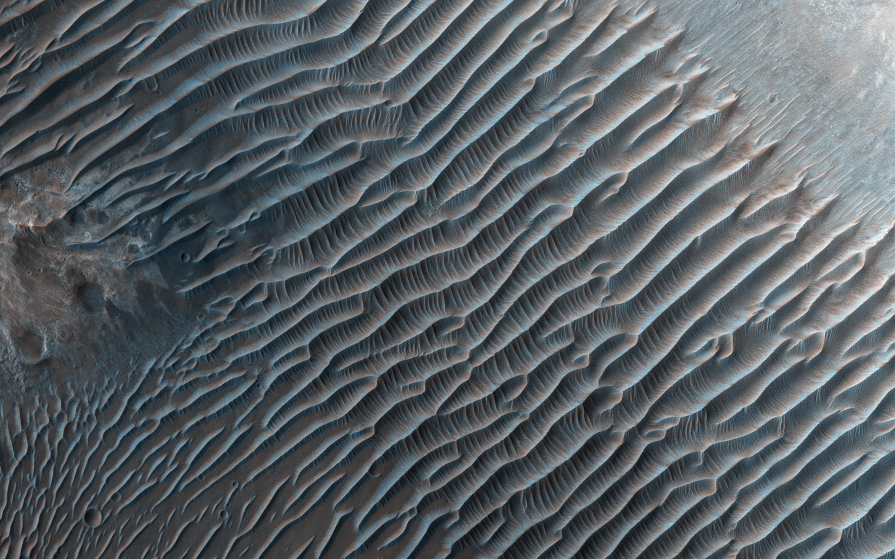
Map Projected Browse Image
Click on the image for larger version
This image from NASA's Mars Reconnaissance Orbiter shows small ripples , about 10 meters apart, located in Her Desher Vallis. Her Desher is a small channel that shows evidence of phyllosilicates -- silicates with a sheet-like structure, such as clay minerals.
Much larger images of this area show that Her Desher Vallis appears isolated, with no obvious connections to craters or larger valleys. Her Desher, the ancient Egyptian name for Mars, translates to "the Red One."
This is a stereo pair with ESP_013771_1550 .
The map is projected here at a scale of 50 centimeters (19.7 inches) per pixel. [The original image scale is 55.8 centimeters (21.9 inches) per pixel (with 2 x 2 binning); objects on the order of 167 centimeters (65.7 inches) across are resolved. North is up.
Background Info:
The University of Arizona, Tucson, operates HiRISE, which was built by Ball Aerospace & Technologies Corp., Boulder, Colo. NASA's Jet Propulsion Laboratory, a division of Caltech in Pasadena, California, manages the Mars Reconnaissance Orbiter Project for NASA's Science Mission Directorate, Washington.
Cataloging Keywords:
| Name | Value | Additional Values |
|---|---|---|
| Target | Mars | |
| System | ||
| Target Type | Planet | |
| Mission | Mars Reconnaissance Orbiter (MRO) | |
| Instrument Host | Mars Reconnaissance Orbiter | |
| Host Type | Orbiter | |
| Instrument | High Resolution Imaging Science Experiment (HiRISE) | |
| Detector | ||
| Extra Keywords | Color, Crater, Map | |
| Acquisition Date | ||
| Release Date | 2017-05-23 | |
| Date in Caption | ||
| Image Credit | NASA/JPL-Caltech/Univ. of Arizona | |
| Source | photojournal.jpl.nasa.gov/catalog/PIA21639 | |
| Identifier | PIA21639 | |