|
An Oblique View of Uplifted Rocks
- Click the image above for a larger view
- Full-Res JPEG (2880 x 1800) (820.7 kB)
- Full-Res TIFF (2880 x 1800) (15.6 MB)
Caption:
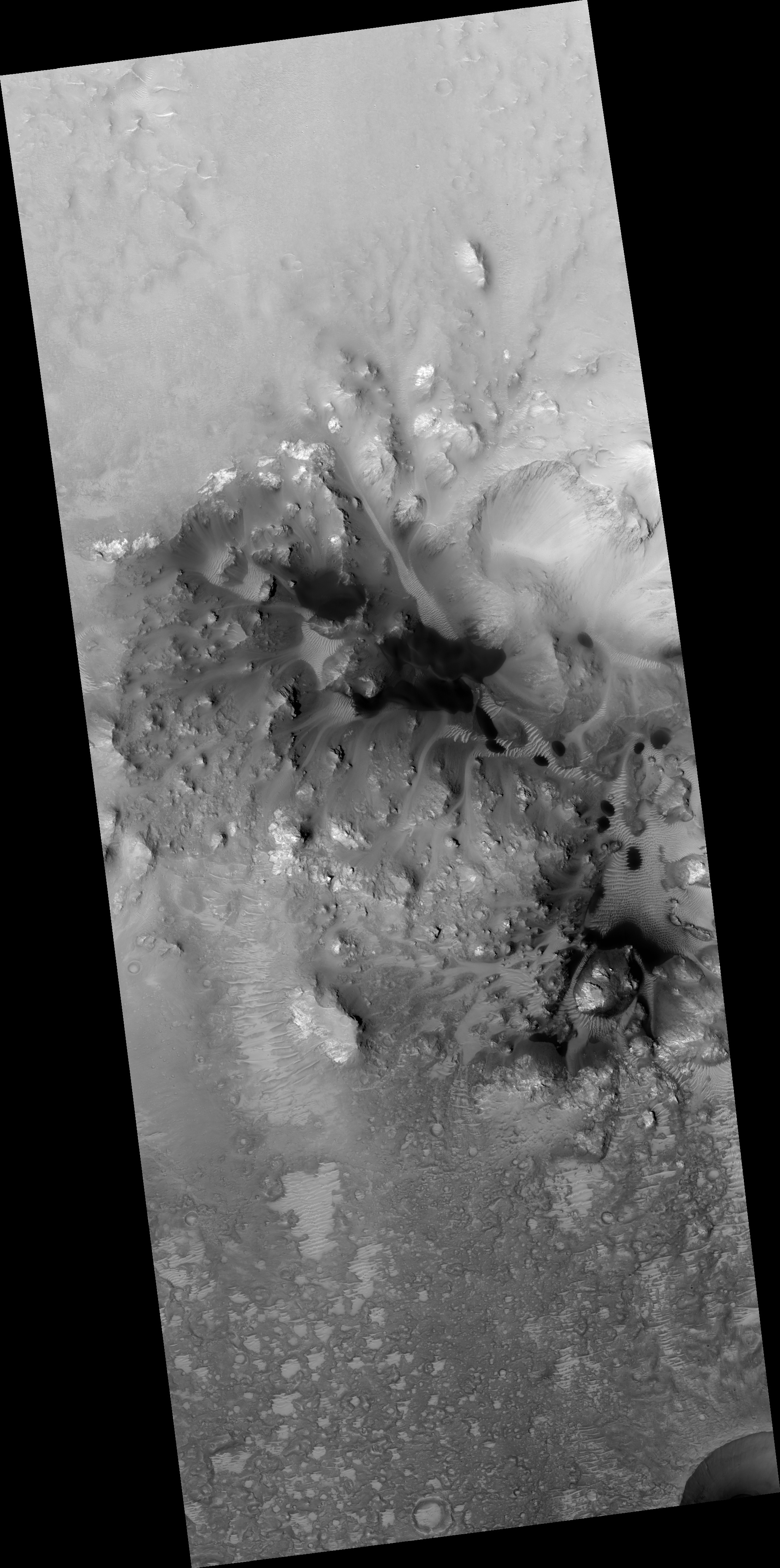
Map Projected Browse Image
Click on the image for larger version
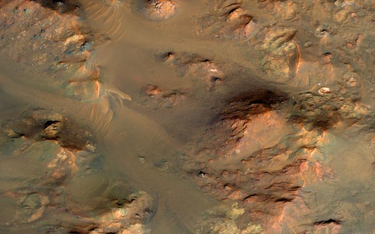
This image from NASA's Mars Reconnaissance Orbiter shows part of the central uplifted region of an impact crater more than 50 kilometers wide. That means that the bedrock has been raised from a depth of about 5 kilometers, exposing ancient materials.
The warm (yellowish-reddish) colors mark the presence of minerals altered by water, whereas the bluish and greenish rocks have escaped alteration. Sharp-crested ridges and smooth areas are young windblown materials.
This is a stereo pair with ESP_013198_1660 .
The map is projected here at a scale of 50 centimeters (19.7 inches) per pixel. [The original image scale is 59.6 centimeters (23.5 inches) per pixel (with 2 x 2 binning); objects on the order of 179 centimeters (70.4 inches) across are resolved. North is up.
Background Info:
The University of Arizona, Tucson, operates HiRISE, which was built by Ball Aerospace & Technologies Corp., Boulder, Colo. NASA's Jet Propulsion Laboratory, a division of Caltech in Pasadena, California, manages the Mars Reconnaissance Orbiter Project for NASA's Science Mission Directorate, Washington.
Cataloging Keywords:
| Name | Value | Additional Values |
|---|---|---|
| Target | Mars | |
| System | ||
| Target Type | Planet | |
| Mission | Mars Reconnaissance Orbiter (MRO) | |
| Instrument Host | Mars Reconnaissance Orbiter | |
| Host Type | Orbiter | |
| Instrument | High Resolution Imaging Science Experiment (HiRISE) | |
| Detector | ||
| Extra Keywords | Color, Crater, Impact, Map, Water | |
| Acquisition Date | ||
| Release Date | 2017-05-24 | |
| Date in Caption | ||
| Image Credit | NASA/JPL-Caltech/Univ. of Arizona | |
| Source | photojournal.jpl.nasa.gov/catalog/PIA21640 | |
| Identifier | PIA21640 | |