
|
The Specters of Mars
- Click the image above for a larger view
- Full-Res JPEG (2880 x 1800) (1.1 MB)
- Full-Res TIFF (2880 x 1800) (5.2 MB)
Caption:
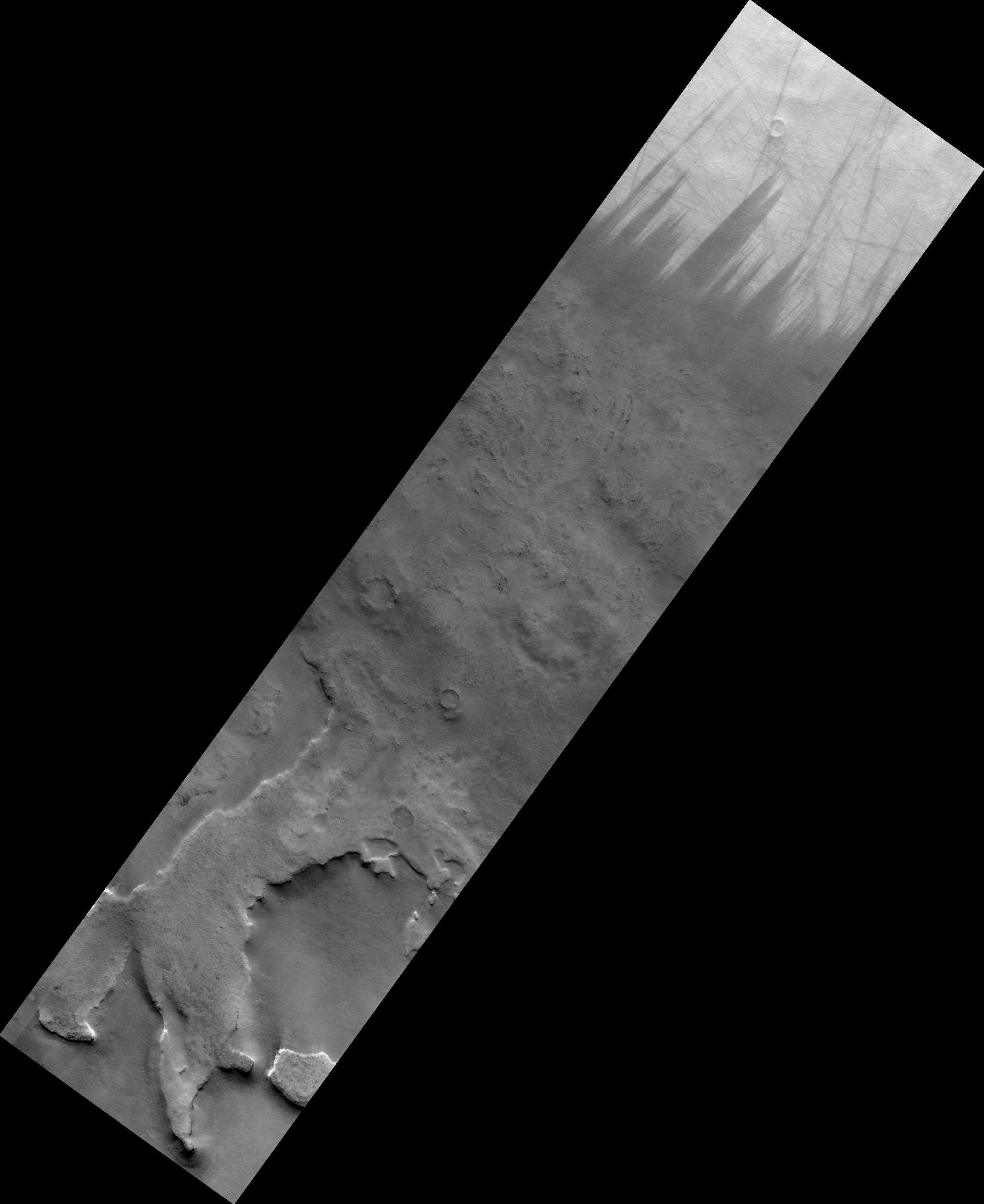
Map Projected Browse Image
Click on the image for larger version
This image from NASA's Mars Reconnaissance Orbiter shows Malea Planum,a polar region in the Southern hemisphere of Mars, directly south of Hellas Basin, which contains the lowest point of elevation on the planet. The jagged saw-tooth dichotomy, over a grainy texture, seen in this close-up image . The region contains ancient volcanoes of a certain type, referred to as "paterae." Patera is the Latin word for a shallow drinking bowl, and was first applied to volcanic-looking features, with scalloped-edged calderas. Malea is also a low-lying plain, known to be covered in dust. These two pieces of information provide regional context that aid our understanding of the scene and features contained in our image. The area rises gradually to a ridge (which can be seen in this Context Camera image ) and light-colored dust is blown away by gusts of the Martian wind, which accelerate up the slope to the ridge, leading to more sharp angles of contact between light and dark surface materials.
The map is projected here at a scale of 50 centimeters (19.7 inches) per pixel. [The original image scale is 49.6 centimeters (19.5 inches) per pixel (with 2 x 2 binning); objects on the order of 149 centimeters (58.6 inches) across are resolved.] North is up.
Background Info:
The University of Arizona, Tucson, operates HiRISE, which was built by Ball Aerospace & Technologies Corp., Boulder, Colo. NASA's Jet Propulsion Laboratory, a division of Caltech in Pasadena, California, manages the Mars Reconnaissance Orbiter Project for NASA's Science Mission Directorate, Washington.
Cataloging Keywords:
| Name | Value | Additional Values |
|---|---|---|
| Target | Mars | |
| System | ||
| Target Type | Planet | |
| Mission | Mars Reconnaissance Orbiter (MRO) | |
| Instrument Host | Mars Reconnaissance Orbiter | |
| Host Type | Orbiter | |
| Instrument | High Resolution Imaging Science Experiment (HiRISE) | |
| Detector | ||
| Extra Keywords | Dust, Grayscale, Map, Volcano | |
| Acquisition Date | ||
| Release Date | 2017-07-13 | |
| Date in Caption | ||
| Image Credit | NASA/JPL-Caltech/Univ. of Arizona | |
| Source | photojournal.jpl.nasa.gov/catalog/PIA21784 | |
| Identifier | PIA21784 | |