
|
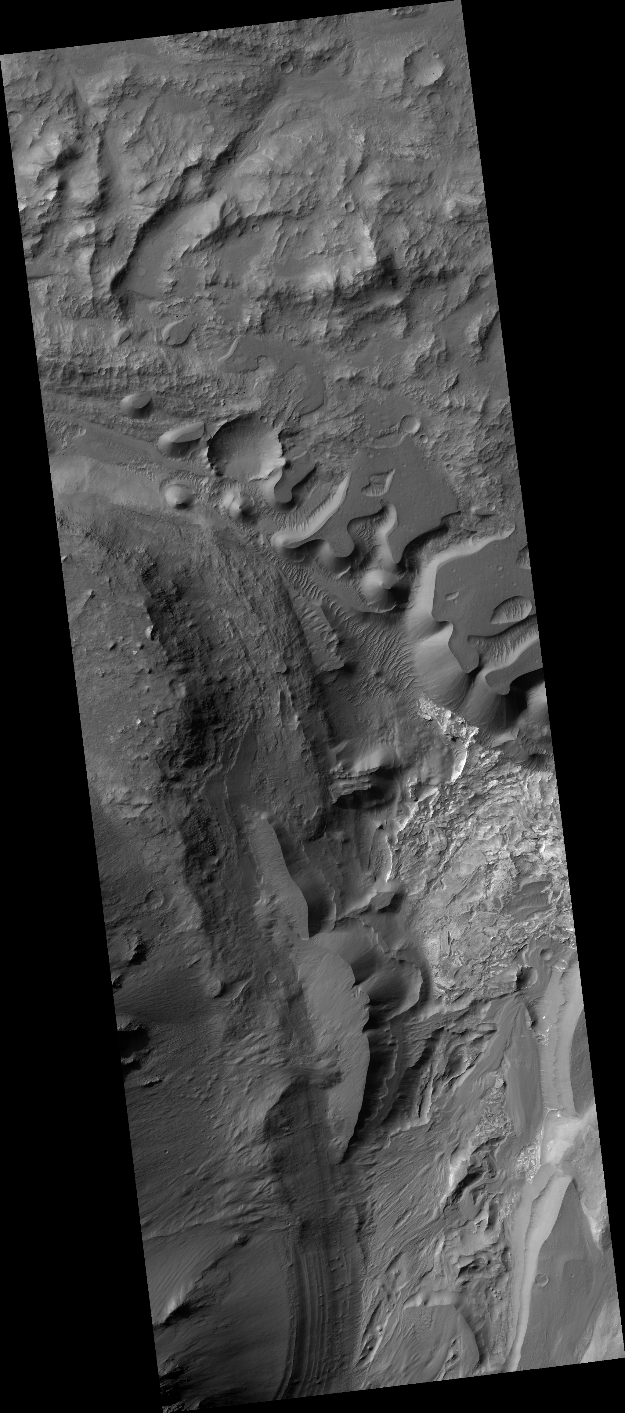
Along the Floor of Coprates Chasma
- Click the image above for a larger view
- Full-Res JPEG (2880 x 1800) (644.0 kB)
- Full-Res TIFF (2880 x 1800) (14.4 MB)
Caption:
Map Projected Browse Image
Click on the image for larger version
This image from NASA's Mars Reconnaissance Orbiter shows a small portion of the floor of Coprates Chasma , a large trough within the Valles Marineris system of canyons.
Although the exact sequence of events that formed Coprates Chasma is unknown, the ripples, mesas, and craters visible throughout the terrain point to a complex history involving multiple mechanisms of erosion and deposition. The main trough of Coprates Chasma ranges from 60 to 100 kilometers in width.
The map is projected here at a scale of 25 centimeters (9.8 inches) per pixel. [The original image scale is 26.6 centimeters (10.5 inches) per pixel (with 1 x 1 binning); objects on the order of 80 centimeters (31.5 inches) across are resolved.] North is up.
Background Info:
The University of Arizona, Tucson, operates HiRISE, which was built by Ball Aerospace & Technologies Corp., Boulder, Colo. NASA's Jet Propulsion Laboratory, a division of Caltech in Pasadena, California, manages the Mars Reconnaissance Orbiter Project for NASA's Science Mission Directorate, Washington.
Cataloging Keywords:
| Name | Value | Additional Values |
|---|---|---|
| Target | Mars | |
| System | ||
| Target Type | Planet | |
| Mission | Mars Reconnaissance Orbiter (MRO) | Mariner |
| Instrument Host | Mars Reconnaissance Orbiter | |
| Host Type | Orbiter | Flyby Spacecraft |
| Instrument | High Resolution Imaging Science Experiment (HiRISE) | |
| Detector | ||
| Extra Keywords | Color, Crater, Map | |
| Acquisition Date | ||
| Release Date | 2017-08-08 | |
| Date in Caption | ||
| Image Credit | NASA/JPL-Caltech/Univ. of Arizona | |
| Source | photojournal.jpl.nasa.gov/catalog/PIA21872 | |
| Identifier | PIA21872 | |