|
The Hoodoos of Mars
- Click the image above for a larger view
- Full-Res JPEG (2880 x 1800) (882.2 kB)
- Full-Res TIFF (2880 x 1800) (15.6 MB)
Caption:

Map Projected Browse Image
Click on the image for larger version
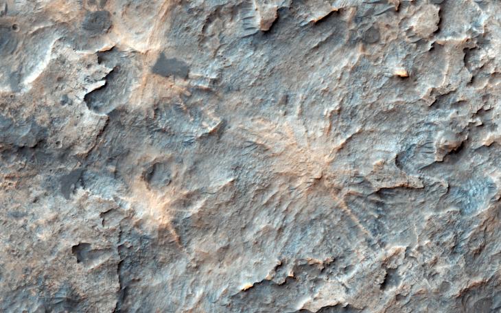
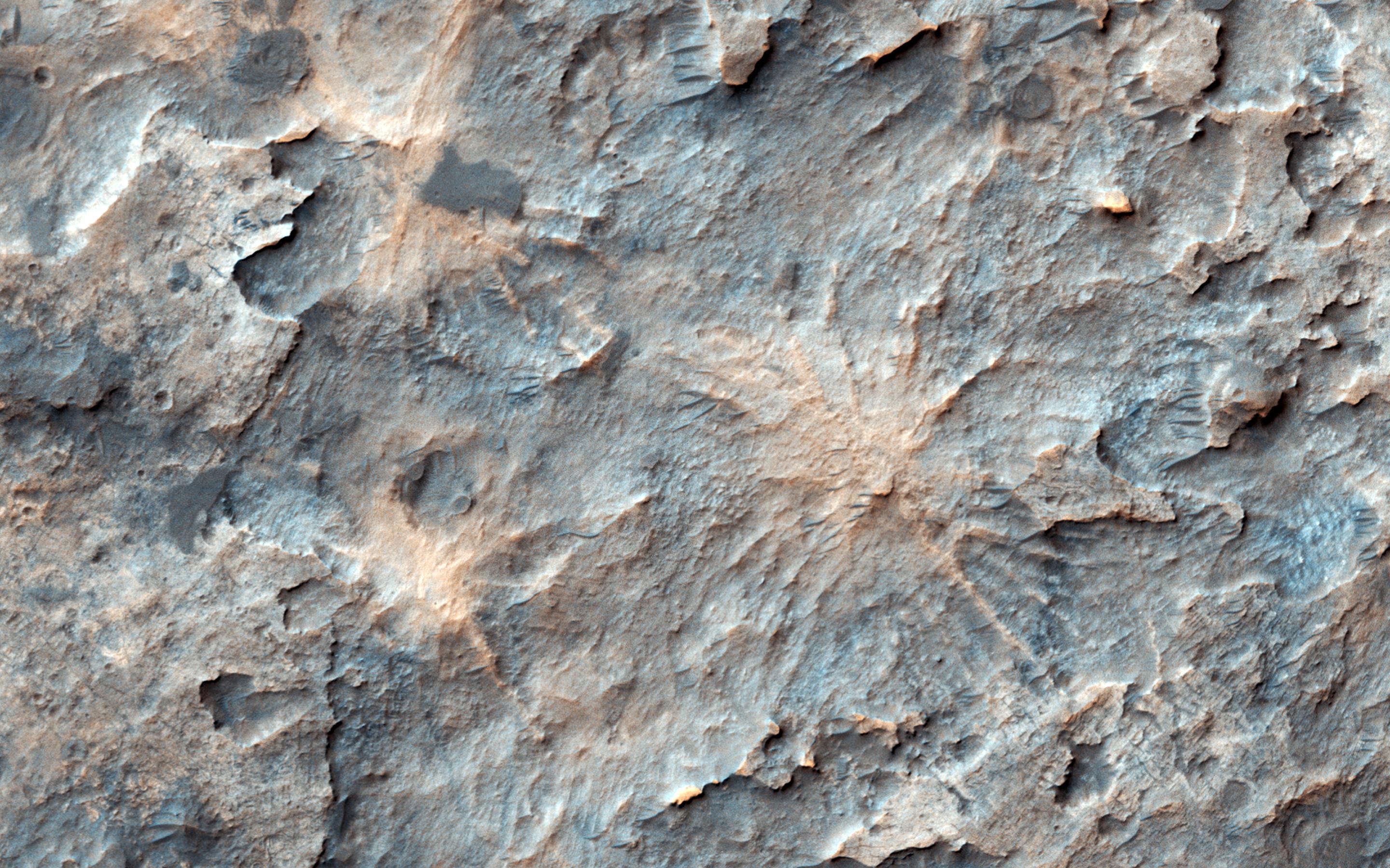
On Mars, NASA's Mars Reconnaissance Orbiter often sees inverted river channels preserved perched above the surrounding terrain because the sediment inside the river channel was stronger than its surroundings. This is common in the American Southwest in places where lava flowed down river channels and the surrounding sandstone subsequently eroded away leaving ridges in places that started as valleys.
There's another example of high-standing columns protected by a strong cap rock, called "hoodoos." Looking more closely at our image , we see what looks like a crater and its rays of ejecta, preserved and slightly higher than the surrounding terrain, possibly due to a similar process.
This is a stereo pair with ESP_050415_1565 .
The map is projected here at a scale of 50 centimeters (19.7 inches) per pixel. [The original image scale is 54.7 centimeters (21.5 inches) per pixel (with 2 x 2 binning); objects on the order of 164 centimeters (64.6 inches) across are resolved.] North is up.
Background Info:
The University of Arizona, Tucson, operates HiRISE, which was built by Ball Aerospace & Technologies Corp., Boulder, Colo. NASA's Jet Propulsion Laboratory, a division of Caltech in Pasadena, California, manages the Mars Reconnaissance Orbiter Project for NASA's Science Mission Directorate, Washington.
Cataloging Keywords:
| Name | Value | Additional Values |
|---|---|---|
| Target | Mars | |
| System | ||
| Target Type | Planet | |
| Mission | Mars Reconnaissance Orbiter (MRO) | |
| Instrument Host | Mars Reconnaissance Orbiter | |
| Host Type | Orbiter | |
| Instrument | High Resolution Imaging Science Experiment (HiRISE) | |
| Detector | ||
| Extra Keywords | Color, Crater, Map | |
| Acquisition Date | ||
| Release Date | 2017-08-21 | |
| Date in Caption | ||
| Image Credit | NASA/JPL-Caltech/Univ. of Arizona | |
| Source | photojournal.jpl.nasa.gov/catalog/PIA21883 | |
| Identifier | PIA21883 | |