Mixtures of Sulfates in Melas Chasma
Caption:

Map Projected Browse Image
Click on the image for larger version
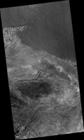
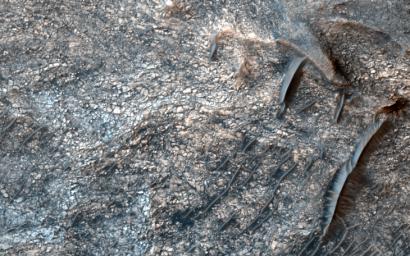
In this image from NASA's Mars Reconnaissance Orbiter, layering within the light-toned sulfate deposit is the result of different states of hydration. Some of the layers have sulfates with little water (known as monohydrated sulfates) whereas other layers have higher amounts of water (called polyhydrated sulfates). The different amounts of water within the sulfates may reflect changes in the water chemistry during deposition of the sulfates, or may have occurred after the sulfates were laid down when heat or pressure forced the water out of some layers, causing a decrease in the hydration state.
Many locations on Mars have sulfates, which are sedimentary rocks formed in water. Within Valles Marineris, the large canyon system that cuts across the planet, there are big and thick sequences of sulfates.
The CRISM instrument on MRO is crucial for telling scientists which type of sulfate is associated with each layer, because each hydration state will produce a spectrum with absorptions at specific wavelengths depending upon the amount of water contained within the sulfate.
The map is projected here at a scale of 25 centimeters (9.8 inches) per pixel. [The original image scale is 26.4 centimeters (10.4 inches) per pixel (with 1 x 1 binning); objects on the order of 79 centimeters (31.1 inches) across are resolved.] North is up.
Background Info:
The University of Arizona, Tucson, operates HiRISE, which was built by Ball Aerospace & Technologies Corp., Boulder, Colo. NASA's Jet Propulsion Laboratory, a division of Caltech in Pasadena, California, manages the Mars Reconnaissance Orbiter Project for NASA's Science Mission Directorate, Washington.
Cataloging Keywords:
| Name |
Value |
Additional Values |
| Target |
Mars |
|
| System |
|
|
| Target Type |
Planet |
|
| Mission |
Mars Reconnaissance Orbiter (MRO) |
Mariner |
| Instrument Host |
Mars Reconnaissance Orbiter |
|
| Host Type |
Orbiter |
Flyby Spacecraft |
| Instrument |
High Resolution Imaging Science Experiment (HiRISE) |
Compact Reconnaissance Imaging Spectrometer for Mars (CRISM) |
| Detector |
|
|
| Extra Keywords |
Color, Map, Water |
| Acquisition Date |
|
| Release Date |
2017-09-04 |
| Date in Caption |
|
|
| Image Credit |
NASA/JPL-Caltech/Univ. of Arizona |
| Source |
photojournal.jpl.nasa.gov/catalog/PIA21935 |
| Identifier |
PIA21935 |

 Planetary Data System

