
|
A Sequence of Beauty in Terby Crater
- Click the image above for a larger view
- Full-Res JPEG (2880 x 1800) (958.8 kB)
- Full-Res TIFF (2880 x 1800) (15.6 MB)
Caption:
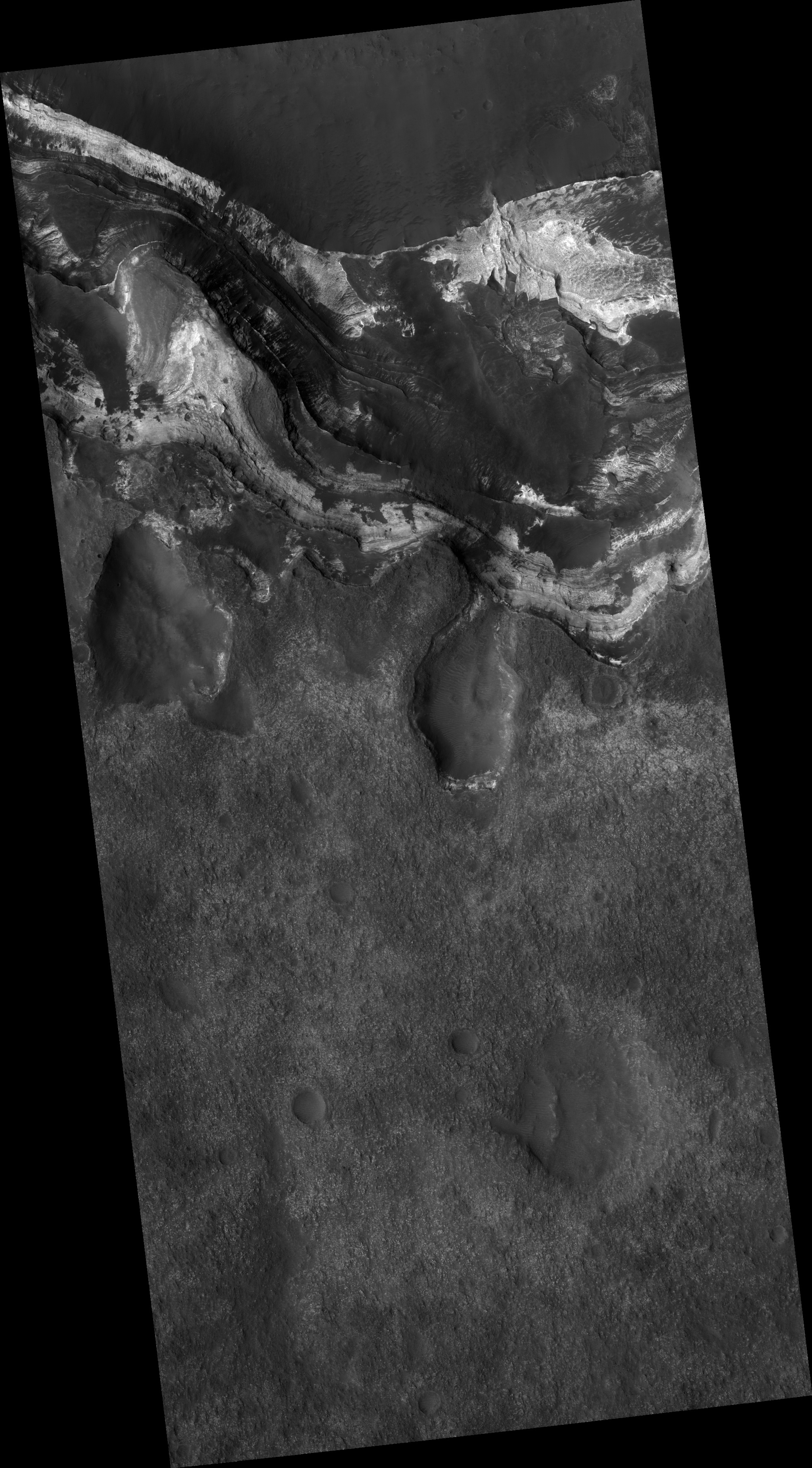
Map Projected Browse Image
Click on the image for larger version
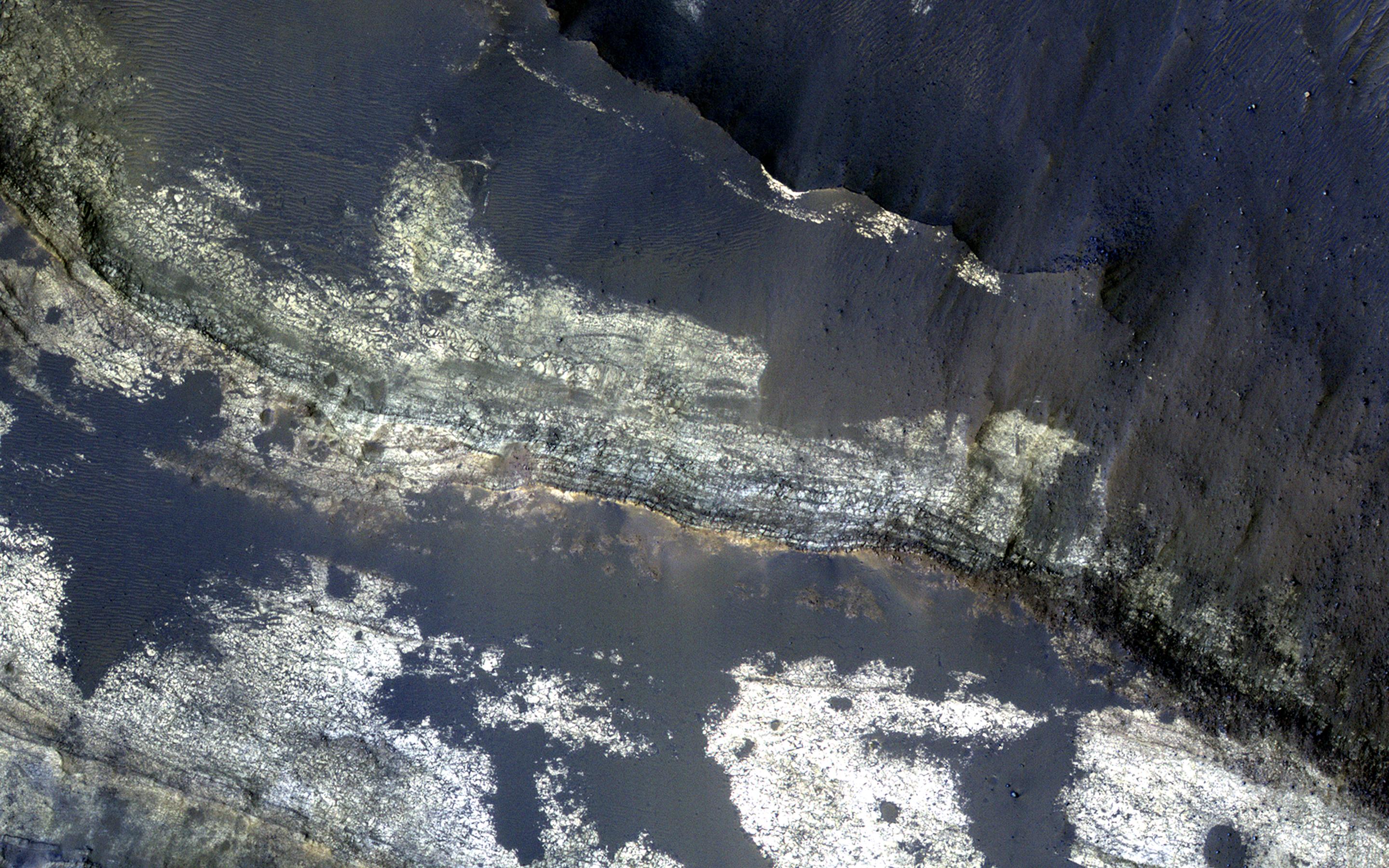
This image from NASA's Mars Reconnaissance Orbiter shows the north-facing wall of a moat-like depression in the middle of Terby Crater, exposing a beautiful 400 meter-high sequence of light-toned, repetitive sedimentary layers . These deposits are often obscured by darker-toned patches of material as well as ripples and dunes.
The deposits in Terby, located on the northern rim of Hellas Planitia, are consistent with deposition in a standing body of water. The layers have been proposed as science targets for future landed missions.
The map is projected here at a scale of 50 centimeters (19.7 inches) per pixel. [The original image scale is 52.2 centimeters (20.6 inches) per pixel (with 2 x 2 binning); objects on the order of 157 centimeters (61.8 inches) across are resolved.] North is up.
Background Info:
The University of Arizona, Tucson, operates HiRISE, which was built by Ball Aerospace & Technologies Corp., Boulder, Colo. NASA's Jet Propulsion Laboratory, a division of Caltech in Pasadena, California, manages the Mars Reconnaissance Orbiter Project for NASA's Science Mission Directorate, Washington.
Cataloging Keywords:
| Name | Value | Additional Values |
|---|---|---|
| Target | Mars | |
| System | ||
| Target Type | Planet | |
| Mission | Mars Reconnaissance Orbiter (MRO) | |
| Instrument Host | Mars Reconnaissance Orbiter | |
| Host Type | Orbiter | |
| Instrument | High Resolution Imaging Science Experiment (HiRISE) | |
| Detector | ||
| Extra Keywords | Color, Crater, Dune, Map, Water | |
| Acquisition Date | ||
| Release Date | 2017-09-18 | |
| Date in Caption | ||
| Image Credit | NASA/JPL-Caltech/Univ. of Arizona | |
| Source | photojournal.jpl.nasa.gov/catalog/PIA21952 | |
| Identifier | PIA21952 | |