|
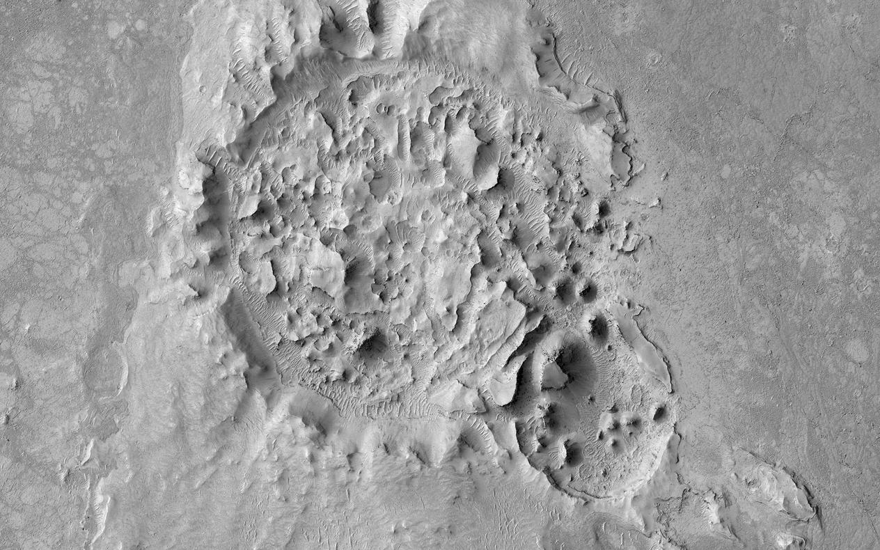
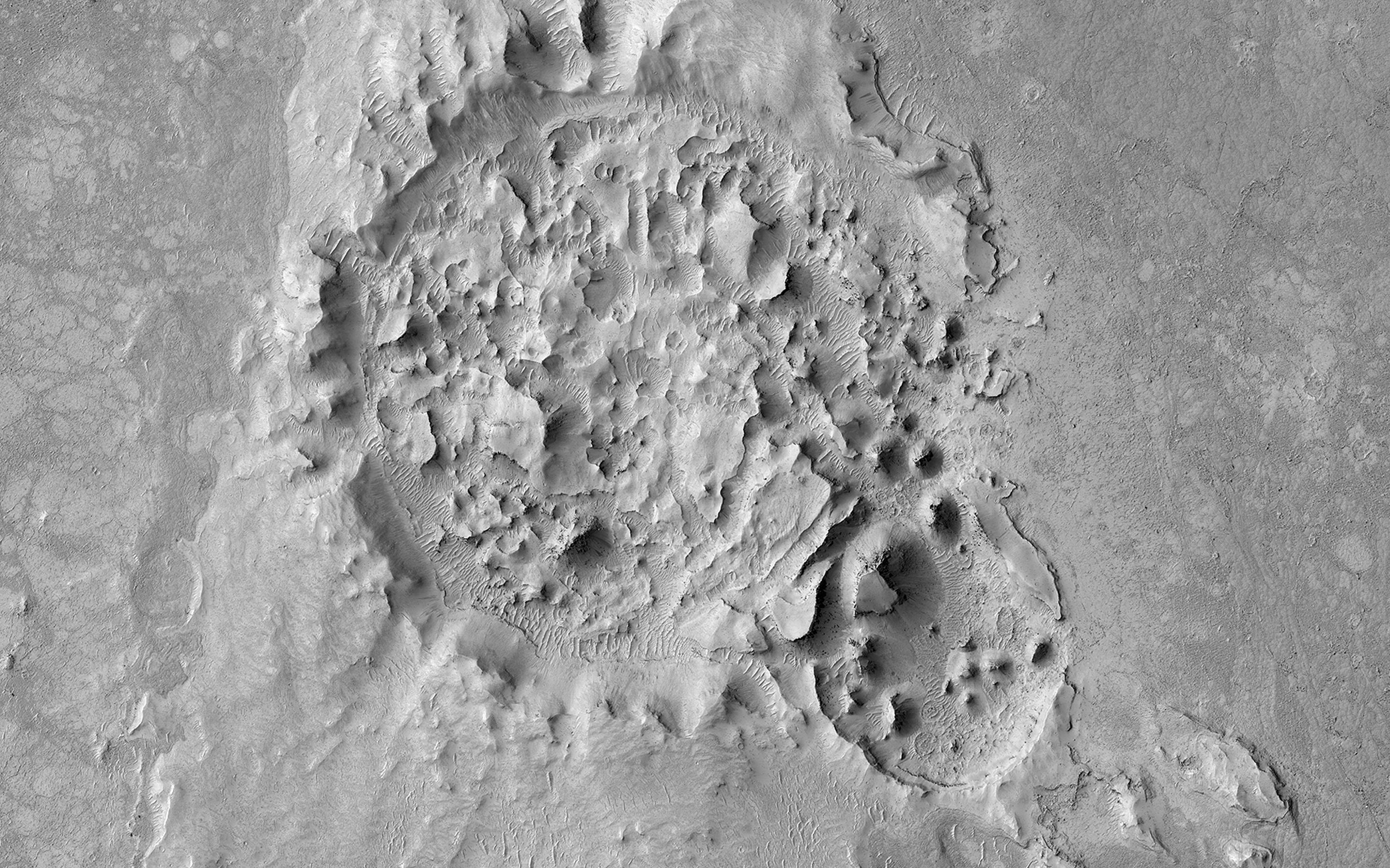
A Highly Disrupted Crater
- Click the image above for a larger view
- Full-Res JPEG (2880 x 1800) (999.4 kB)
- Full-Res TIFF (2880 x 1800) (5.2 MB)
Caption:

Map Projected Browse Image
Click on the image for larger version
This 2.5-kilometer diameter crater observed by NASA’s Mars Reconnaissance Orbiter (MRO) has been significantly altered from the usual bowl-shaped appearance we associate with craters. Material has covered significant portions of the ejecta and filled in the crater. This fill material has since been subject to erosion – like boulders weathering out of the slopes – and the crater rim is also highly irregular.
This crater is located in Elysium Planitia, an area dominated by volcanic processes. It is likely that the crater fill material is volcanic in origin, and possible that the rim was etched by lava, either flowing into the crater or spilling over after the crater filled completely. However, there are also signs of erosion by wind, like the parallel ridges in the rim breaches and between high-standing regions of the crater fill. It is likely that the current appearance of this crater is due to a combination of surface processes.
This is a stereo pair with ESP_045319_1830 .
The map is projected here at a scale of 50 centimeters (19.7 inches) per pixel. [The original image scale is 61.7 centimeters (21 inches) per pixel (with 2 x 2 binning); objects on the order of 185 centimeters (59.8 inches) across are resolved.] North is up.
Background Info:
The University of Arizona, Tucson, operates HiRISE, which was built by Ball Aerospace & Technologies Corp., Boulder, Colo. NASA's Jet Propulsion Laboratory, a division of Caltech in Pasadena, California, manages the Mars Reconnaissance Orbiter Project for NASA's Science Mission Directorate, Washington.
Cataloging Keywords:
| Name | Value | Additional Values |
|---|---|---|
| Target | Mars | |
| System | ||
| Target Type | Planet | |
| Mission | Mars Reconnaissance Orbiter (MRO) | |
| Instrument Host | Mars Reconnaissance Orbiter | |
| Host Type | Orbiter | |
| Instrument | High Resolution Imaging Science Experiment (HiRISE) | |
| Detector | ||
| Extra Keywords | Crater, Grayscale, Map, Volcano | |
| Acquisition Date | ||
| Release Date | 2017-10-09 | |
| Date in Caption | ||
| Image Credit | NASA/JPL-Caltech/Univ. of Arizona | |
| Source | photojournal.jpl.nasa.gov/catalog/PIA22041 | |
| Identifier | PIA22041 | |