|
Depressions and Channels on the Floor of Lyot Crater
- Click the image above for a larger view
- Full-Res JPEG (2880 x 1800) (1.1 MB)
- Full-Res TIFF (2880 x 1800) (15.6 MB)
Caption:

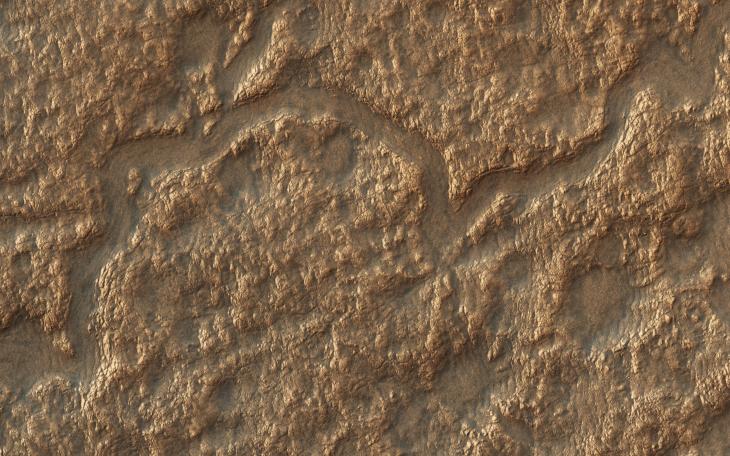
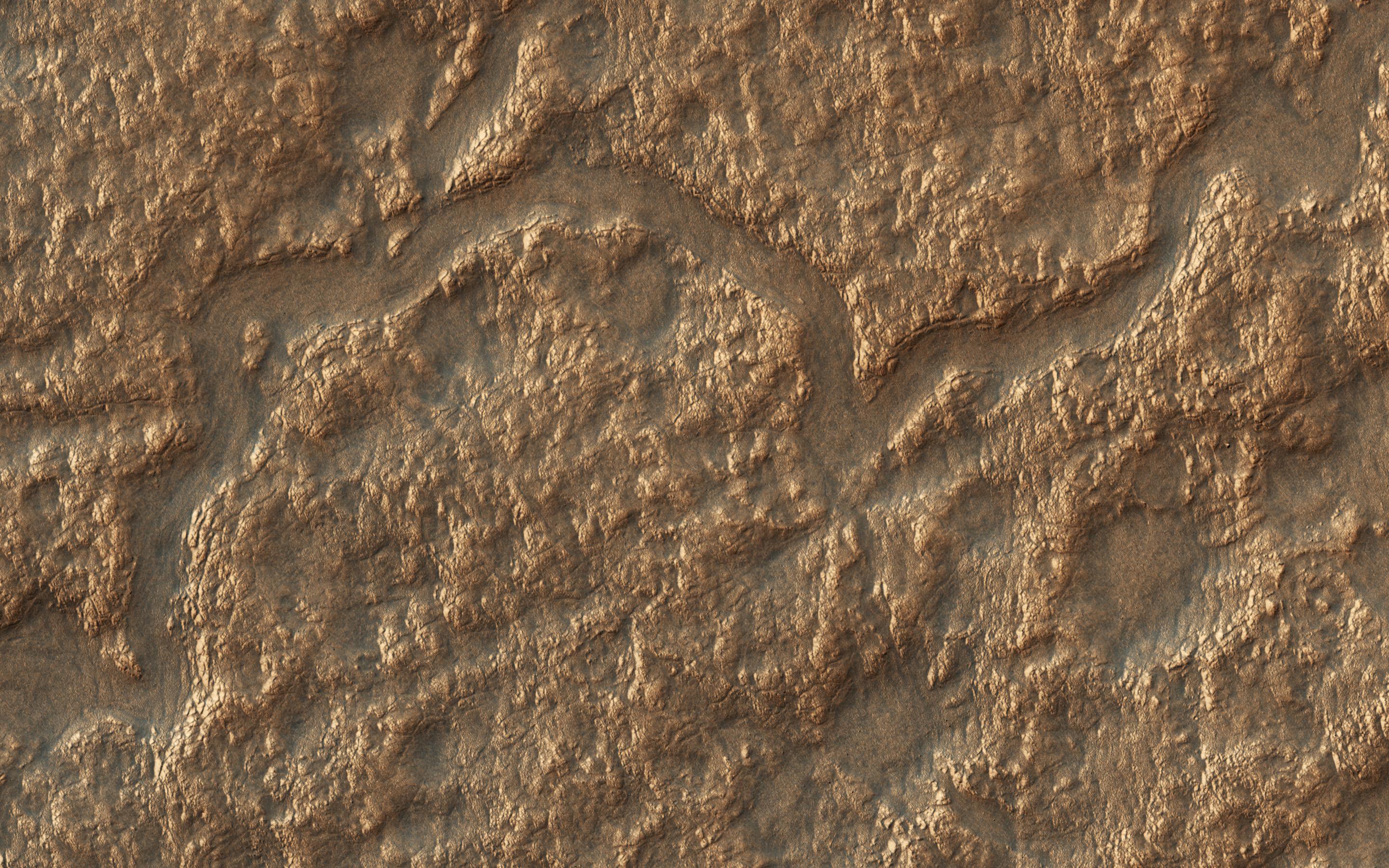
Map Projected Browse Image
Click on the image for larger version
Lyot Crater (220-kilometers in diameter) is located in the Northern lowlands of Mars. The crater's floor marks the lowest elevation in the Northern Hemisphere as seen in this image from NASA's Mars Reconnaissance Orbiter (MRO).
On the crater's floor, we see a network of channels . connecting a series of irregular shaped pits. These resemble terrestrial beaded streams, which are common in the Arctic regions of Earth and develop from uneven permafrost thawing.
If terrestrial beaded streams are a good analog, these landforms suggest liquid water flow in the past. If not then these pits may result from the process of sublimation and would indicate pockets of easily accessible near-surface ground ice, which might have potentially preserved evidence of past habitability.
The map is projected here at a scale of 25 centimeters (9.8 inches) per pixel. [The original image scale is 12.2 centimeters (9.8 inches) per pixel (with 1 x 1 binning); objects on the order of 93 centimeters (36.6 inches) across are resolved.] North is up.
This is a stereo pair with ESP_052694_2310 .
Background Info:
The University of Arizona, Tucson, operates HiRISE, which was built by Ball Aerospace & Technologies Corp., Boulder, Colorado. NASA's Jet Propulsion Laboratory, a division of Caltech in Pasadena, California, manages the Mars Reconnaissance Orbiter Project for NASA's Science Mission Directorate, Washington.
Cataloging Keywords:
| Name | Value | Additional Values |
|---|---|---|
| Target | Mars | |
| System | ||
| Target Type | Planet | |
| Mission | Mars Reconnaissance Orbiter (MRO) | |
| Instrument Host | Mars Reconnaissance Orbiter | |
| Host Type | Orbiter | |
| Instrument | High Resolution Imaging Science Experiment (HiRISE) | |
| Detector | ||
| Extra Keywords | Color, Crater, Map, Water | |
| Acquisition Date | ||
| Release Date | 2017-12-12 | |
| Date in Caption | ||
| Image Credit | NASA/JPL-Caltech/Univ. of Arizona | |
| Source | photojournal.jpl.nasa.gov/catalog/PIA22186 | |
| Identifier | PIA22186 | |