|
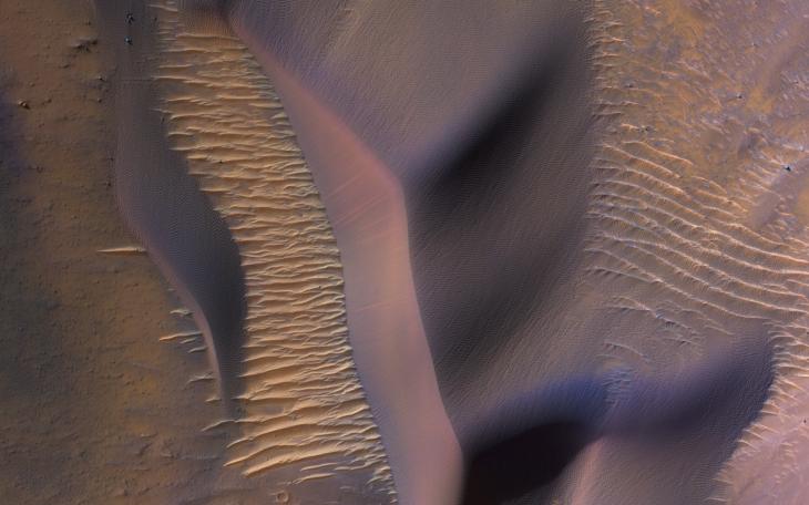
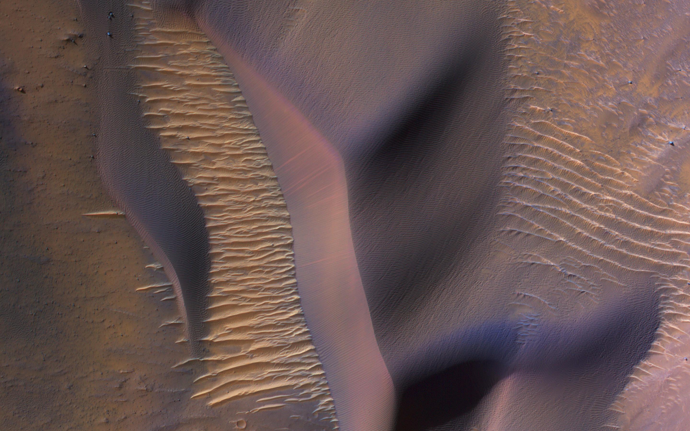
Dunes in Nectaris Montes
- Click the image above for a larger view
- Full-Res JPEG (2880 x 1800) (598.3 kB)
- Full-Res TIFF (2880 x 1800) (15.6 MB)
Caption:
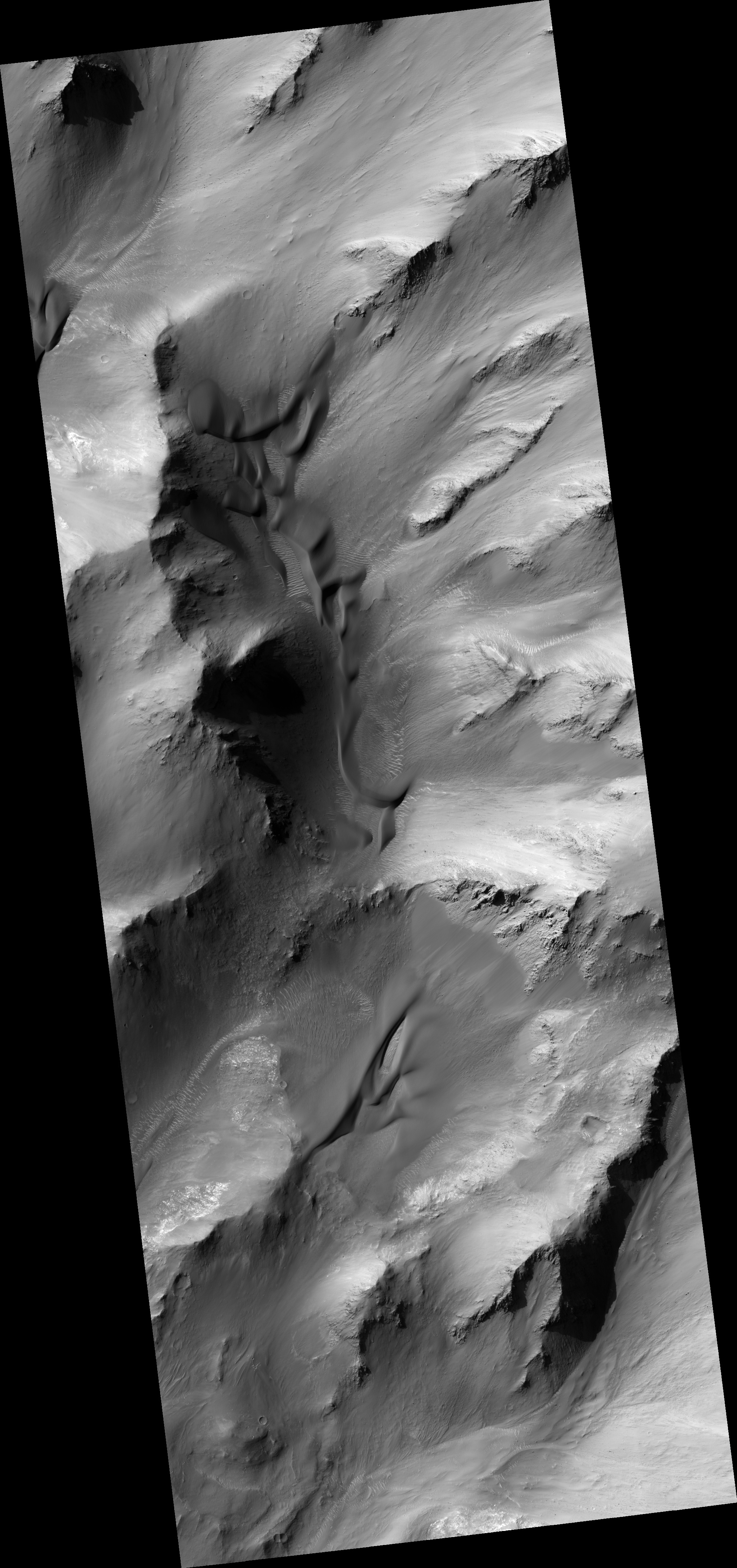
Map Projected Browse Image
Click on image for larger version
|
This image from NASA's Mars Reconnaissance Orbiter (MRO) shows some of these on the slopes of Nectaris Montes within Coprates Chasma. Sand dunes in Valles Marineris can be impressive in size, with steep slopes that seem to climb and descend.
The brighter bedforms are inactive while the bigger dunes move over the landscape, burying and exhuming the surface.
This is a stereo pair with ESP_054029_1650 .
Background Info:
The University of Arizona, Tucson, operates HiRISE, which was built by Ball Aerospace & Technologies Corp., Boulder, Colorado. NASA's Jet Propulsion Laboratory, a division of Caltech in Pasadena, California, manages the Mars Reconnaissance Orbiter Project for NASA's Science Mission Directorate, Washington.
Cataloging Keywords:
| Name | Value | Additional Values |
|---|---|---|
| Target | Mars | |
| System | ||
| Target Type | Planet | |
| Mission | Mars Reconnaissance Orbiter (MRO) | Mariner |
| Instrument Host | Mars Reconnaissance Orbiter | |
| Host Type | Orbiter | Flyby Spacecraft |
| Instrument | High Resolution Imaging Science Experiment (HiRISE) | |
| Detector | ||
| Extra Keywords | Color, Dune, Map, Mountain | |
| Acquisition Date | ||
| Release Date | 2018-05-14 | |
| Date in Caption | ||
| Image Credit | NASA/JPL-Caltech/Univ. of Arizona | |
| Source | photojournal.jpl.nasa.gov/catalog/PIA22455 | |
| Identifier | PIA22455 | |