
|
Patches of Snow
- Click the image above for a larger view
- Full-Res JPEG (2880 x 1800) (516.8 kB)
- Full-Res TIFF (2880 x 1800) (13.9 MB)
Caption:

Map Projected Browse Image
Click on image for larger version
|
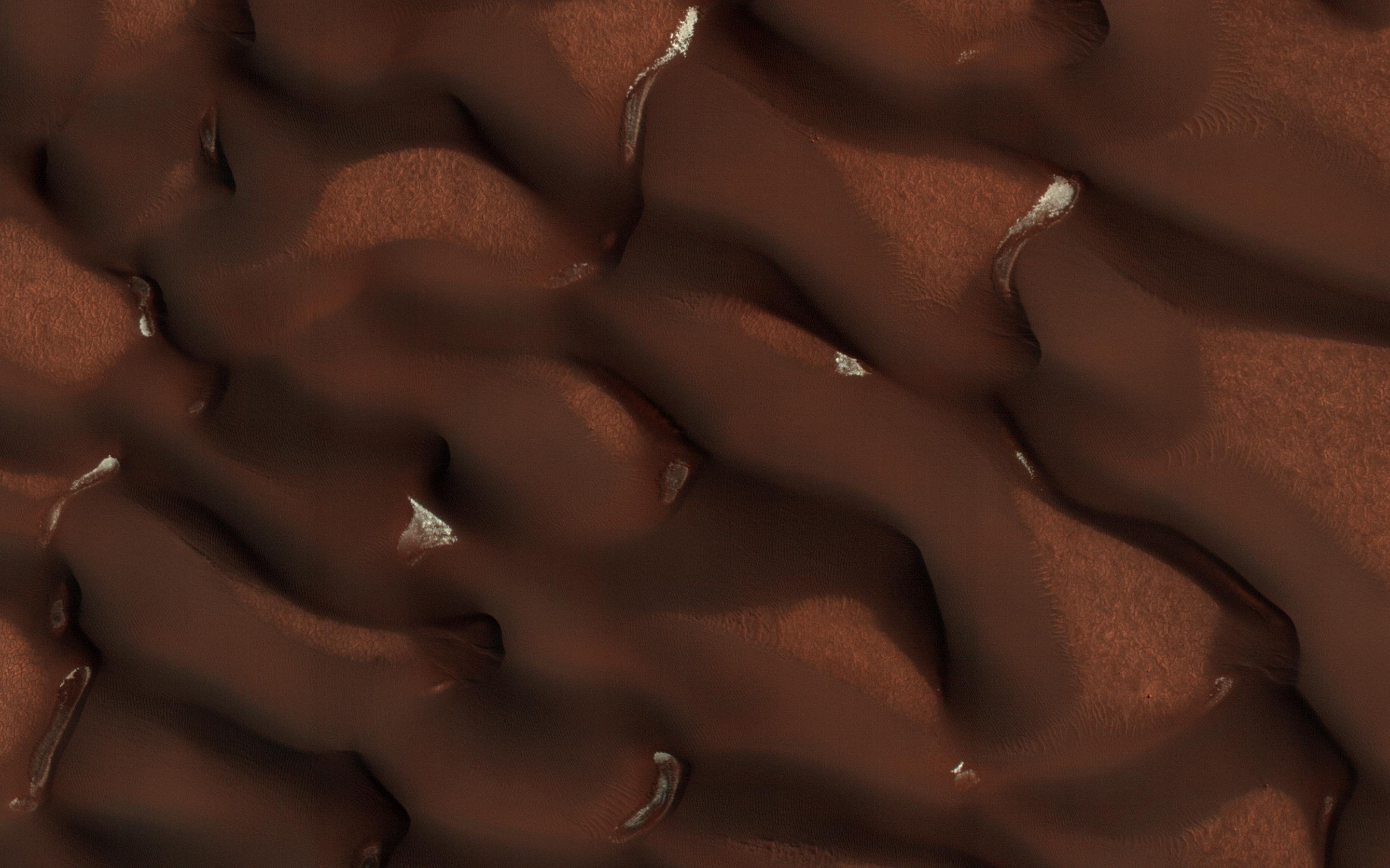
In early Martian summer, at the time NASA's Mars Reconnaissance Orbiter (MRO) acquired this image, the dunes are almost free of their seasonal ice cover. Only pockets of ice protected in the shade most of the day remain.
The North Pole of Mars is surrounded by a vast sea of sand dunes. In this dune field, the dunes are covered by a seasonal cap of dry ice in the winter.
This is a stereo pair with ESP_053377_2570 .
Background Info:
The University of Arizona, Tucson, operates HiRISE, which was built by Ball Aerospace & Technologies Corp., Boulder, Colorado. NASA's Jet Propulsion Laboratory, a division of Caltech in Pasadena, California, manages the Mars Reconnaissance Orbiter Project for NASA's Science Mission Directorate, Washington.
Cataloging Keywords:
| Name | Value | Additional Values |
|---|---|---|
| Target | Mars | |
| System | ||
| Target Type | Planet | |
| Mission | Mars Reconnaissance Orbiter (MRO) | |
| Instrument Host | Mars Reconnaissance Orbiter | |
| Host Type | Orbiter | |
| Instrument | High Resolution Imaging Science Experiment (HiRISE) | |
| Detector | ||
| Extra Keywords | Color, Dune, Map | |
| Acquisition Date | ||
| Release Date | 2018-05-29 | |
| Date in Caption | ||
| Image Credit | NASA/JPL-Caltech/Univ. of Arizona | |
| Source | photojournal.jpl.nasa.gov/catalog/PIA22463 | |
| Identifier | PIA22463 | |