|
Kasei Valles
- Click the image above for a larger view
- Full-Res JPEG (1390 x 2643) (249.8 kB)
- Full-Res TIFF (1390 x 2643) (2.5 MB)
Caption:
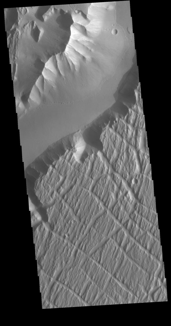
Context image
Today's VIS image is located near the beginning of Kasei Valles. At the top of the image is the relative high land of Lunae Planum. The Kasei Valles channel is just below. The bottom part of the image is an eroded surface that forms an island in the channel. The surface of the island has been modified by the flow of water. The linear features forming right angle intersections were caused by tectonic forces in the region.
Orbit Number: 72404 Latitude: 18.9511 Longitude: 286.59 Instrument: VIS Captured: 2018-04-10 22:34
Background Info:
Please see the THEMIS Data Citation Note for details on crediting THEMIS images.
NASA's Jet Propulsion Laboratory manages the 2001 Mars Odyssey mission for NASA's Science Mission Directorate, Washington, D.C. The Thermal Emission Imaging System (THEMIS) was developed by Arizona State University, Tempe, in collaboration with Raytheon Santa Barbara Remote Sensing. The THEMIS investigation is led by Dr. Philip Christensen at Arizona State University. Lockheed Martin Astronautics, Denver, is the prime contractor for the Odyssey project, and developed and built the orbiter. Mission operations are conducted jointly from Lockheed Martin and from JPL, a division of the California Institute of Technology in Pasadena.
Cataloging Keywords:
| Name | Value | Additional Values |
|---|---|---|
| Target | Mars | |
| System | ||
| Target Type | Planet | |
| Mission | 2001 Mars Odyssey | |
| Instrument Host | Mars Odyssey | |
| Host Type | Orbiter | |
| Instrument | Thermal Emission Imaging System (THEMIS) | |
| Detector | ||
| Extra Keywords | Grayscale, Thermal, Water | |
| Acquisition Date | ||
| Release Date | 2018-07-09 | |
| Date in Caption | 2018-04-10 | |
| Image Credit | NASA/JPL-Caltech/ASU | |
| Source | photojournal.jpl.nasa.gov/catalog/PIA22584 | |
| Identifier | PIA22584 | |