|
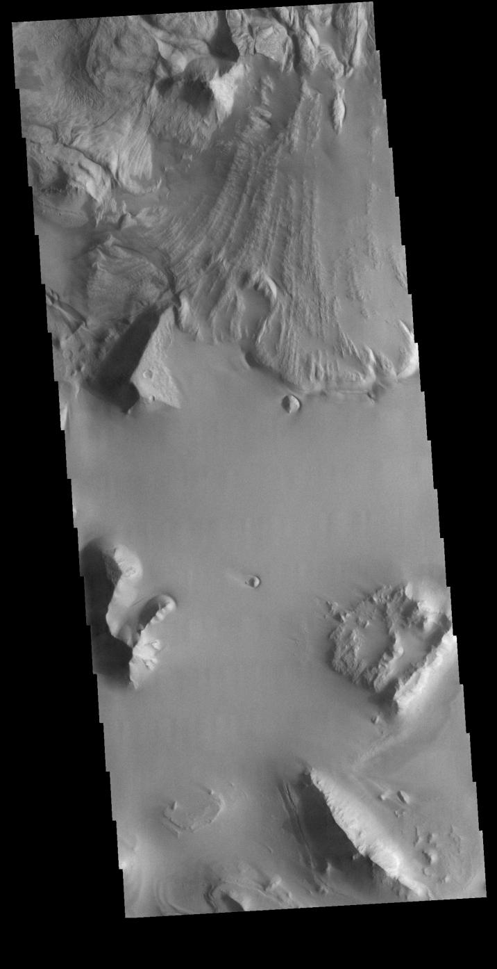
Ganges Chasma Landslide
- Click the image above for a larger view
- Full-Res JPEG (1362 x 2651) (294.3 kB)
- Full-Res TIFF (1362 x 2651) (2.6 MB)
Caption:
Context image
This VIS image is located in central Ganges Chasma. A large landslide deposit fills the top third of the image. The radial grooves on the top of the landslide are a common feature formed by the downslope movement of the landslide materials. The landslide was deflected in some areas by preexisting blocks on the chasma floor. Ganges Chasma is part of the Valles Marineris chasma system, but is north of the main section of canyons.
Orbit Number: 72790 Latitude: -7.88588 Longitude: 309.432 Instrument: VIS Captured: 2018-05-12 17:34
Background Info:
Please see the THEMIS Data Citation Note for details on crediting THEMIS images.
NASA's Jet Propulsion Laboratory manages the 2001 Mars Odyssey mission for NASA's Science Mission Directorate, Washington, D.C. The Thermal Emission Imaging System (THEMIS) was developed by Arizona State University, Tempe, in collaboration with Raytheon Santa Barbara Remote Sensing. The THEMIS investigation is led by Dr. Philip Christensen at Arizona State University. Lockheed Martin Astronautics, Denver, is the prime contractor for the Odyssey project, and developed and built the orbiter. Mission operations are conducted jointly from Lockheed Martin and from JPL, a division of the California Institute of Technology in Pasadena.
Cataloging Keywords:
| Name | Value | Additional Values |
|---|---|---|
| Target | Mars | |
| System | ||
| Target Type | Planet | |
| Mission | 2001 Mars Odyssey | Mariner |
| Instrument Host | Mars Odyssey | |
| Host Type | Orbiter | Flyby Spacecraft |
| Instrument | Thermal Emission Imaging System (THEMIS) | |
| Detector | ||
| Extra Keywords | Grayscale, Thermal | |
| Acquisition Date | ||
| Release Date | 2018-08-01 | |
| Date in Caption | 2018-05-12 | |
| Image Credit | NASA/JPL-Caltech/ASU | |
| Source | photojournal.jpl.nasa.gov/catalog/PIA22616 | |
| Identifier | PIA22616 | |