|
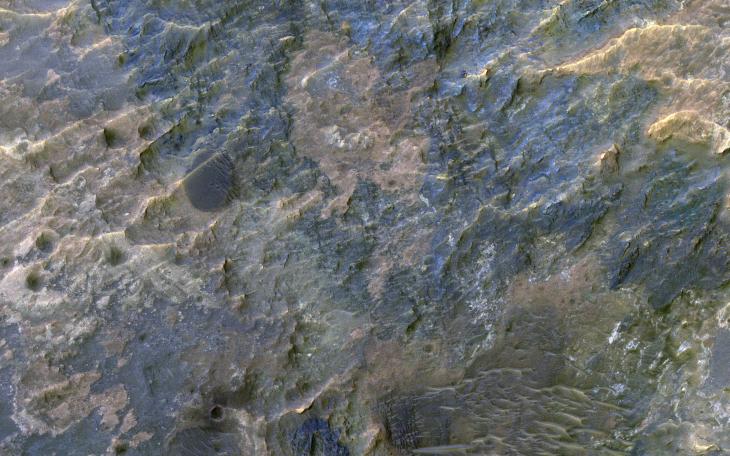
Colorful Impact Ejecta in Ladon Valles
- Click the image above for a larger view
- Full-Res JPEG (2880 x 1800) (1.1 MB)
- Full-Res TIFF (2880 x 1800) (15.6 MB)
Caption:
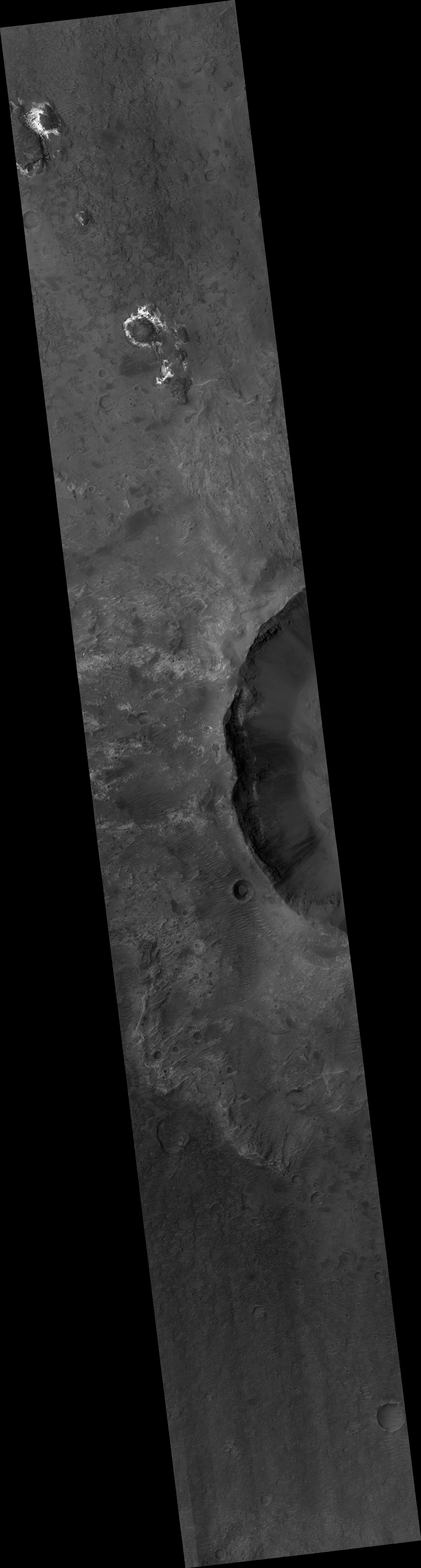
Map Projected Browse Image
Click on image for larger version
This image covers the western portion of a well-preserved (recent) impact crater in Ladon Basin. Ladon is filled by diverse materials including chemically-altered sediments and unaltered lava, so the impact event ejected and deposited a wide range of elements .
This image is the first of a pair of images for stereo coverage, so check out the stereo anaglyph when completed.
The map is projected here at a scale of 50 centimeters (19.7 inches) per pixel. [The original image scale is 52.4 centimeters (20.6 inches) per pixel (with 2 x 2 binning); objects on the order of 157 centimeters (61.8 inches) across are resolved.] North is up.
Background Info:
The University of Arizona, Tucson, operates HiRISE, which was built by Ball Aerospace & Technologies Corp., Boulder, Colorado. NASA's Jet Propulsion Laboratory, a division of Caltech in Pasadena, California, manages the Mars Reconnaissance Orbiter Project for NASA's Science Mission Directorate, Washington.
Cataloging Keywords:
| Name | Value | Additional Values |
|---|---|---|
| Target | Mars | |
| System | ||
| Target Type | Planet | |
| Mission | Mars Reconnaissance Orbiter (MRO) | |
| Instrument Host | Mars Reconnaissance Orbiter | |
| Host Type | Orbiter | |
| Instrument | High Resolution Imaging Science Experiment (HiRISE) | |
| Detector | ||
| Extra Keywords | Color, Crater, Impact, Map | |
| Acquisition Date | ||
| Release Date | 2019-03-04 | |
| Date in Caption | ||
| Image Credit | NASA/JPL-Caltech/University of Arizona | |
| Source | photojournal.jpl.nasa.gov/catalog/PIA23079 | |
| Identifier | PIA23079 | |