|
First Global Geologic Map of Titan
- Click the image above for a larger view
- Full-Res JPEG (6604 x 3746) (2.0 MB)
- Full-Res TIFF (6604 x 3746) (8.7 MB)
Caption:
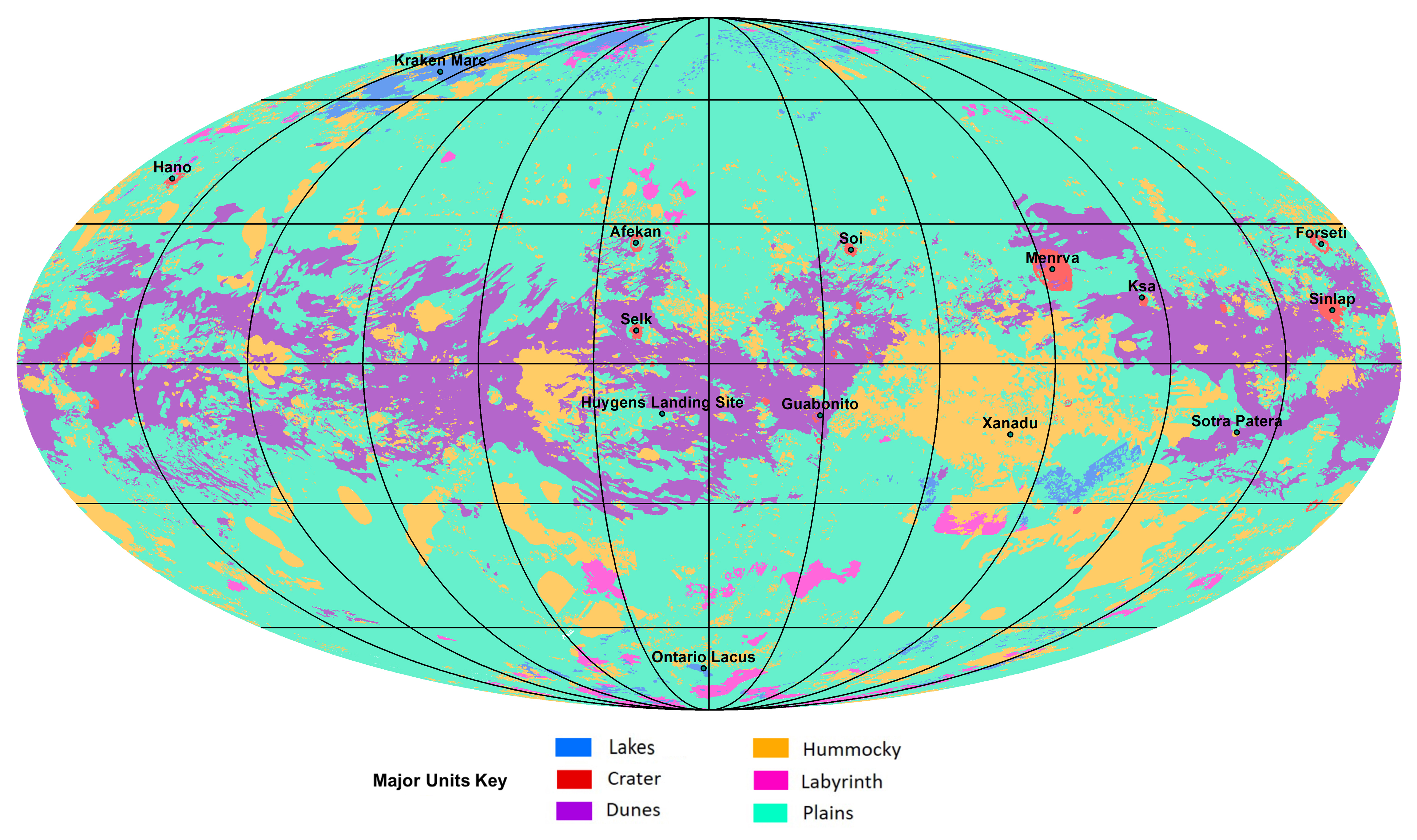
Annotated Figure
Click on the image for larger version
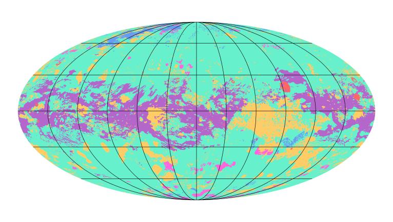
The first global geologic map of Saturn's largest moon, Titan, is based on radar and visible and infrared images from NASA's Cassini mission, which orbited Saturn from 2004 to 2017.
Black lines mark 30 degrees of latitude and longitude. Map is in Mollweide projection, a global view that attempts to minimize the size or area distortion, especially at the poles (although shapes are increasingly distorted away from the center of the map). It is centered on 0 degrees latitude, 180 degrees longitude. Map scale is 1:20,000,000.
In the annotated figure, the map is labeled with several of the named surface features. Also located is the landing site of the European Space Agency's (ESA) Huygens Probe, part of NASA's Cassini mission.
The map legend colors represent the broad types of geologic units found on Titan: plains (broad, relatively flat regions), labyrinth (tectonically disrupted regions often containing fluvial channels), hummocky (hilly, with some mountains), dunes (mostly linear dunes, produced by winds in Titan's atmosphere), craters (formed by impacts) and lakes (regions now or previously filled with liquid methane or ethane). Titan is the only planetary body in our solar system other than Earth known to have stable liquid on its surface — methane and ethane.
The map was developed using Cassini radar data and Imaging Science Subsystem (ISS) images.
Background Info:
For more information about the Cassini-Huygens mission visit http://saturn.jpl.nasa.gov and http://www.nasa.gov/cassini .
Cataloging Keywords:
| Name | Value | Additional Values |
|---|---|---|
| Target | Titan | Saturn |
| System | Saturn | |
| Target Type | Satellite | Planet |
| Mission | Cassini-Huygens | |
| Instrument Host | Cassini Orbiter | Huygens Probe |
| Host Type | Orbiter | Lander, Probe |
| Instrument | Imaging Science Subsystem (ISS) | Radar Mapper |
| Detector | ||
| Extra Keywords | Atmosphere, Color, Crater, Dune, Impact, Infrared, Map, Methane, Mountain, Radar, Visual | |
| Acquisition Date | ||
| Release Date | 2019-11-18 | |
| Date in Caption | ||
| Image Credit | NASA/JPL-Caltech/ASU | |
| Source | photojournal.jpl.nasa.gov/catalog/PIA23174 | |
| Identifier | PIA23174 | |