skip to navigation
|
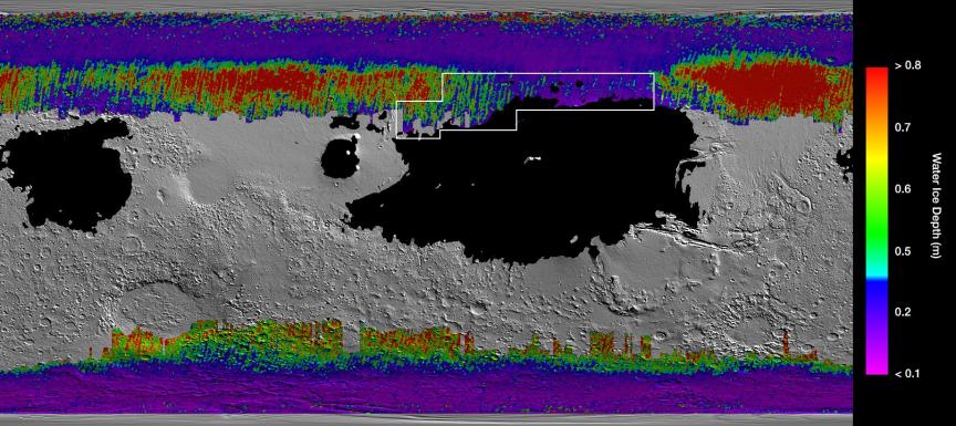
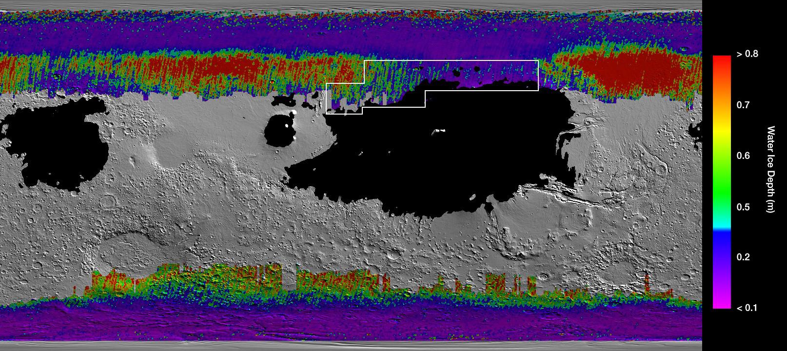
A Water Ice Map for Mars
- Click the image above for a larger view
- Full-Res JPEG (1614 x 720) (311.5 kB)
- Full-Res TIFF (1614 x 720) (2.4 MB)
Caption:
This rainbow-colored map shows underground water ice on Mars. Cool colors represent less than one foot (30 centimeters) below the surface; warm colors are over two feet (60 centimeters) deep. Sprawling black zones on the map represent areas where a landing spacecraft would sink into fine dust. The outlined box represents the ideal region to send astronauts for them to be able to dig up water ice.
The map was created by combining data from multiple NASA orbiters, including the Mars Reconnaissance Orbiter and its Mars Climate Sounder instrument; Mars Odyssey and its Thermal Emission Imaging System; and the Mars Global Surveyor.
Cataloging Keywords:
| Name | Value | Additional Values |
|---|---|---|
| Target | Mars | |
| System | ||
| Target Type | Planet | |
| Mission | 2001 Mars Odyssey | Mars Global Surveyor (MGS), Mars Reconnaissance Orbiter (MRO) |
| Instrument Host | Mars Odyssey | Mars Global Surveyor, Mars Reconnaissance Orbiter |
| Host Type | Orbiter | |
| Instrument | MCS | Thermal Emission Imaging System (THEMIS) |
| Detector | ||
| Extra Keywords | Color, Dust, Map, Thermal, Water | |
| Acquisition Date | ||
| Release Date | 2019-12-10 | |
| Date in Caption | ||
| Image Credit | NASA/JPL-Caltech/ASU | |
| Source | photojournal.jpl.nasa.gov/catalog/PIA23514 | |
| Identifier | PIA23514 | |