
|
A First Look at a Gullied Slope
- Click the image above for a larger view
- Full-Res JPEG (1680 x 666) (298.5 kB)
- Full-Res TIFF (1680 x 666) (3.4 MB)
Caption:
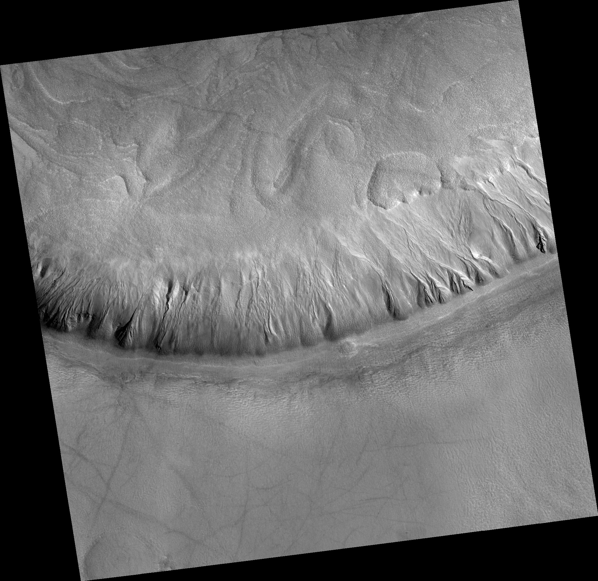
Map Projected Browse Image
Click on image for larger version
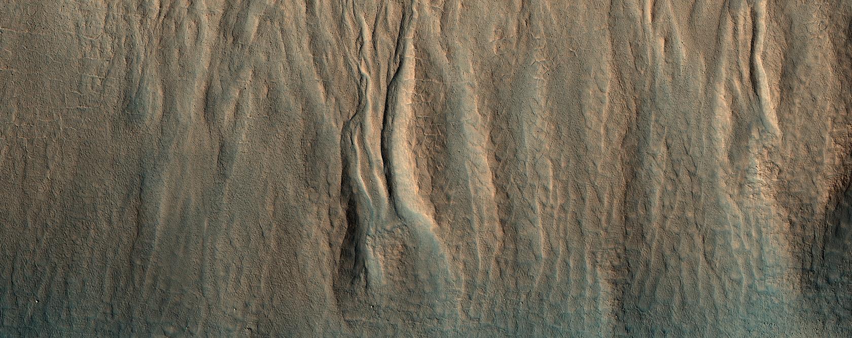
HiRISE has been operating since 2006, and lately many of our observations of gullies are repeat images designed to study changes. However, we are also collecting data over gullies never before seen at this resolution, to study their morphology and allow us to look for changes in the future.
This is the first HiRISE look at a cluster of gullies that appear modified or degraded —the gully fans have ripples and ridges that have formed since the last major gully activity, suggesting that they don't change very often, but we won't know for sure unless we look!
The map is projected here at a scale of 25 centimeters (9.8 inches) per pixel. (The original image scale is 30.8 centimeters [12.1 inches] per pixel [with 1 x 1 binning]; objects on the order of 92 centimeters [36.2 inches] across are resolved.) North is up.
Background Info:
The University of Arizona, in Tucson, operates HiRISE, which was built by Ball Aerospace & Technologies Corp., in Boulder, Colorado. NASA's Jet Propulsion Laboratory, a division of Caltech in Pasadena, California, manages the Mars Reconnaissance Orbiter Project for NASA's Science Mission Directorate, Washington.
Cataloging Keywords:
| Name | Value | Additional Values |
|---|---|---|
| Target | Mars | |
| System | ||
| Target Type | Planet | |
| Mission | Mars Reconnaissance Orbiter (MRO) | |
| Instrument Host | Mars Reconnaissance Orbiter | |
| Host Type | Orbiter | |
| Instrument | High Resolution Imaging Science Experiment (HiRISE) | |
| Detector | ||
| Extra Keywords | Color, Map | |
| Acquisition Date | ||
| Release Date | 2020-01-16 | |
| Date in Caption | ||
| Image Credit | NASA/JPL-Caltech/University of Arizona | |
| Source | photojournal.jpl.nasa.gov/catalog/PIA23666 | |
| Identifier | PIA23666 | |