
|
Exposing Colorful Deep Bedrock
- Click the image above for a larger view
- Full-Res JPEG (2880 x 1800) (835.7 kB)
- Full-Res TIFF (2880 x 1800) (15.6 MB)
Caption:
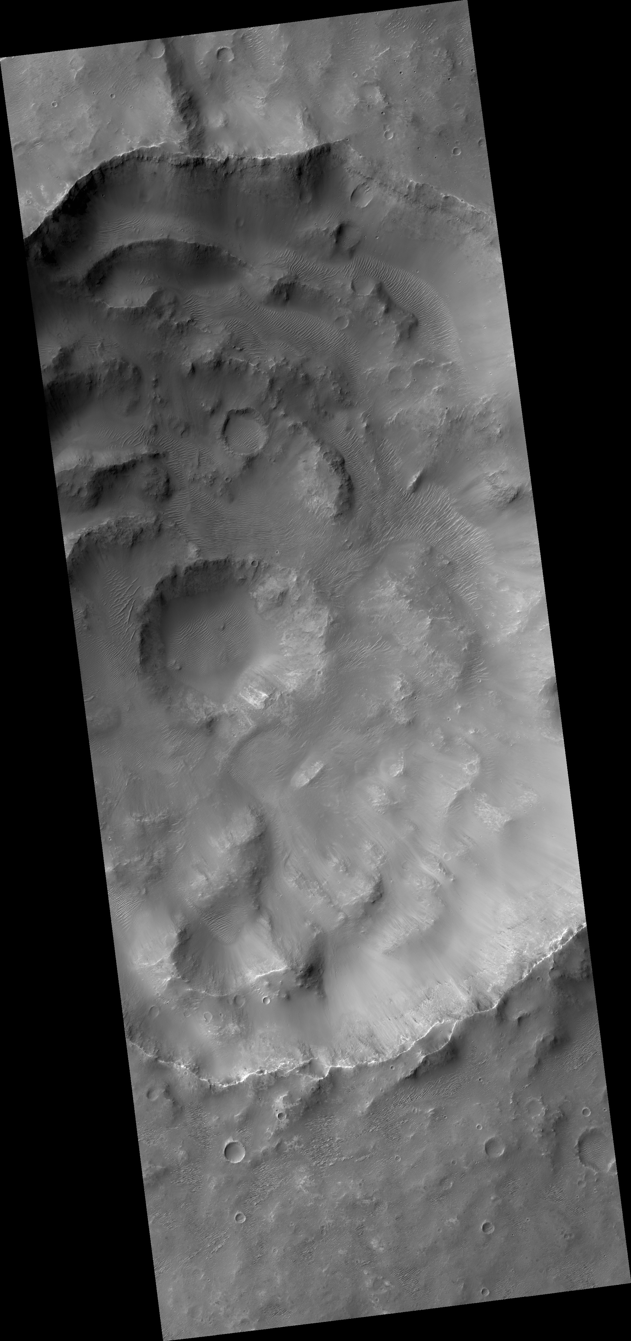
Map Projected Browse Image
Click on image for larger version
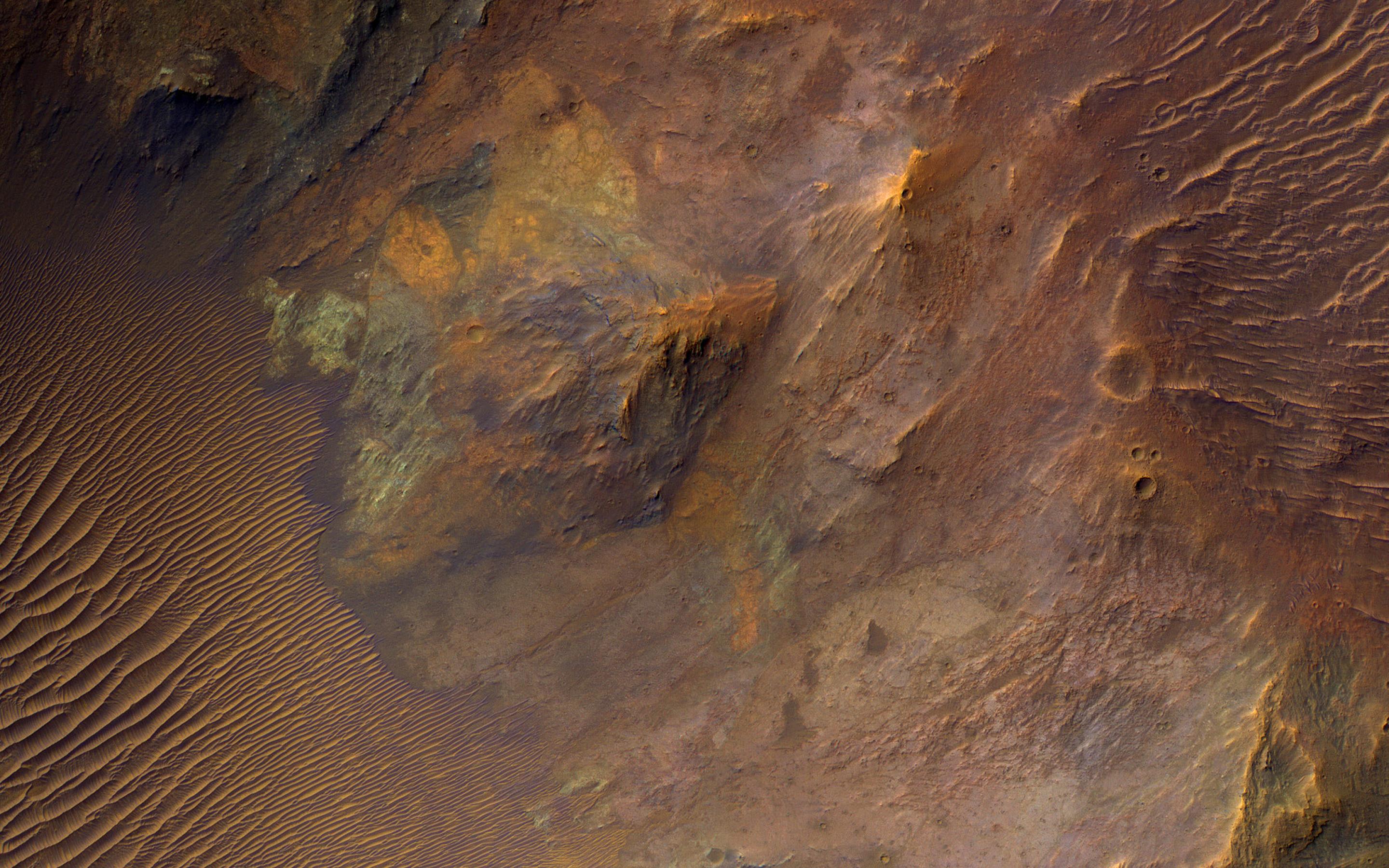
Large impacts produce uplifted central structures, either peaks, or pits, or an uplifted peak with a central pit. This crater south of Aurorae Chaos has a central pit exposing bedrock units with diverse colors, indicating diverse rock compositions.
This crater includes clay-rich minerals identified by the CRISM instrument on MRO. See this enhanced-color cutout over the eastern half of the central pit.
The map is projected here at a scale of 50 centimeters (19.7 inches) per pixel. (The original image scale is 53.4 centimeters [21.0 inches] per pixel [with 2 x 2 binning]; objects on the order of 160 centimeters [63.0 inches] across are resolved.) North is up.
This is a stereo pair with ESP_044930_1690 .
Background Info:
The University of Arizona, in Tucson, operates HiRISE, which was built by Ball Aerospace & Technologies Corp., in Boulder, Colorado. NASA's Jet Propulsion Laboratory, a division of Caltech in Pasadena, California, manages the Mars Reconnaissance Orbiter Project for NASA's Science Mission Directorate, Washington.
Cataloging Keywords:
| Name | Value | Additional Values |
|---|---|---|
| Target | Mars | |
| System | ||
| Target Type | Planet | |
| Mission | Mars Reconnaissance Orbiter (MRO) | |
| Instrument Host | Mars Reconnaissance Orbiter | |
| Host Type | Orbiter | |
| Instrument | High Resolution Imaging Science Experiment (HiRISE) | Compact Reconnaissance Imaging Spectrometer for Mars (CRISM) |
| Detector | ||
| Extra Keywords | Color, Crater, Impact, Map | |
| Acquisition Date | ||
| Release Date | 2020-02-14 | |
| Date in Caption | ||
| Image Credit | NASA/JPL-Caltech/University of Arizona | |
| Source | photojournal.jpl.nasa.gov/catalog/PIA23737 | |
| Identifier | PIA23737 | |